


<< Our Photo Pages >> Gleann Mor - Standing Stones in Scotland in Isle of Harris
Submitted by Andy B on Friday, 05 February 2010 Page Views: 7152
Neolithic and Bronze AgeSite Name: Gleann Mor Alternative Name: St Kilda, HirtaCountry: Scotland
NOTE: This site is 0.2 km away from the location you searched for.
County: Isle of Harris Type: Standing Stones
Map Ref: NF08869943
Latitude: 57.812757N Longitude: 8.590696W
Condition:
| 5 | Perfect |
| 4 | Almost Perfect |
| 3 | Reasonable but with some damage |
| 2 | Ruined but still recognisable as an ancient site |
| 1 | Pretty much destroyed, possibly visible as crop marks |
| 0 | No data. |
| -1 | Completely destroyed |
| 5 | Superb |
| 4 | Good |
| 3 | Ordinary |
| 2 | Not Good |
| 1 | Awful |
| 0 | No data. |
| 5 | Can be driven to, probably with disabled access |
| 4 | Short walk on a footpath |
| 3 | Requiring a bit more of a walk |
| 2 | A long walk |
| 1 | In the middle of nowhere, a nightmare to find |
| 0 | No data. |
| 5 | co-ordinates taken by GPS or official recorded co-ordinates |
| 4 | co-ordinates scaled from a detailed map |
| 3 | co-ordinates scaled from a bad map |
| 2 | co-ordinates of the nearest village |
| 1 | co-ordinates of the nearest town |
| 0 | no data |
Be the first person to rate this site - see the 'Contribute!' box in the right hand menu.
Internal Links:
External Links:
")
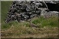
The circle does not appear to be the remains of a fold, as one would expect more stone, or at least traces of an earth and stone bank, to indicate an enclosure. Its isolation from the settlement at the foot of the glen is another significant feature.
The site is slightly embanked (0.2m high) on the down-hill (north) side. (Stone settings have been recorded in association with 'Altars' on Soay and Boreray).
Visited by OS (J L D) 9 August 1967.
(Classification amended to enclosure and location amended to NF 08879 99423). This enclosure is situated on a grass slope at the head of Gleann Mor and is defined for the most part by a ring of intermittent boulders set within a low bank. It measures 14.7m from E to W by 13.5m transversely over a bank 0.5m in thickness and up to 0.4m in height, but on the upslope SE arc the bank has been reduced to a low scarp and for a short stretch it has been buried by hillwash.
Information from RCAHMS (ARG) 13 June 2008
NF 0886 9943 This site was surveyed and appeared in DES 2007, 198. The site was photographed and planned in 2008.
M R Curtis and G R Curtis, 2008
Source: Canmore
You may be viewing yesterday's version of this page. To see the most up to date information please register for a free account.
Do not use the above information on other web sites or publications without permission of the contributor.
Nearby Images from Geograph Britain and Ireland:
©2008(licence)
©2008(licence)
©2008(licence)
©2005(licence)
©2006(licence)
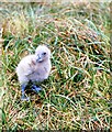
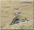
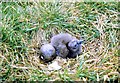
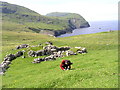
The above images may not be of the site on this page, they are loaded from Geograph.
Please Submit an Image of this site or go out and take one for us!
Click here to see more info for this site
Nearby sites
Key: Red: member's photo, Blue: 3rd party photo, Yellow: other image, Green: no photo - please go there and take one, Grey: site destroyed
Download sites to:
KML (Google Earth)
GPX (GPS waypoints)
CSV (Garmin/Navman)
CSV (Excel)
To unlock full downloads you need to sign up as a Contributory Member. Otherwise downloads are limited to 50 sites.
Turn off the page maps and other distractions
Nearby sites listing. In the following links * = Image available
673m NNW 348° The Amazon's House (Hirta) Ancient Village or Settlement (NA08780010)
842m NNW 340° Tobar nam Buadh (St Kilda) Holy Well or Sacred Spring (NA0864400247)
1.2km E 85° House Of The Fairies* Souterrain (Fogou, Earth House) (NF1001799410)
8.3km NE 42° Boreray* Stone Circle (NA15060499)
68.1km ESE 109° Dun Grogary Stone Fort or Dun (NF71257141)
68.4km ESE 105° Dun Scolpaig* Stone Fort or Dun (NF7310375028)
71.5km ESE 108° Cleithreabhal* Chambered Cairn (NF749713)
71.6km ESE 108° South Clettraval* Standing Stone (Menhir) (NF75017118)
71.6km ESE 103° Bac Mic Connain Stone Fort or Dun (NF76947619)
71.7km ESE 104° Bac Mhic Connain Ancient Village or Settlement (NF76737537)
71.8km ESE 108° Clettraval South* Burial Chamber or Dolmen (NF75167101)
71.8km ESE 104° Geirisclett* Chambered Cairn (NF76847520)
71.8km ESE 103° Vallay (N Uist) Rock Art (NF77137600)
71.9km ESE 105° Airigh Mhic Ruairidh* Stone Fort or Dun (NF76597440)
72.4km ESE 105° Cnoc A'Comhdhalach Ancient Village or Settlement (NF77087415)
72.5km ESE 106° Buaile Risary Wheelhouse Ancient Village or Settlement (NF76677291)
72.5km ESE 106° Buaile Risary Cup Marked Stone Rock Art (NF76697293)
72.5km ESE 105° Garry Iochdrach Ancient Village or Settlement (NF77237427)
72.9km ESE 105° Eilean Maleit Ancient Village or Settlement (NF77487388)
73.2km ESE 103° Rudh' An Duin Stone Fort or Dun (NF7859376180)
73.5km ESE 103° Leac nan Cailleacha Dubha Standing Stones (NF79087650)
73.8km ESE 108° Toroghas* Standing Stones (NF77007029)
74.9km ESE 103° Sollas, Machair Leathann Ancient Village or Settlement (NF80117533)
75.5km ESE 110° Clach Mhor a' Che* Standing Stone (Menhir) (NF770662)
75.6km ESE 103° Dun Skellor Broch or Nuraghe (NF80757507)
View more nearby sites and additional images


 We would like to know more about this location. Please feel free to add a brief description and any relevant information in your own language.
 Wir möchten mehr über diese Stätte erfahren. Bitte zögern Sie nicht, eine kurze Beschreibung und relevante Informationen in Deutsch hinzuzufügen.
 Nous aimerions en savoir encore un peu sur les lieux. S'il vous plaît n'hesitez pas à ajouter une courte description et tous les renseignements pertinents dans votre propre langue.
 Quisieramos informarnos un poco más de las lugares. No dude en añadir una breve descripción y otros datos relevantes en su propio idioma.