


<< Text Pages >> Villa Romana de Rabaçal - Ancient Village or Settlement in Portugal in Coimbra
Submitted by holger_rix on Monday, 07 December 2015 Page Views: 880
Multi-periodSite Name: Villa Romana de RabaçalCountry: Portugal
NOTE: This site is 21.613 km away from the location you searched for.
Distrito: Coimbra Type: Ancient Village or Settlement
Latitude: 40.037750N Longitude: 8.45869W
Condition:
| 5 | Perfect |
| 4 | Almost Perfect |
| 3 | Reasonable but with some damage |
| 2 | Ruined but still recognisable as an ancient site |
| 1 | Pretty much destroyed, possibly visible as crop marks |
| 0 | No data. |
| -1 | Completely destroyed |
| 5 | Superb |
| 4 | Good |
| 3 | Ordinary |
| 2 | Not Good |
| 1 | Awful |
| 0 | No data. |
| 5 | Can be driven to, probably with disabled access |
| 4 | Short walk on a footpath |
| 3 | Requiring a bit more of a walk |
| 2 | A long walk |
| 1 | In the middle of nowhere, a nightmare to find |
| 0 | No data. |
| 5 | co-ordinates taken by GPS or official recorded co-ordinates |
| 4 | co-ordinates scaled from a detailed map |
| 3 | co-ordinates scaled from a bad map |
| 2 | co-ordinates of the nearest village |
| 1 | co-ordinates of the nearest town |
| 0 | no data |
Be the first person to rate this site - see the 'Contribute!' box in the right hand menu.
Internal Links:
External Links:
Ancient Village or Settlement in Coimbra
You may be viewing yesterday's version of this page. To see the most up to date information please register for a free account.
Do not use the above information on other web sites or publications without permission of the contributor.
Nearby Images from Flickr
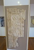
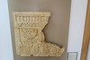


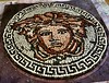

The above images may not be of the site on this page, but were taken nearby. They are loaded from Flickr so please click on them for image credits.
Click here to see more info for this site
Nearby sites
Click here to view sites on an interactive map of the areaKey: Red: member's photo, Blue: 3rd party photo, Yellow: other image, Green: no photo - please go there and take one, Grey: site destroyed
Download sites to:
KML (Google Earth)
GPX (GPS waypoints)
CSV (Garmin/Navman)
CSV (Excel)
To unlock full downloads you need to sign up as a Contributory Member. Otherwise downloads are limited to 50 sites.
Turn off the page maps and other distractions
Nearby sites listing. In the following links * = Image available
7.3km NNW 338° Parque Arqueológico de Conimbriga* Ancient Village or Settlement
18.4km SW 215° Anta do Alto da Carrasqueira* Burial Chamber or Dolmen
23.6km S 170° Castro da Serra de Alvaiázere* Castro or Chafurdão
26.5km NW 304° Necrópole do Ferrestelo Cist
26.7km NW 304° Castro de Santa Olaia* Castro or Chafurdão
30.7km NE 44° Dólmen de São Pedro Dias* Burial Chamber or Dolmen
30.9km SSE 155° Anthropomorphic Trapezoid Visigothic Grave* Rock Cut Tomb
31.6km SSE 166° Complexo Megalítico do Rego da Murta* Burial Chamber or Dolmen
33.9km WNW 299° Anta das Carniçosas* Burial Chamber or Dolmen
36.5km WNW 291° Museu Municipal Santos Rocha Museum
38.4km N 1° Mealhada City Park Sculptured Megalithic Circle Modern Stone Circle etc
42.7km ENE 58° Castro da Lomba do Canho Castro or Chafurdão
53.1km SE 141° Castro de São Miguel de Amêndoa* Castro or Chafurdão
53.8km SSW 209° Miradouro Jurássico de Alqueidão da Serra* Modern Stone Circle etc
54.6km SE 132° Anta da Lajinha* Burial Chamber or Dolmen
55.2km SSE 166° Anta de Vale da Lage* Burial Chamber or Dolmen
60.0km ENE 68° Chãs d’Égua* Museum
60.6km NE 39° Orca do sto. Tisco* Burial Chamber or Dolmen
61.0km SE 125° Anta do Cão do Ribeiro* Burial Chamber or Dolmen
61.3km NE 53° Anta do Pinheiro dos Abraços* Burial Chamber or Dolmen
61.9km SE 124° Anta do Cabeço da Anta* Burial Chamber or Dolmen
62.0km SE 125° Anta do Vale do Alvito* Burial Chamber or Dolmen
62.1km NE 47° Anta da Cavada* Burial Chamber or Dolmen
62.3km NE 44° Complexos Rupestres do Ameal* Rock Art
62.4km NE 44° Orquinha da Víbora* Burial Chamber or Dolmen
View more nearby sites and additional images


 We would like to know more about this location. Please feel free to add a brief description and any relevant information in your own language.
 Wir möchten mehr über diese Stätte erfahren. Bitte zögern Sie nicht, eine kurze Beschreibung und relevante Informationen in Deutsch hinzuzufügen.
 Nous aimerions en savoir encore un peu sur les lieux. S'il vous plaît n'hesitez pas à ajouter une courte description et tous les renseignements pertinents dans votre propre langue.
 Quisieramos informarnos un poco más de las lugares. No dude en añadir una breve descripción y otros datos relevantes en su propio idioma.