

<< Our Photo Pages >> Thunderbird Archaeological District - Ancient Mine, Quarry or other Industry in United States in Mid Atlantic
Submitted by chuquisaca1 on Wednesday, 03 April 2024 Page Views: 25
Multi-periodSite Name: Thunderbird Archaeological District Alternative Name: Flint Run Complex, the Thunderbird Site, the Fifty Site, the Fifty BogCountry: United States Region: Mid Atlantic Type: Ancient Mine, Quarry or other Industry
Nearest Town: Front Royal Nearest Village: Limeton
Latitude: 38.869444N Longitude: 78.271944W
Condition:
| 5 | Perfect |
| 4 | Almost Perfect |
| 3 | Reasonable but with some damage |
| 2 | Ruined but still recognisable as an ancient site |
| 1 | Pretty much destroyed, possibly visible as crop marks |
| 0 | No data. |
| -1 | Completely destroyed |
| 5 | Superb |
| 4 | Good |
| 3 | Ordinary |
| 2 | Not Good |
| 1 | Awful |
| 0 | No data. |
| 5 | Can be driven to, probably with disabled access |
| 4 | Short walk on a footpath |
| 3 | Requiring a bit more of a walk |
| 2 | A long walk |
| 1 | In the middle of nowhere, a nightmare to find |
| 0 | No data. |
| 5 | co-ordinates taken by GPS or official recorded co-ordinates |
| 4 | co-ordinates scaled from a detailed map |
| 3 | co-ordinates scaled from a bad map |
| 2 | co-ordinates of the nearest village |
| 1 | co-ordinates of the nearest town |
| 0 | no data |
Internal Links:
External Links:
")
This archaeological site, located in Warren County, Virginia, near modern-day Front Royal in the Shenandoah River Valley is a major site of the Paleoindian Clovis culture in Virginia. It was designated a National Historic Landmark in 1977 because it yielded dense archaeological remains as well as evidence for what is quite possibly the oldest structure in North America.
The site is one of three which make up the Thunderbird archaeological complex which consists of 2,500 acres of sites spanning the prehistoric era. The major occupations at Thunderbird site are known to date to the Late Pleistocene-Early Holocene epochs and include Clovis and later projectile points forms, as well as an array of other tools and manufacturing debris. Radiocarbon dates indicate some of the occupations date to 9900 BP (before present).
More at Wikipedia: en.wikipedia.org/wiki/Thunderbird_Archaeological_District
You may be viewing yesterday's version of this page. To see the most up to date information please register for a free account.
")
Do not use the above information on other web sites or publications without permission of the contributor.
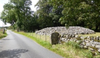
Nearby Images from Flickr


The above images may not be of the site on this page, but were taken nearby. They are loaded from Flickr so please click on them for image credits.
Click here to see more info for this site
Nearby sites
Click here to view sites on an interactive map of the areaKey: Red: member's photo, Blue: 3rd party photo, Yellow: other image, Green: no photo - please go there and take one, Grey: site destroyed
Download sites to:
KML (Google Earth)
GPX (GPS waypoints)
CSV (Garmin/Navman)
CSV (Excel)
To unlock full downloads you need to sign up as a Contributory Member. Otherwise downloads are limited to 50 sites.
Turn off the page maps and other distractions
Nearby sites listing. In the following links * = Image available
43.0km NE 53° Spout Run* Not Known (by us)
67.4km E 89° Foamhenge (Cox Farms) Modern Stone Circle etc
106.1km E 87° Embassy of Costa Rica, Washington DC Carving
129.1km S 173° Elk Hill Petroglyphs Rock Art
136.1km E 93° Pig Point Ancient Village or Settlement
168.2km E 96° Paw Paw Cove Natural Stone / Erratic / Other Natural Feature
175.9km SW 219° Foamhenge (Natural Bridge)* Modern Stone Circle etc
199.2km NE 55° Safe Harbor Petroglyphs* Rock Art
216.9km NE 48° Bring Rocks Manheim* Modern Stone Circle etc
218.0km SSE 159° Cactus Hill Ancient Village or Settlement
234.4km NW 320° McKees Rocks Mound* Artificial Mound
239.1km NE 38° Boxcar Rocks* Natural Stone / Erratic / Other Natural Feature
242.3km WNW 300° Grave Creek Mound* Artificial Mound
247.2km NW 310° Meadowcroft Rockshelter* Cave or Rock Shelter
250.1km NW 316° Artificial Mound in Great Lakes Midwest* Artificial Mound
253.5km NW 306° Hodgen's Cemetery Mound* Artificial Mound
258.5km WNW 285° Reynolds Mound* Artificial Mound
277.4km WSW 253° Armstrong Mountain* Artificial Mound
278.7km WNW 297° Barnesville Rock Art* Rock Art
281.0km WNW 284° Marietta Earthworks - Conus* Artificial Mound
281.6km WNW 284° Marietta Earthworks - Capitolium* Artificial Mound
281.8km WNW 284° Campus Martius* Museum
281.9km WNW 284° Marietta Earthworks - Quadranaou* Pyramid / Mastaba
282.1km WNW 284° Marietta Earthworks* Misc. Earthwork
286.1km SW 229° Fort Bragg Misc. Earthwork
View more nearby sites and additional images


 We would like to know more about this location. Please feel free to add a brief description and any relevant information in your own language.
 Wir möchten mehr über diese Stätte erfahren. Bitte zögern Sie nicht, eine kurze Beschreibung und relevante Informationen in Deutsch hinzuzufügen.
 Nous aimerions en savoir encore un peu sur les lieux. S'il vous plaît n'hesitez pas à ajouter une courte description et tous les renseignements pertinents dans votre propre langue.
 Quisieramos informarnos un poco más de las lugares. No dude en añadir una breve descripción y otros datos relevantes en su propio idioma.