


<< Our Photo Pages >> Guitarrero Cave - Cave or Rock Shelter in Peru
Submitted by davidmorgan on Saturday, 06 October 2012 Page Views: 4897
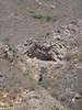
Natural PlacesSite Name: Guitarrero Cave Alternative Name: Cueva del GuitarreroCountry: Peru
NOTE: This site is 19.52 km away from the location you searched for.
Type: Cave or Rock Shelter
Nearest Town: Huaraz
Latitude: 9.200457S Longitude: 77.709745W
Condition:
| 5 | Perfect |
| 4 | Almost Perfect |
| 3 | Reasonable but with some damage |
| 2 | Ruined but still recognisable as an ancient site |
| 1 | Pretty much destroyed, possibly visible as crop marks |
| 0 | No data. |
| -1 | Completely destroyed |
| 5 | Superb |
| 4 | Good |
| 3 | Ordinary |
| 2 | Not Good |
| 1 | Awful |
| 0 | No data. |
| 5 | Can be driven to, probably with disabled access |
| 4 | Short walk on a footpath |
| 3 | Requiring a bit more of a walk |
| 2 | A long walk |
| 1 | In the middle of nowhere, a nightmare to find |
| 0 | No data. |
| 5 | co-ordinates taken by GPS or official recorded co-ordinates |
| 4 | co-ordinates scaled from a detailed map |
| 3 | co-ordinates scaled from a bad map |
| 2 | co-ordinates of the nearest village |
| 1 | co-ordinates of the nearest town |
| 0 | no data |
Be the first person to rate this site - see the 'Contribute!' box in the right hand menu.
Internal Links:
External Links:
")
Note: Carbon dating identifies South America's oldest textiles
You may be viewing yesterday's version of this page. To see the most up to date information please register for a free account.
Do not use the above information on other web sites or publications without permission of the contributor.
Nearby Images from Flickr
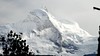
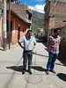
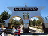
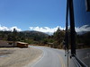

The above images may not be of the site on this page, but were taken nearby. They are loaded from Flickr so please click on them for image credits.
Click here to see more info for this site
Nearby sites
Click here to view sites on an interactive map of the areaKey: Red: member's photo, Blue: 3rd party photo, Yellow: other image, Green: no photo - please go there and take one, Grey: site destroyed
Download sites to:
KML (Google Earth)
GPX (GPS waypoints)
CSV (Garmin/Navman)
CSV (Excel)
To unlock full downloads you need to sign up as a Contributory Member. Otherwise downloads are limited to 50 sites.
Turn off the page maps and other distractions
Nearby sites listing. In the following links * = Image available
21.4km NNW 328° Tumshukayko* Ancient Village or Settlement
38.2km SE 145° Willkawain* Chambered Tomb
38.9km SE 145° Ichik Willkawain* Chambered Tomb
41.7km SSE 152° Museo Regional de Áncash Museum
48.8km SW 220° Pallka Ancient Village or Settlement
52.3km W 281° Siete Huaca* Ancient Village or Settlement
54.3km WSW 250° Huerequeque Ancient Village or Settlement
65.5km WSW 243° Sechin Alto Ancient Village or Settlement
65.5km WSW 239° Pampa de Las Llamas - Moxeque Ancient Village or Settlement
65.9km WSW 244° Taukachi-Konkan Ancient Village or Settlement
67.6km WSW 244° Sechin Bajo Ancient Palace
67.9km WSW 243° Cerro Sechin* Ancient Temple
69.3km WSW 238° La Cantina Ancient Village or Settlement
69.5km SW 235° Chankillo - 13 Towers* Ancient Temple
70.0km SW 235° Chankillo Fortress* Ancient Temple
72.8km SE 127° Chavín de Huantar* Ancient Village or Settlement
78.2km W 264° Huambacho Ancient Village or Settlement
85.1km SW 229° Las Aldas Ancient Village or Settlement
92.2km SE 146° Pastoruri Road Rock Art
94.8km NNW 329° La Galgada Pyramid / Mastaba
106.1km SSW 205° El Castillo de Huarmey* Pyramid / Mastaba
111.9km E 100° Piruro Hillfort
113.8km ESE 101° Susupillo Hillfort
121.4km ESE 119° Saway Ancient Village or Settlement
123.6km SE 127° Wanuku Pampa* Ancient Village or Settlement
View more nearby sites and additional images


 We would like to know more about this location. Please feel free to add a brief description and any relevant information in your own language.
 Wir möchten mehr über diese Stätte erfahren. Bitte zögern Sie nicht, eine kurze Beschreibung und relevante Informationen in Deutsch hinzuzufügen.
 Nous aimerions en savoir encore un peu sur les lieux. S'il vous plaît n'hesitez pas à ajouter une courte description et tous les renseignements pertinents dans votre propre langue.
 Quisieramos informarnos un poco más de las lugares. No dude en añadir una breve descripción y otros datos relevantes en su propio idioma.