


<< Text Pages >> Cantalloc Aqueduct - Ancient Mine, Quarry or other Industry in Peru
Submitted by bat400 on Monday, 08 March 2010 Page Views: 3923
Multi-periodSite Name: Cantalloc AqueductCountry: Peru Type: Ancient Mine, Quarry or other Industry
Nearest Town: Nazca, Peru Nearest Village: Cantalloc, Peru
Latitude: 14.8266S Longitude: 74.91W
Condition:
| 5 | Perfect |
| 4 | Almost Perfect |
| 3 | Reasonable but with some damage |
| 2 | Ruined but still recognisable as an ancient site |
| 1 | Pretty much destroyed, possibly visible as crop marks |
| 0 | No data. |
| -1 | Completely destroyed |
| 5 | Superb |
| 4 | Good |
| 3 | Ordinary |
| 2 | Not Good |
| 1 | Awful |
| 0 | No data. |
| 5 | Can be driven to, probably with disabled access |
| 4 | Short walk on a footpath |
| 3 | Requiring a bit more of a walk |
| 2 | A long walk |
| 1 | In the middle of nowhere, a nightmare to find |
| 0 | No data. |
| 5 | co-ordinates taken by GPS or official recorded co-ordinates |
| 4 | co-ordinates scaled from a detailed map |
| 3 | co-ordinates scaled from a bad map |
| 2 | co-ordinates of the nearest village |
| 1 | co-ordinates of the nearest town |
| 0 | no data |
Be the first person to rate this site - see the 'Contribute!' box in the right hand menu.
Internal Links:
External Links:
Ancient Industry in Ica Department.
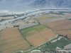
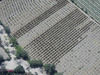
An underground aqueduct associated with the Nasca culture. The ancient aqueduct and surface access points has been maintained into the modern era. Visible on the surface are multiple spiral pathways from the surface and down through the earth to the aqueduct.
You may be viewing yesterday's version of this page. To see the most up to date information please register for a free account.
Do not use the above information on other web sites or publications without permission of the contributor.
Nearby Images from Flickr
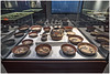
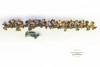
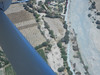
The above images may not be of the site on this page, but were taken nearby. They are loaded from Flickr so please click on them for image credits.
Click here to see more info for this site
Nearby sites
Click here to view sites on an interactive map of the areaKey: Red: member's photo, Blue: 3rd party photo, Yellow: other image, Green: no photo - please go there and take one, Grey: site destroyed
Download sites to:
KML (Google Earth)
GPX (GPS waypoints)
CSV (Garmin/Navman)
CSV (Excel)
To unlock full downloads you need to sign up as a Contributory Member. Otherwise downloads are limited to 50 sites.
Turn off the page maps and other distractions
Nearby sites listing. In the following links * = Image available
2.1km W 274° Museo Antonini Museum
2.3km NE 34° La Tiza Ancient Village or Settlement
3.2km WSW 238° Paredones Ancient Village or Settlement
4.2km NE 49° El Trigal Ancient Village or Settlement
9.2km W 277° Nazca Lines - Whale* Hill Figure or Geoglyph
17.4km S 186° Chauchilla Necropolis Barrow Cemetery
20.4km WNW 296° Nazca Lines - "The Astronaut"* Hill Figure or Geoglyph
22.3km W 273° Cahuachi Ancient Village or Settlement
26.5km NW 304° Nazca Lines - Hands and Tree* Hill Figure or Geoglyph
27.2km WNW 303° Nazca Lines - Spider* Hill Figure or Geoglyph
27.6km NW 304° Nazca Lines - Small Spiral* Hill Figure or Geoglyph
27.9km WNW 298° Nazca Lines - Monkey* Hill Figure or Geoglyph
29.1km WNW 303° Museo Maria Reiche Museum
29.7km WNW 300° Nazca Lines - Hummingbird* Hill Figure or Geoglyph
30.3km WNW 300° Nazca Lines - Trapezoids Hill Figure or Geoglyph
30.6km WNW 299° Nazca Lines* Hill Figure or Geoglyph
30.7km NW 312° Mina Primavera Ancient Mine, Quarry or other Industry
40.7km NW 310° Petroglifos de Llipata* Hill Figure or Geoglyph
45.3km NW 318° Solar Watch Hill Figure or Geoglyph
49.1km NW 319° Pernil Alto Ancient Village or Settlement
144.1km NNW 341° Huaytara Ancient Palace
144.1km NNW 345° Inka Wasi Ancient Palace
159.3km NW 321° Tambo Colorado* Ancient Village or Settlement
166.2km NE 38° Vilcashuamán Ancient Village or Settlement
181.6km NW 307° Paracas History Museum* Museum
View more nearby sites and additional images


 We would like to know more about this location. Please feel free to add a brief description and any relevant information in your own language.
 Wir möchten mehr über diese Stätte erfahren. Bitte zögern Sie nicht, eine kurze Beschreibung und relevante Informationen in Deutsch hinzuzufügen.
 Nous aimerions en savoir encore un peu sur les lieux. S'il vous plaît n'hesitez pas à ajouter une courte description et tous les renseignements pertinents dans votre propre langue.
 Quisieramos informarnos un poco más de las lugares. No dude en añadir una breve descripción y otros datos relevantes en su propio idioma.