


<< Text Pages >> Villa de Mosteiros - Ancient Village or Settlement in Portugal in Évora
Submitted by holger_rix on Monday, 07 December 2015 Page Views: 695
Multi-periodSite Name: Villa de MosteirosCountry: Portugal
NOTE: This site is 6.585 km away from the location you searched for.
Distrito: Évora Type: Ancient Village or Settlement
Latitude: 38.309310N Longitude: 7.88522W
Condition:
| 5 | Perfect |
| 4 | Almost Perfect |
| 3 | Reasonable but with some damage |
| 2 | Ruined but still recognisable as an ancient site |
| 1 | Pretty much destroyed, possibly visible as crop marks |
| 0 | No data. |
| -1 | Completely destroyed |
| 5 | Superb |
| 4 | Good |
| 3 | Ordinary |
| 2 | Not Good |
| 1 | Awful |
| 0 | No data. |
| 5 | Can be driven to, probably with disabled access |
| 4 | Short walk on a footpath |
| 3 | Requiring a bit more of a walk |
| 2 | A long walk |
| 1 | In the middle of nowhere, a nightmare to find |
| 0 | No data. |
| 5 | co-ordinates taken by GPS or official recorded co-ordinates |
| 4 | co-ordinates scaled from a detailed map |
| 3 | co-ordinates scaled from a bad map |
| 2 | co-ordinates of the nearest village |
| 1 | co-ordinates of the nearest town |
| 0 | no data |
Be the first person to rate this site - see the 'Contribute!' box in the right hand menu.
Internal Links:
External Links:
Ancient Village or Settlement in Évora
You may be viewing yesterday's version of this page. To see the most up to date information please register for a free account.
Do not use the above information on other web sites or publications without permission of the contributor.
Nearby Images from Flickr
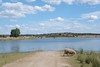
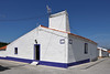
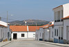
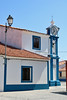

The above images may not be of the site on this page, but were taken nearby. They are loaded from Flickr so please click on them for image credits.
Click here to see more info for this site
Nearby sites
Click here to view sites on an interactive map of the areaKey: Red: member's photo, Blue: 3rd party photo, Yellow: other image, Green: no photo - please go there and take one, Grey: site destroyed
Download sites to:
KML (Google Earth)
GPX (GPS waypoints)
CSV (Garmin/Navman)
CSV (Excel)
To unlock full downloads you need to sign up as a Contributory Member. Otherwise downloads are limited to 50 sites.
Turn off the page maps and other distractions
Nearby sites listing. In the following links * = Image available
9.6km N 3° Anta da Herdade da Murteira Burial Chamber or Dolmen
10.2km S 175° Menir de Mac Abraão Standing Stone (Menhir)
10.2km SSE 160° São Cucufate* Ancient Village or Settlement
11.7km NW 321° Anta de Aguiar* Burial Chamber or Dolmen
12.0km NNE 21° Anta da Herdade da Tisnada Burial Chamber or Dolmen
14.8km E 81° Castro de Castelo Velho Castro or Chafurdão
15.8km E 89° Antas da Herdade do Freixo* Burial Chamber or Dolmen
19.3km NNW 345° Anta da Herdade do Zambujal Burial Chamber or Dolmen
20.3km NE 35° Castelos de Monte Novo Castro or Chafurdão
22.6km N 7° Anta da Herdada do Vale de Moura 3* Burial Chamber or Dolmen
24.5km NNW 335° Anta Herdade do Barrocal 1* Burial Chamber or Dolmen
24.6km NNW 335° Anta do Barrocal 2* Burial Chamber or Dolmen
24.8km NNW 330° Villa de Nossa Senhora de Tourega* Ancient Village or Settlement
25.5km N 0° Anta da Herdade das Azinheiras* Burial Chamber or Dolmen
25.7km NW 324° Vale de Rodrigo 2* Burial Chamber or Dolmen
26.5km NW 324° Vale de Rodrigo 3* Burial Chamber or Dolmen
26.6km ENE 58° Anta e Menir da Igreja de São Vicente do Pigeiro* Modern Stone Circle etc
27.2km NW 324° Conjunto Megalítico de Vale de Rodrigo* Barrow Cemetery
27.4km NW 324° Vale de Rodrigo 1* Round Barrow(s)
27.5km NNW 336° Miliário da Mitra (Valverde)* Marker Stone
27.6km E 95° Anta do Chão da Pereira* Burial Chamber or Dolmen
27.9km NNW 336° Anta Grande do Zambujeiro* Burial Chamber or Dolmen
28.2km NNW 336° Anta Pequena do Zambujeiro* Burial Chamber or Dolmen
28.4km NNW 347° Menir 2 das Lajes* Standing Stone (Menhir)
28.4km NNW 333° Castelo do Giraldo* Castro or Chafurdão
View more nearby sites and additional images


 We would like to know more about this location. Please feel free to add a brief description and any relevant information in your own language.
 Wir möchten mehr über diese Stätte erfahren. Bitte zögern Sie nicht, eine kurze Beschreibung und relevante Informationen in Deutsch hinzuzufügen.
 Nous aimerions en savoir encore un peu sur les lieux. S'il vous plaît n'hesitez pas à ajouter une courte description et tous les renseignements pertinents dans votre propre langue.
 Quisieramos informarnos un poco más de las lugares. No dude en añadir una breve descripción y otros datos relevantes en su propio idioma.