Featured: Hare and Tabor T Shirts for discerning antiquarians

Hare and Tabor T Shirts for discerning antiquarians

Rocks & Rows, Sailing Routes across the Atlantic and the Copper Trade

Rocks & Rows, Sailing Routes across the Atlantic and the Copper Trade

Who's Online

There are currently, 257 guests and 3 members online.

You are a guest. To join in, please register for free by clicking here

Sponsors

<< Our Photo Pages >> Beltany - Stone Circle in Ireland (Republic of) in Co. Donegal

Submitted by enkidu41 on Sunday, 13 October 2002  Page Views:

Neolithic and Bronze AgeSite Name: Beltany Alternative Name: Beltany Tops
Country: Ireland (Republic of)
NOTE: This site is 3.94 km away from the location you searched for.

County: Co. Donegal Type: Stone Circle
Nearest Town: Strabane  Nearest Village: Raphoe
Map Ref: C2543600364
Discovery Map Number: D6
Latitude: 54.850398N  Longitude: 7.604762W
Condition:
5Perfect
4Almost Perfect
3Reasonable but with some damage
2Ruined but still recognisable as an ancient site
1Pretty much destroyed, possibly visible as crop marks
0No data.
-1Completely destroyed
4 Ambience:
5Superb
4Good
3Ordinary
2Not Good
1Awful
0No data.
4 Access:
5Can be driven to, probably with disabled access
4Short walk on a footpath
3Requiring a bit more of a walk
2A long walk
1In the middle of nowhere, a nightmare to find
0No data.
3 Accuracy:
5co-ordinates taken by GPS or official recorded co-ordinates
4co-ordinates scaled from a detailed map
3co-ordinates scaled from a bad map
2co-ordinates of the nearest village
1co-ordinates of the nearest town
0no data
5

Internal Links:
External Links:

I have visited· I would like to visit

Andy B radrad would like to visit

SteveC visited on 10th May 2010 - their rating: Cond: 5 Amb: 5 Access: 4

jeffrep visited on 24th Apr 2009 - their rating: Cond: 3 Amb: 4 Access: 3

X-Ice visited on 7th Dec 1982 - their rating: Cond: 4 Amb: 4 Access: 4

DrewParsons paulcall have visited here

Average ratings for this site from all visit loggers: Condition: 4 Ambience: 4.33 Access: 3.67
Beltany
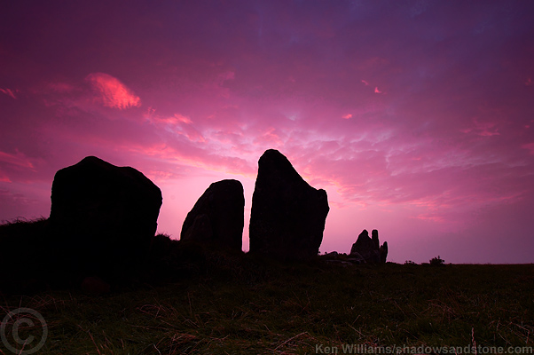
Beltany submitted by kenwilliams : Dawn on 16th October 2005. (Vote or comment on this photo)
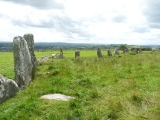
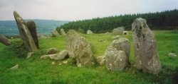
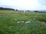
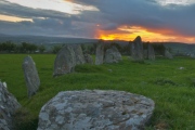
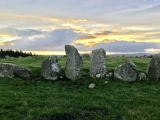
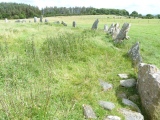
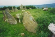
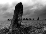
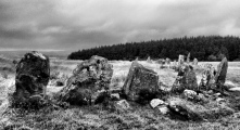
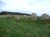
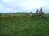
Stone Circle in Co. Donegal. A 45m diameter circle of 60 surviving stones averaging 1.6m in height, the tallest at the WSW. It is the kerb, contiguous in places of a much reduced cairn prominently sited on a 1m to 1.2m platform atop a hill. On the E and W sides are pairs of conspicuously large stones 2.7m high. A single monolith 1.8m high stands 20m to the SE. From the high pillarstone at the WSW of the circle a cupmarked 1.5m high triangular slab at the ENE marks the point where the sun rises on May Day (Bealtaine or 'Beltany'). There are also standing-stones to the N and NW.
You may be viewing yesterday's version of this page. To see the most up to date information please register for a free account.
Beltany
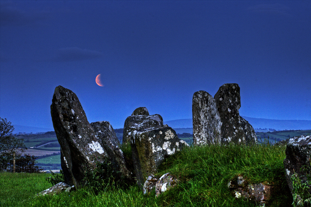
Beltany submitted by Flickr : Lunar eclipse at Beltany Stone Circle 15th June 2011 (HDR) Image copyright: Daragh McDonough (Daragh McDonough), hosted on Flickr and displayed under the terms of their API. (Vote or comment on this photo)

Beltany
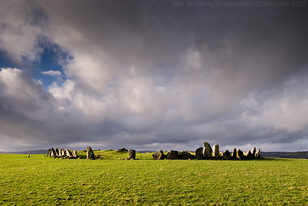
Beltany submitted by KenWilliams : Beltany Tops stone circle, 6/1/07. A burst of sunshine as the clouds roll in. (3 comments - Vote or comment on this photo)

Beltany
Beltany submitted by DrewParsons : September 2008 (Vote or comment on this photo)

Beltany
Beltany submitted by DrewParsons (Vote or comment on this photo)

Beltany
Beltany submitted by paulcall : Another partial view of the circle with the outlier at the south-east.

Beltany
Beltany submitted by Swinside : Part view of perimeter of the stone circle

Beltany
Beltany submitted by Bladup : Beltany tops stone circle.

Beltany
Beltany submitted by KaiHofmann : Beltany stone circle - closer view. (2 comments)

Beltany
Beltany submitted by KaiHofmann : Beltany stone circle, closer view.

Beltany
Beltany submitted by DrewParsons : September 2008

Beltany
Beltany submitted by twentytrees : Fine stone circle this. One of very few in Donegal. Easily accessible about 200m from car parking. Excellent views in all directions except north which is obscured by fir trees. (1 comment)

Beltany
Beltany submitted by twentytrees : Looking west near sunset.

Beltany
Beltany submitted by Perrydigm : 10/17/17 6:04 pm

Beltany
Beltany submitted by Swinside : Part view of perimeter of the stone circle

Beltany
Beltany submitted by Bladup : Beltany tops stone circle.

Beltany
Beltany submitted by ainsloch : The beautiful Beltany stone circle

Beltany
Beltany submitted by KaiHofmann : Beltany stone circle and the marker stone.

Beltany
Beltany submitted by KaiHofmann : Beltany stone circle.

Beltany
Beltany submitted by DrewParsons : September 2008. The solitary outlier stone 2 metres high standing to the south east of the circle.

Beltany
Beltany submitted by DrewParsons : September 2008

Beltany
Beltany submitted by DrewParsons

Beltany
Beltany submitted by DrewParsons

Beltany
Beltany submitted by Swinside : Approach to the stone circle - it has a huge perimeter

Beltany
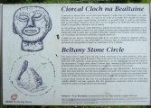
Beltany submitted by Swinside : Stone circle info plaque at entry to site

These are just the first 25 photos of Beltany. If you log in with a free user account you will be able to see our entire collection.

Do not use the above information on other web sites or publications without permission of the contributor.
Click here to see more info for this site

Nearby sites

Click here to view sites on an interactive map of the area

Key: Red: member's photo, Blue: 3rd party photo, Yellow: other image, Green: no photo - please go there and take one, Grey: site destroyed

Download sites to:
KML (Google Earth)
GPX (GPS waypoints)
CSV (Garmin/Navman)
CSV (Excel)

To unlock full downloads you need to sign up as a Contributory Member. Otherwise downloads are limited to 50 sites.

Stone Pages (Still Images) by Arosio and Meozzi


Turn off the page maps and other distractions

Nearby sites listing. In the following links * = Image available
 3.3km SSE 148° Kilmonaster Site D* Passage Grave
 3.3km SE 146° Kilmonaster Site A* Passage Grave
 5.3km ESE 123° Croaghan Hill* Cairn
 9.4km N 350° Labbadish Stone Row / Alignment (C238096)
 11.9km S 180° Creevy Upper Stone Row / Alignment (H255885)
 12.0km W 272° Magherayall* Chambered Tomb (C134007)
 14.1km ENE 72° Sandville and Lisvdin* Standing Stones
 14.5km SSW 202° Garvagh Court Tomb Court Tomb (H201869)
 14.7km NE 43° Cloghfin Standing Stones (C355111)
 15.6km E 96° Knocknahorna Stone Circle (H410989)
 15.6km E 96° Knocknahorna Multiple Stone Rows / Avenue (H410989)
 16.1km ENE 74° Ballynabwee fort* Stone Fort or Dun (C40880495)
 16.7km SSE 159° Crew Lower* Standing Stones (H315848)
 19.5km W 272° Moonbeg* Chambered Tomb (C059010)
 20.0km SE 129° Glenknock Portal Tomb Portal Tomb (H411879)
 20.2km E 91° Lisnaragh Irish rath* Stone Fort or Dun (C45690023)
 20.2km S 188° Leitrim Portal Tomb* Portal Tomb (H227803)
 20.3km W 264° Ballybotemple* Standing Stones (H0517297963)
 20.5km E 98° Meendamph B* Stone Circle (H458976)
 20.5km SE 128° Crosh Portal Tomb Portal Tomb (H417878)
 20.8km E 100° Meendamph A Stone Circle (H460970)
 20.9km SE 146° Ballyrenan* Portal Tomb (H3733083180)
 21.3km E 98° Banagher* Stone Circle (H466977)
 21.5km ESE 104° Balix standing stone* Standing Stone (Menhir) (H46369523)
 22.3km NNE 30° Grianán of Ailech* Stone Fort or Dun (C366197)
View more nearby sites and additional images

<< Templebryan stone circle

Lissacresig >>

Please add your thoughts on this site

Clickable Map of Ireland

Mesolithic Britain and Ireland: New Approaches

Mesolithic Britain and Ireland: New Approaches

Web Links for Beltany

Stone Pages (Still Images) by Arosio and Meozzi

Sponsors

Auto-Translation (Google)

Translate from English into:

"Beltany" | Login/Create an Account | 6 News and Comments
  
Go back to top of page    Comments are owned by the poster. We aren't responsible for their content.
Re: Beltany by Andy B on Monday, 07 May 2018
(User Info | Send a Message)
National Monuments Service:
Class Stone circle
Townland TOPS
SMR No. DG070-026001-
Description This monument, on a hilltop with an extensive outlook in all directions, is known as Beltany Stone Circle. It lies 3.2km NNW of the cemetery of megalithic tombs centred on Kilmonaster Middle townland. It consists of a disturbed artificial platform now c. 0.5m high, perhaps the base of a cairn, bounded by a circle of large stones. The circle is c. 45m in diameter. At present 64 stones stand in the circle, and there may originally have been up to 80. Some large stones are exposed in the disturbed interior. It has been suggested that there may have been a megalithic chamber within the circle (O.D. 1939), perhaps a passage tomb (Ó Nualláin 1995, 15). The earliest accounts of the site seem to be those in the unpublished documentation of the Ordnance Survey dating to the years shortly before the mid-19th century. It is clear that the monument was considerably disturbed at this stage. According to the OS Memoir (1836), there had been a cairn or 'vast heap of stones' within the circle, but it had been removed to form fences in the vicinity. Thomas Fagan (1845-8), who saw the monument in 1846, observed that both the interior and the enclosing circle of stones were much disfigured. He was informed that 'the interior was raised with earth and stones covering and encircling sepulchral graves' and that decayed bones were unearthed here. Excavation would be required to determine whether the enclosed platform is the base of a cairn and whether there was any form of megalithic chamber here.OS Mem oirs, Raphoe parish (1836), 1, 27; Fagan 1845-8, book 10, 28; H. Morris 1939 (Beltany); O.D. 1939 (Beltany); Lacy 1983, 72-3, no. 329 (fig.); SMR 1987, 70:26B; Ó Nualláin 1995, 15; RMP 1995, 70:26/1. The above description was published in the 'Survey of the Megalithic Tombs of Ireland. Volume VI, County Donegal.' Compiled by: Eamon Cody (Dublin: Stationery Office, 2002). The Beltany Stone Circle (National Monument Number No. 463), consists of a disturbed artificial platform c. 0.5m high defined by a circle of large stones of which sixty-four remain but which originally may have numbered about eighty (Boyle-Somerville 1922-3, 212). The stones are of varying sizes and one of them on the NE is covered on the internal side with cupmarks (there is possibly one cupmark on the external side also). The interior of the site was considerably interfered with in the 1930's (Davies 1939b, 293). Great numbers of loose stones are now lying up against the perimeter megaliths and dotted about the surface of the interior. Several stones protrude from the surface of the interior and in the SW sector there is a standing stone 1m high, almost an equilateral triangle in plan, each side .6m. Partially exposed in the ground to the W of the standing stone is the top of a long stone, possibly that referred to by Davies as suggesting a megalithic chamber. To the SE of the circle is an out-lying standing stone (DG070-026002-) 2m high. Boyle-Somerville suggested that this outlier as well as other features of the adjacent horizon were employed by the circle builders to determine astronomical alignments. The circle is situated on the summit of Beltany Hill in good land with excellent views. Sixty metres to the SW of the stone circle and on a slight terrace just below the summit of the hill, is a circular area (DG070-025----) 35m in diameter, open on the W side but defined elsewhere by stone-wall field boundaries. The area is marked as a 'Graveyard' on the 1st edition of the OS 6-inch maps and as an 'Old Graveyard' on the 2nd edition. It is not clear what the exact nature of this site was but its proximity to the stone circle might suggest that they were in some way related. The above description was derived from the 'Archaeological Survey of County Donegal. A description of the field antiquities of the County from the Mesolithic Period to the 17th century.' Compiled by: Brian Lacey with Eamon Cody, Claire Cotter, Judy Cuppage, Noel Dunne, Vincent Hu

Read the rest of this post...
[ Reply to This ]

Re: Beltany by Anonymous on Thursday, 17 September 2015
I find picture # PID:95945 interesting as from a distance there appears to be the body of a man with rays extending from the head.
[ Reply to This ]

Beltany Stone Circle, Donegal, Ireland - May Magic by Andy B on Tuesday, 17 August 2010
(User Info | Send a Message)
[ Reply to This ]

Re: Beltany by jeffrep on Thursday, 13 August 2009
(User Info | Send a Message)
Condition:3
Ambience:4
Access:3
Accuracy:
[ Reply to This ]

Re: Beltany by coldrum on Wednesday, 01 April 2009
(User Info | Send a Message)
Link:

http://www.donegaldirect.com/ws_business_details.aspx?BusinessID=619&Region=Stranorlar&BusinessNm=Beltany+Stone+Circle
[ Reply to This ]

Re: Beltany by Anonymous on Tuesday, 02 March 2004
Although originating in megalithic times, the commonest kind of bullaun is a portable stone associated with an ancient church or monastery, in which there is a deep, hemispherical depression.

we have one of the bullaun on the farm (convoy)not to far from this stone circle in Raphoe Approached via a farm lane leading W from a by-road running due S from Raphoe, this fine early circle (perhaps contemporaneous with, or a little earlier than, Ballynoe, Down) of 60 surviving stones averaging 1.6 metres in height is the kerb of a much reduced cairn, and similar to kerbed boulder-circles at Carrowmore in Sligo. Also known as Beltany, it is prominently sited on a hilltop, and affords wide views. Well outside the ring to the SE is a tall outlier. From the high pillarstone at the WSW of the circle a cupmarked triangular slab at the ENE marks the point where the sun rises on May Day (Bealtaine or 'Beltany'). There are also standing-stones to the N and NW.

From an anonymous poster.
[ Reply to This ]

Your Name: Anonymous [ Register Now ]
Subject:


Add your comment or contribution to this page. Spam or offensive posts are deleted immediately, don't even bother

<<< What is five plus one as a number? (Please type the answer to this question in the little box on the left)
You can also embed videos and other things. For Youtube please copy and paste the 'embed code'.
For Google Street View please include Street View in the text.
Create a web link like this: <a href="https://www.megalithic.co.uk">This is a link</a>  

Allowed HTML is:
<p> <b> <i> <a> <img> <em> <br> <strong> <blockquote> <tt> <li> <ol> <ul> <object> <param> <embed> <iframe>

We would like to know more about this location. Please feel free to add a brief description and any relevant information in your own language.
Wir möchten mehr über diese Stätte erfahren. Bitte zögern Sie nicht, eine kurze Beschreibung und relevante Informationen in Deutsch hinzuzufügen.
Nous aimerions en savoir encore un peu sur les lieux. S'il vous plaît n'hesitez pas à ajouter une courte description et tous les renseignements pertinents dans votre propre langue.
Quisieramos informarnos un poco más de las lugares. No dude en añadir una breve descripción y otros datos relevantes en su propio idioma.