 with our Megalithic Portal iPhone app")


<< Text Pages >> Karikon Teichos - Ancient Village or Settlement in Morocco
Submitted by AlexHunger on Friday, 18 April 2008 Page Views: 6200
Multi-periodSite Name: Karikon Teichos Alternative Name: Kir Chares, AzzemourCountry: Morocco
NOTE: This site is 73.534 km away from the location you searched for.
Type: Ancient Village or Settlement
Nearest Town: Azemmour Nearest Village: Azemmour
Latitude: 33.284012N Longitude: 8.339926W
Condition:
| 5 | Perfect |
| 4 | Almost Perfect |
| 3 | Reasonable but with some damage |
| 2 | Ruined but still recognisable as an ancient site |
| 1 | Pretty much destroyed, possibly visible as crop marks |
| 0 | No data. |
| -1 | Completely destroyed |
| 5 | Superb |
| 4 | Good |
| 3 | Ordinary |
| 2 | Not Good |
| 1 | Awful |
| 0 | No data. |
| 5 | Can be driven to, probably with disabled access |
| 4 | Short walk on a footpath |
| 3 | Requiring a bit more of a walk |
| 2 | A long walk |
| 1 | In the middle of nowhere, a nightmare to find |
| 0 | No data. |
| 5 | co-ordinates taken by GPS or official recorded co-ordinates |
| 4 | co-ordinates scaled from a detailed map |
| 3 | co-ordinates scaled from a bad map |
| 2 | co-ordinates of the nearest village |
| 1 | co-ordinates of the nearest town |
| 0 | no data |
Be the first person to rate this site - see the 'Contribute!' box in the right hand menu.
Internal Links:
External Links:
Ancient Village or Settlement in Marocco
Emporium founded by the Carthaginian s in the 5th Century BCE. Several Carthaginian tombs have been found at Azzemour. The site was mentioned in the Periples of Hanno the Navigator.
Exact location unknown.
You may be viewing yesterday's version of this page. To see the most up to date information please register for a free account.
Do not use the above information on other web sites or publications without permission of the contributor.
Nearby Images from Flickr
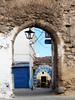
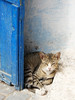
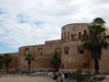
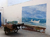

The above images may not be of the site on this page, but were taken nearby. They are loaded from Flickr so please click on them for image credits.
Click here to see more info for this site
Nearby sites
Click here to view sites on an interactive map of the areaKey: Red: member's photo, Blue: 3rd party photo, Yellow: other image, Green: no photo - please go there and take one, Grey: site destroyed
Download sites to:
KML (Google Earth)
GPX (GPS waypoints)
CSV (Garmin/Navman)
CSV (Excel)
To unlock full downloads you need to sign up as a Contributory Member. Otherwise downloads are limited to 50 sites.
Turn off the page maps and other distractions
Nearby sites listing. In the following links * = Image available
15.7km W 259° Akra Ancient Village or Settlement
161.6km ENE 60° Chellah* Ancient Village or Settlement
207.1km NE 55° Thamusida* Ancient Village or Settlement
219.2km ENE 74° Rock Shelter near Khemisset Cave or Rock Shelter
235.7km S 169° Oukaimeden* Rock Art
241.0km SW 215° Mogador* Promontory Fort / Cliff Castle
252.2km NE 54° Banasa* Ancient Village or Settlement
272.1km ENE 70° Volubilis* Ancient Village or Settlement
296.4km NE 43° Lixus* Ancient Village or Settlement
322.4km NE 42° Msoura* Stone Circle
333.8km NE 41° Ad Mercuri* Ancient Village or Settlement
384.7km SE 138° Ait Ouazik Menhir* Standing Stone (Menhir)
384.8km SE 138° Ait Ouazik Burial Mounds* Barrow Cemetery
384.9km SE 138° Ait Ouazik gravures rupestres* Rock Art
390.0km NE 36° Ranchiles Natural Stone / Erratic / Other Natural Feature
390.3km NE 36° Cueva del Moro (Tarifa) Cave or Rock Shelter
390.4km NE 36° Baelo Claudia* Ancient Village or Settlement
393.2km NE 37° Los Algarbes* Rock Cut Tomb
393.4km NE 39° Tarifa Castro or Chafurdão
393.8km NE 36° Silla del Papa* Hillfort
398.5km NE 37° Dolmen del Bujeo* Burial Chamber or Dolmen
399.0km NE 37° Menhir de Tribucio Standing Stone (Menhir)
402.0km S 189° Tazca gravures rupestres* Rock Art
412.7km NE 34° Cueva Tajo de Las Figuras Cave or Rock Shelter
417.2km N 4° Tanques romanos de salga de peixe* Ancient Mine, Quarry or other Industry
View more nearby sites and additional images


 We would like to know more about this location. Please feel free to add a brief description and any relevant information in your own language.
 Wir möchten mehr über diese Stätte erfahren. Bitte zögern Sie nicht, eine kurze Beschreibung und relevante Informationen in Deutsch hinzuzufügen.
 Nous aimerions en savoir encore un peu sur les lieux. S'il vous plaît n'hesitez pas à ajouter une courte description et tous les renseignements pertinents dans votre propre langue.
 Quisieramos informarnos un poco más de las lugares. No dude en añadir una breve descripción y otros datos relevantes en su propio idioma.