


<< Our Photo Pages >> Stiaraval Chambered Cairn - Chambered Cairn in Scotland in Isle of Benbecula
Submitted by h_fenton on Tuesday, 15 January 2008 Page Views: 5772
Neolithic and Bronze AgeSite Name: Stiaraval Chambered CairnCountry: Scotland
NOTE: This site is 0.147 km away from the location you searched for.
County: Isle of Benbecula Type: Chambered Cairn
Nearest Town: Baile a Mhanaich
Map Ref: NF81215260
Latitude: 57.451315N Longitude: 7.316939W
Condition:
| 5 | Perfect |
| 4 | Almost Perfect |
| 3 | Reasonable but with some damage |
| 2 | Ruined but still recognisable as an ancient site |
| 1 | Pretty much destroyed, possibly visible as crop marks |
| 0 | No data. |
| -1 | Completely destroyed |
| 5 | Superb |
| 4 | Good |
| 3 | Ordinary |
| 2 | Not Good |
| 1 | Awful |
| 0 | No data. |
| 5 | Can be driven to, probably with disabled access |
| 4 | Short walk on a footpath |
| 3 | Requiring a bit more of a walk |
| 2 | A long walk |
| 1 | In the middle of nowhere, a nightmare to find |
| 0 | No data. |
| 5 | co-ordinates taken by GPS or official recorded co-ordinates |
| 4 | co-ordinates scaled from a detailed map |
| 3 | co-ordinates scaled from a bad map |
| 2 | co-ordinates of the nearest village |
| 1 | co-ordinates of the nearest town |
| 0 | no data |
Internal Links:
External Links:
I have visited· I would like to visit
DrewParsons would like to visit
h_fenton has visited here
")
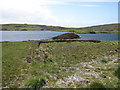
It's difficult to estimate exactly how big the cairn was because much of the stone has been robbed to build shielings, some of which were built on the cairn itself and others nearbly.
Viewing from the Stiaraval CC, the Airidh na h-aon Oidche Chambered Cairn lies roughly to the east 490metres away on a hilltop and forms part of the skyline/horizon, on very clear days Airidh na h-aon Oidche sits between two distant hills over on the Isle of Skye 26 miles away.
You may be viewing yesterday's version of this page. To see the most up to date information please register for a free account.
")
")
Do not use the above information on other web sites or publications without permission of the contributor.
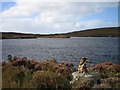
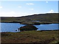
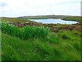
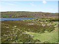
Nearby Images from Geograph Britain and Ireland:
©2007(licence)
©2010(licence)
©2017(licence)
©2009(licence)
©2009(licence)
The above images may not be of the site on this page, they are loaded from Geograph.
Please Submit an Image of this site or go out and take one for us!
Click here to see more info for this site
Nearby sites
Key: Red: member's photo, Blue: 3rd party photo, Yellow: other image, Green: no photo - please go there and take one, Grey: site destroyed
Download sites to:
KML (Google Earth)
GPX (GPS waypoints)
CSV (Garmin/Navman)
CSV (Excel)
To unlock full downloads you need to sign up as a Contributory Member. Otherwise downloads are limited to 50 sites.
Turn off the page maps and other distractions
Nearby sites listing. In the following links * = Image available
505m E 100° Airidh na h-aon Oidche Chambered Cairn* Chambered Cairn (NF81705247)
576m NNE 18° Stiaraval* Standing Stone (Menhir) (NF8143053134)
2.0km SW 224° Dun Aonais Stone Fort or Dun (NF79685125)
2.3km SSW 207° Dun Mhic Uisdein Stone Fort or Dun (NF80015064)
2.3km N 5° Olabhat Standing Stone* Standing Stone (Menhir) (NF8160754868)
2.7km NW 314° Dun Buidhe Stone Fort or Dun (NF7942354582)
2.9km NNE 22° Suidhheachadh Sealg* Stone Circle (NF82495521)
3.4km ENE 62° Benbencula, Hacklett Ancient Village or Settlement (NF8434753976)
3.4km ENE 65° Hacklett Standing Stone* Standing Stone (Menhir) (NF8444453837)
3.6km WSW 236° Dun Shuinish Stone Fort or Dun (NF78075086)
3.6km WSW 244° Loch An Dunain (Benbecula) Stone Fort or Dun (NF77865129)
3.8km NNE 16° Gramisdale* Stone Circle (NF82515613)
3.9km SSW 192° Dun Fhearchair Stone Fort or Dun (NF80104890)
4.7km NW 323° Bruach Ban Ancient Village or Settlement (NF787566)
4.9km SW 229° Lionacleit Submerged Forest Natural Stone / Erratic / Other Natural Feature (NF77274969)
7.1km S 177° Sig More* Chambered Cairn (NF8098345483)
7.2km NE 49° Dun Ban (Loch Hornaraigh)* Stone Fort or Dun (NF8697956930)
7.2km NE 44° Grimsay, Bagh Nam Feadhag* Ancient Village or Settlement (NF8665257367)
7.7km NE 47° Meall Na Hoa Cairn (NF8727157420)
7.8km N 10° Carinish* Stone Circle (NF83236020)
8.1km NNE 13° Caravat Barp* Passage Grave (NF837603)
8.4km NNE 25° Barp Hacklett Chambered Cairn (NF85395993)
8.8km NNW 335° Sloc Sabhaid* Ancient Village or Settlement (NF781609)
9.2km NNE 13° Possible Carved Footprints near Beinn Na Coille Carving (NF8398761447)
9.4km NNW 339° Dun Na H'Ola Stone Fort or Dun (NF78546161)
View more nearby sites and additional images


 We would like to know more about this location. Please feel free to add a brief description and any relevant information in your own language.
 Wir möchten mehr über diese Stätte erfahren. Bitte zögern Sie nicht, eine kurze Beschreibung und relevante Informationen in Deutsch hinzuzufügen.
 Nous aimerions en savoir encore un peu sur les lieux. S'il vous plaît n'hesitez pas à ajouter une courte description et tous les renseignements pertinents dans votre propre langue.
 Quisieramos informarnos un poco más de las lugares. No dude en añadir una breve descripción y otros datos relevantes en su propio idioma.