


<< Our Photo Pages >> Sepultura antropomórfica de Rochoso - Rock Cut Tomb in Portugal in Guarda
Submitted by Alta-Falisa on Friday, 28 August 2015 Page Views: 1581
Multi-periodSite Name: Sepultura antropomórfica de RochosoCountry: Portugal
NOTE: This site is 9.406 km away from the location you searched for.
Distrito: Guarda Type: Rock Cut Tomb
Nearest Town: Guarda Nearest Village: Rochoso
Latitude: 40.502100N Longitude: 7.0894W
Condition:
| 5 | Perfect |
| 4 | Almost Perfect |
| 3 | Reasonable but with some damage |
| 2 | Ruined but still recognisable as an ancient site |
| 1 | Pretty much destroyed, possibly visible as crop marks |
| 0 | No data. |
| -1 | Completely destroyed |
| 5 | Superb |
| 4 | Good |
| 3 | Ordinary |
| 2 | Not Good |
| 1 | Awful |
| 0 | No data. |
| 5 | Can be driven to, probably with disabled access |
| 4 | Short walk on a footpath |
| 3 | Requiring a bit more of a walk |
| 2 | A long walk |
| 1 | In the middle of nowhere, a nightmare to find |
| 0 | No data. |
| 5 | co-ordinates taken by GPS or official recorded co-ordinates |
| 4 | co-ordinates scaled from a detailed map |
| 3 | co-ordinates scaled from a bad map |
| 2 | co-ordinates of the nearest village |
| 1 | co-ordinates of the nearest town |
| 0 | no data |
Internal Links:
External Links:
")
A rock cut single tomb.
The rock is not dug into the ground ; and the rim all around the cavity (designed to receive a lid, now lost) and the place provided for the head show a rather sophisticated Sepultura may all indicate a late creation.
Leave Rochoso towards the South on road M.530. About 250 m after crossing the railway, you'll see a signpost at (40.5046 -7.0900) to the right, where you leave your car and walk uphill for about 350 m. Signposted again twice along the path. You cannot miss it.
March 2015.
You may be viewing yesterday's version of this page. To see the most up to date information please register for a free account.
")
")
")
")
Do not use the above information on other web sites or publications without permission of the contributor.
Nearby Images from Flickr
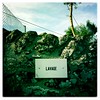
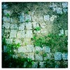
The above images may not be of the site on this page, but were taken nearby. They are loaded from Flickr so please click on them for image credits.
Click here to see more info for this site
Nearby sites
Click here to view sites on an interactive map of the areaKey: Red: member's photo, Blue: 3rd party photo, Yellow: other image, Green: no photo - please go there and take one, Grey: site destroyed
Download sites to:
KML (Google Earth)
GPX (GPS waypoints)
CSV (Garmin/Navman)
CSV (Excel)
To unlock full downloads you need to sign up as a Contributory Member. Otherwise downloads are limited to 50 sites.
Turn off the page maps and other distractions
Nearby sites listing. In the following links * = Image available
1.6km N 360° Menires de Rochoso* Standing Stones
8.7km NNW 342° Castro do Jarmelo Castro or Chafurdão
14.9km WNW 288° Nossa Senhora da Póvoa de Mileu Ancient Village or Settlement
16.6km NNW 327° Anta de Pêra do Moço* Burial Chamber or Dolmen
16.7km S 181° Museu do Sabugal* Museum
17.7km E 87° Anta da Pedra de Anta Burial Chamber or Dolmen
19.7km WNW 289° Castro de Tintinolho Castro or Chafurdão
20.6km NE 50° Piedra Caballero en Castelo Bom* Natural Stone / Erratic / Other Natural Feature
23.5km W 263° Sepulturas antropomórficas de la Ermida de Nª Sª de Soito* Rock Cut Tomb
25.5km WSW 237° Torre de Centum Cellas Ancient Village or Settlement
27.3km SW 234° Castro da Chandeirinha de Belmonte Castro or Chafurdão
29.4km SW 230° Villa Romana da Fórnea Ancient Village or Settlement
31.0km WNW 303° Estação arqueólogica de São Gens* Rock Cut Tomb
32.2km WSW 236° Castro de Orjais e ruínas dunha construción ao carón da capela de Nossa Senhora Castro or Chafurdão
32.6km SW 227° Anta da Rotunda de Caria* Modern Stone Circle etc
34.0km NNE 30° Necrópole de sepulturas escavadas na rocha em Malpartida* Rock Cut Tomb
36.7km WNW 295° Castro de Santiago* Castro or Chafurdão
37.2km N 11° Povoação do Colmeal Castro or Chafurdão
37.9km SSE 159° El Palancar Burial Chamber or Dolmen
39.8km WNW 298° Anta Orca de Cortiçô* Burial Chamber or Dolmen
40.5km WNW 301° Necrópole das Forcadas* Rock Cut Tomb
41.8km WNW 297° Dólmen de Matança* Burial Chamber or Dolmen
41.9km NW 311° Dolmen de Carapito 1* Burial Chamber or Dolmen
42.2km NW 311° Dolmen de Carapito 2* Burial Chamber or Dolmen
42.2km ENE 59° Siega Verde* Rock Art
View more nearby sites and additional images


 We would like to know more about this location. Please feel free to add a brief description and any relevant information in your own language.
 Wir möchten mehr über diese Stätte erfahren. Bitte zögern Sie nicht, eine kurze Beschreibung und relevante Informationen in Deutsch hinzuzufügen.
 Nous aimerions en savoir encore un peu sur les lieux. S'il vous plaît n'hesitez pas à ajouter une courte description et tous les renseignements pertinents dans votre propre langue.
 Quisieramos informarnos un poco más de las lugares. No dude en añadir una breve descripción y otros datos relevantes en su propio idioma.