


<< Our Photo Pages >> Pucara de Quitor - Stone Fort or Dun in Chile
Submitted by SolarMegalith on Tuesday, 12 October 2010 Page Views: 5056
Multi-periodSite Name: Pucara de Quitor Alternative Name: Pukara de QuitorCountry: Chile
NOTE: This site is 1.112 km away from the location you searched for.
Type: Stone Fort or Dun
Nearest Town: San Pedro de Atacama
Latitude: 22.90069S Longitude: 68.21806W
Condition:
| 5 | Perfect |
| 4 | Almost Perfect |
| 3 | Reasonable but with some damage |
| 2 | Ruined but still recognisable as an ancient site |
| 1 | Pretty much destroyed, possibly visible as crop marks |
| 0 | No data. |
| -1 | Completely destroyed |
| 5 | Superb |
| 4 | Good |
| 3 | Ordinary |
| 2 | Not Good |
| 1 | Awful |
| 0 | No data. |
| 5 | Can be driven to, probably with disabled access |
| 4 | Short walk on a footpath |
| 3 | Requiring a bit more of a walk |
| 2 | A long walk |
| 1 | In the middle of nowhere, a nightmare to find |
| 0 | No data. |
| 5 | co-ordinates taken by GPS or official recorded co-ordinates |
| 4 | co-ordinates scaled from a detailed map |
| 3 | co-ordinates scaled from a bad map |
| 2 | co-ordinates of the nearest village |
| 1 | co-ordinates of the nearest town |
| 0 | no data |
Internal Links:
External Links:
I have visited· I would like to visit
Dutch visited on 1st Jan 1997 - their rating: Cond: 2
")
Pucara de Quitor is a wonderful place - it's not far from San Pedro de Atacama town, but not many visitors come here. The fortress is located on top of the hill with wonderful view for the surroundings. The footpath fo Pucara de Quitor starts in San Pedro de Atacama - shortly after crossing the the river the ruins will be visible on your left.
You may be viewing yesterday's version of this page. To see the most up to date information please register for a free account.
")
Do not use the above information on other web sites or publications without permission of the contributor.
Nearby Images from Flickr
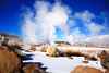
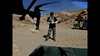
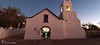
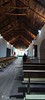
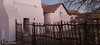
The above images may not be of the site on this page, but were taken nearby. They are loaded from Flickr so please click on them for image credits.
Click here to see more info for this site
Nearby sites
Click here to view sites on an interactive map of the areaKey: Red: member's photo, Blue: 3rd party photo, Yellow: other image, Green: no photo - please go there and take one, Grey: site destroyed
Download sites to:
KML (Google Earth)
GPX (GPS waypoints)
CSV (Garmin/Navman)
CSV (Excel)
To unlock full downloads you need to sign up as a Contributory Member. Otherwise downloads are limited to 50 sites.
Turn off the page maps and other distractions
Nearby sites listing. In the following links * = Image available
1.9km ESE 112° R. P. Gustavo Le Paige Archaeological Museum* Museum
7.9km SSW 198° Tulor Ancient Village or Settlement
25.0km N 356° Petroglifos Yerbas Buenas* Rock Art
125.5km NW 308° Chug Chug Geoglyphs* Hill Figure or Geoglyph
203.1km S 189° Llullaillaco Vault Chambered Tomb
293.7km NNW 329° Cerro Pintados* Hill Figure or Geoglyph
294.6km E 101° Los Armarillos Ancient Village or Settlement
296.0km ESE 104° Pucará de Juella Hillfort
296.6km E 97° Pucará de Peñas Blancas Hillfort
297.6km ESE 105° Pucará de Tilcara* Ancient Village or Settlement
298.8km ESE 103° Pucará del Angosto de Perchel Hillfort
299.2km E 101° Pucará de Yacoraite Hillfort
299.5km ESE 102° Pucará de Campo Morado Hillfort
301.3km E 96° Coctaca Ancient Village or Settlement
304.1km ESE 103° La Huerta Ancient Village or Settlement
307.9km SSW 210° San Ramon 15 Ancient Mine, Quarry or other Industry
307.9km SE 135° Potrero de Payogasta* Ancient Village or Settlement
318.7km SE 140° Bogatta Ancient Village or Settlement
322.2km SE 140° Mariscal Ancient Village or Settlement
323.4km SE 140° Archaeological Museum Pío Pablo Díaz* Museum
354.4km SE 127° MAAM* Museum
358.4km NNW 338° Tarapacá geoglyphs Hill Figure or Geoglyph
359.4km NNW 336° Atacama Giant* Hill Figure or Geoglyph
414.5km NNW 334° Tiliviche Geoglyphs* Hill Figure or Geoglyph
445.6km NE 35° Cerro Rico* Ancient Mine, Quarry or other Industry
View more nearby sites and additional images


 We would like to know more about this location. Please feel free to add a brief description and any relevant information in your own language.
 Wir möchten mehr über diese Stätte erfahren. Bitte zögern Sie nicht, eine kurze Beschreibung und relevante Informationen in Deutsch hinzuzufügen.
 Nous aimerions en savoir encore un peu sur les lieux. S'il vous plaît n'hesitez pas à ajouter une courte description et tous les renseignements pertinents dans votre propre langue.
 Quisieramos informarnos un poco más de las lugares. No dude en añadir una breve descripción y otros datos relevantes en su propio idioma.