


<< Text Pages >> Dehesa de Enmedio - Burial Chamber or Dolmen in Spain in Extremadura
Submitted by TheCaptain on Wednesday, 08 September 2010 Page Views: 1151
Neolithic and Bronze AgeSite Name: Dehesa de EnmedioCountry: Spain
NOTE: This site is 8.785 km away from the location you searched for.
Region: Extremadura Type: Burial Chamber or Dolmen
Nearest Town: Badajoz Nearest Village: Almendral
Latitude: 38.612000N Longitude: 6.822W
Condition:
| 5 | Perfect |
| 4 | Almost Perfect |
| 3 | Reasonable but with some damage |
| 2 | Ruined but still recognisable as an ancient site |
| 1 | Pretty much destroyed, possibly visible as crop marks |
| 0 | No data. |
| -1 | Completely destroyed |
| 5 | Superb |
| 4 | Good |
| 3 | Ordinary |
| 2 | Not Good |
| 1 | Awful |
| 0 | No data. |
| 5 | Can be driven to, probably with disabled access |
| 4 | Short walk on a footpath |
| 3 | Requiring a bit more of a walk |
| 2 | A long walk |
| 1 | In the middle of nowhere, a nightmare to find |
| 0 | No data. |
| 5 | co-ordinates taken by GPS or official recorded co-ordinates |
| 4 | co-ordinates scaled from a detailed map |
| 3 | co-ordinates scaled from a bad map |
| 2 | co-ordinates of the nearest village |
| 1 | co-ordinates of the nearest town |
| 0 | no data |
Be the first person to rate this site - see the 'Contribute!' box in the right hand menu.
Internal Links:
External Links:
Burial chamber in Extremadura
Dehesa de Enmedio is a burial chamber in the community of Almendral, Province of Badajoz, region of Extremadura
You may be viewing yesterday's version of this page. To see the most up to date information please register for a free account.
Do not use the above information on other web sites or publications without permission of the contributor.
Nearby Images from Flickr
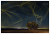
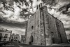


The above images may not be of the site on this page, but were taken nearby. They are loaded from Flickr so please click on them for image credits.
Click here to see more info for this site
Nearby sites
Click here to view sites on an interactive map of the areaKey: Red: member's photo, Blue: 3rd party photo, Yellow: other image, Green: no photo - please go there and take one, Grey: site destroyed
Download sites to:
KML (Google Earth)
GPX (GPS waypoints)
CSV (Garmin/Navman)
CSV (Excel)
To unlock full downloads you need to sign up as a Contributory Member. Otherwise downloads are limited to 50 sites.
Turn off the page maps and other distractions
Nearby sites listing. In the following links * = Image available
87m W 270° Canada de la Murta Burial Chamber or Dolmen
7.0km S 189° El Rocamador Dolmen Burial Chamber or Dolmen
7.0km S 189° El Palacio Dolmen Burial Chamber or Dolmen
7.1km W 275° El Romo Burial Chamber or Dolmen
7.3km WNW 296° Dolmen El Revellado 1* Burial Chamber or Dolmen
8.7km SW 216° Dolmen La Lapita* Burial Chamber or Dolmen
9.4km WNW 298° Dolmen El Revellado 2* Burial Chamber or Dolmen
9.6km S 188° Dolmen La Hermosina* Burial Chamber or Dolmen
10.0km S 188° Dolmen Cabeza Terrazo* Burial Chamber or Dolmen
12.8km SSW 211° El Milano Dolmen* Burial Chamber or Dolmen
13.3km SSW 204° Dolmen El Tajeño Burial Chamber or Dolmen
13.6km SW 218° La Pitera Menhir Standing Stone (Menhir)
14.0km SSW 213° Dolmen San Blas Burial Chamber or Dolmen
14.3km SW 217° Dolmen de La Rana Burial Chamber or Dolmen
14.5km WNW 282° Dolmen Montes Calderón Burial Chamber or Dolmen
14.8km SSE 166° Dolmen Monteporrino (1)* Burial Chamber or Dolmen
15.7km SSE 164° Dolmen Monteporrino (3) Burial Chamber or Dolmen
15.7km SSE 164° Dolmen Monteporrino (4)* Burial Chamber or Dolmen
16.0km SSE 165° Dolmen Monteporrino (5)* Burial Chamber or Dolmen
16.1km SSE 165° Dolmen Monteporrino (6)* Burial Chamber or Dolmen
16.1km SSE 165° Dolmen Monteporrino (7) Burial Chamber or Dolmen
16.2km SSE 166° Dolmen Monteporrino (2) Burial Chamber or Dolmen
16.5km SSE 165° Dolmen Monteporrino (8) Burial Chamber or Dolmen
16.5km SSE 161° Dolmen Monteporrino (14)* Burial Chamber or Dolmen
16.6km SSE 165° Dolmen Monteporrino (9) Burial Chamber or Dolmen
View more nearby sites and additional images


 We would like to know more about this location. Please feel free to add a brief description and any relevant information in your own language.
 Wir möchten mehr über diese Stätte erfahren. Bitte zögern Sie nicht, eine kurze Beschreibung und relevante Informationen in Deutsch hinzuzufügen.
 Nous aimerions en savoir encore un peu sur les lieux. S'il vous plaît n'hesitez pas à ajouter une courte description et tous les renseignements pertinents dans votre propre langue.
 Quisieramos informarnos un poco más de las lugares. No dude en añadir una breve descripción y otros datos relevantes en su propio idioma.