


<< Text Pages >> Viking longhouse Leirvík, Faeröer - Ancient Village or Settlement in Faroe Islands (Føroyar)
Submitted by Team-Omega-25 on Friday, 05 March 2021 Page Views: 493
Early Medieval (Dark Age)Site Name: Viking longhouse Leirvík, FaeröerCountry: Faroe Islands (Føroyar)
NOTE: This site is 13.103 km away from the location you searched for.
Type: Ancient Village or Settlement
Latitude: 62.212623N Longitude: 6.711457W
Condition:
| 5 | Perfect |
| 4 | Almost Perfect |
| 3 | Reasonable but with some damage |
| 2 | Ruined but still recognisable as an ancient site |
| 1 | Pretty much destroyed, possibly visible as crop marks |
| 0 | No data. |
| -1 | Completely destroyed |
| 5 | Superb |
| 4 | Good |
| 3 | Ordinary |
| 2 | Not Good |
| 1 | Awful |
| 0 | No data. |
| 5 | Can be driven to, probably with disabled access |
| 4 | Short walk on a footpath |
| 3 | Requiring a bit more of a walk |
| 2 | A long walk |
| 1 | In the middle of nowhere, a nightmare to find |
| 0 | No data. |
| 5 | co-ordinates taken by GPS or official recorded co-ordinates |
| 4 | co-ordinates scaled from a detailed map |
| 3 | co-ordinates scaled from a bad map |
| 2 | co-ordinates of the nearest village |
| 1 | co-ordinates of the nearest town |
| 0 | no data |
Internal Links:
External Links:
Ancient Village or Settlement in Denmark
Located on the Faeröer islands
You may be viewing yesterday's version of this page. To see the most up to date information please register for a free account.
Do not use the above information on other web sites or publications without permission of the contributor.
Nearby Images from Flickr
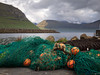
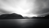
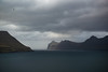
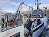

The above images may not be of the site on this page, but were taken nearby. They are loaded from Flickr so please click on them for image credits.
Click here to see more info for this site
Nearby sites
Click here to view sites on an interactive map of the areaKey: Red: member's photo, Blue: 3rd party photo, Yellow: other image, Green: no photo - please go there and take one, Grey: site destroyed
Download sites to:
KML (Google Earth)
GPX (GPS waypoints)
CSV (Garmin/Navman)
CSV (Excel)
To unlock full downloads you need to sign up as a Contributory Member. Otherwise downloads are limited to 50 sites.
Turn off the page maps and other distractions
Nearby sites listing. In the following links * = Image available
21.7km WSW 241° Viking longhouse Kvívík, Faeröer Ancient Village or Settlement
332.0km ESE 123° Loch of Houlland* Broch or Nuraghe (HU2140079160)
332.4km ESE 123° Sae Breck* Broch or Nuraghe (HU21057803)
332.7km ESE 123° Loch of Breckon Burnt Mound* Artificial Mound (HU21437803)
333.1km ESE 122° Hamnavoe Broch* Broch or Nuraghe (HU2389380641)
333.5km ESE 122° Giant's Stones (Shetland)* Standing Stones (HU2431280555)
333.6km ESE 122° Giant's Stones Row (Shetland)* Multiple Stone Rows / Avenue (HU243805)
334.8km ESE 120° Beorgs of Uyea neolithic axe factory* Ancient Mine, Quarry or other Industry (HU3268990052)
334.9km ESE 120° Beorgs of Uyea chambered cairn* Chambered Cairn (HU3278890043)
337.8km ESE 122° Burnside Burnt Mound* Artificial Mound (HU28057842)
337.9km SE 131° Da Heights Stone Circle (HT958407)
338.1km SE 131° The Brethren Standing Stone (Menhir) (HT94853943)
338.8km ESE 122° Gateside Chambered Cairn* Chambered Cairn (HU29137811)
339.5km ESE 116° Pigeon Hellie Broch or Nuraghe (HP485062)
340.3km ESE 120° Trowie Knowe* Chambered Cairn (HU36208552)
340.3km ESE 120° Beorgs of Housetter* Standing Stones (HU36178546)
340.5km SE 126° Doom Rings Stone Circle (HU166596)
341.0km SE 126° Papa Stour Chambered Cairn (HU17025924)
343.1km SE 126° Holm of Melby NW Cairn (HU19195856)
343.2km SE 126° Holm of Melby South Cairn (HU19225851)
343.2km SE 126° Holm of Melby NE Chambered Cairn (HU19315856)
343.6km SE 126° Sandness Class I Pictish Symbol Stone (HU19125765)
344.8km ESE 118° Lumbister, N Yell* Multiple Stone Rows / Avenue (HU486962)
345.0km ESE 119° West Sandwick* Broch or Nuraghe (HU440887)
345.1km SE 126° Ness of Garth* Promontory Fort / Cliff Castle (HU216583)
View more nearby sites and additional images


 We would like to know more about this location. Please feel free to add a brief description and any relevant information in your own language.
 Wir möchten mehr über diese Stätte erfahren. Bitte zögern Sie nicht, eine kurze Beschreibung und relevante Informationen in Deutsch hinzuzufügen.
 Nous aimerions en savoir encore un peu sur les lieux. S'il vous plaît n'hesitez pas à ajouter une courte description et tous les renseignements pertinents dans votre propre langue.
 Quisieramos informarnos un poco más de las lugares. No dude en añadir una breve descripción y otros datos relevantes en su propio idioma.