


<< Text Pages >> Dehesa de Frades - Castro or Chafurdão in Spain in Castilla y León
Submitted by TheCaptain on Wednesday, 08 September 2010 Page Views: 1658
Iron Age and Later PrehistorySite Name: Dehesa de FradesCountry: Spain Region: Castilla y León Type: Castro or Chafurdão
Nearest Town: Salamanca Nearest Village: Ledesma
Latitude: 41.083000N Longitude: 5.983W
Condition:
| 5 | Perfect |
| 4 | Almost Perfect |
| 3 | Reasonable but with some damage |
| 2 | Ruined but still recognisable as an ancient site |
| 1 | Pretty much destroyed, possibly visible as crop marks |
| 0 | No data. |
| -1 | Completely destroyed |
| 5 | Superb |
| 4 | Good |
| 3 | Ordinary |
| 2 | Not Good |
| 1 | Awful |
| 0 | No data. |
| 5 | Can be driven to, probably with disabled access |
| 4 | Short walk on a footpath |
| 3 | Requiring a bit more of a walk |
| 2 | A long walk |
| 1 | In the middle of nowhere, a nightmare to find |
| 0 | No data. |
| 5 | co-ordinates taken by GPS or official recorded co-ordinates |
| 4 | co-ordinates scaled from a detailed map |
| 3 | co-ordinates scaled from a bad map |
| 2 | co-ordinates of the nearest village |
| 1 | co-ordinates of the nearest town |
| 0 | no data |
Be the first person to rate this site - see the 'Contribute!' box in the right hand menu.
Internal Links:
External Links:
Castro in Castilla y León
Dehesa de Frades is a Castro in the community of Ledesma, Province of Salamanca, region of Castilla y León
You may be viewing yesterday's version of this page. To see the most up to date information please register for a free account.
Do not use the above information on other web sites or publications without permission of the contributor.
Nearby Images from Flickr
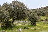
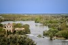
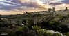


The above images may not be of the site on this page, but were taken nearby. They are loaded from Flickr so please click on them for image credits.
Click here to see more info for this site
Nearby sites
Click here to view sites on an interactive map of the areaKey: Red: member's photo, Blue: 3rd party photo, Yellow: other image, Green: no photo - please go there and take one, Grey: site destroyed
Download sites to:
KML (Google Earth)
GPX (GPS waypoints)
CSV (Garmin/Navman)
CSV (Excel)
To unlock full downloads you need to sign up as a Contributory Member. Otherwise downloads are limited to 50 sites.
Turn off the page maps and other distractions
Nearby sites listing. In the following links * = Image available
1.7km NW 312° Ledesma* Standing Stone (Menhir)
5.0km NE 40° Cuadrilleros Round Barrow(s)
6.2km SSW 211° Zafrón* Stone Circle
7.3km S 181° El Torrejón* Burial Chamber or Dolmen
10.0km S 188° Gejo de Diego Gómez Round Barrow(s)
15.8km WSW 252° Gejuelo Burial Chamber or Dolmen
18.2km WSW 239° Villasdardo Burial Chamber or Dolmen
21.7km WSW 250° Sahelicejos Burial Chamber or Dolmen
21.7km WSW 251° Sahelicejos 2 Burial Chamber or Dolmen
21.7km WSW 250° Sahelicejos 3* Burial Chamber or Dolmen
22.7km NNW 331° Casal del gato Burial Chamber or Dolmen
23.2km S 182° Robliza de Cojos Burial Chamber or Dolmen
27.7km SE 145° Valmuza: Iglesia Round Barrow(s)
27.7km SE 145° Valmuza: túmulo Round Barrow(s)
27.8km SE 145° Valmuza: Carrascalino Round Barrow(s)
27.9km SE 146° Valmuza: La Torrecilla Burial Chamber or Dolmen
31.3km SW 220° Buenamadre* Standing Stone (Menhir)
32.4km NNW 329° Pena del Ejido Castro or Chafurdão
34.5km WSW 245° Casa del Moro I Round Barrow(s)
34.7km WSW 245° Casa del Moro II Burial Chamber or Dolmen
43.1km N 7° San Pelayo Castro or Chafurdão
44.1km NNW 328° Virgen del Castillo Castro or Chafurdão
44.1km WNW 300° Teso de San Cristóbal* Cave or Rock Shelter
46.0km WNW 283° La Pena Gorda Castro or Chafurdão
46.6km WSW 242° Villavieja* Passage Grave
View more nearby sites and additional images


 We would like to know more about this location. Please feel free to add a brief description and any relevant information in your own language.
 Wir möchten mehr über diese Stätte erfahren. Bitte zögern Sie nicht, eine kurze Beschreibung und relevante Informationen in Deutsch hinzuzufügen.
 Nous aimerions en savoir encore un peu sur les lieux. S'il vous plaît n'hesitez pas à ajouter une courte description et tous les renseignements pertinents dans votre propre langue.
 Quisieramos informarnos un poco más de las lugares. No dude en añadir una breve descripción y otros datos relevantes en su propio idioma.