


<< Our Photo Pages >> Collinward Cairn - Cairn in Ireland (Northern) in Co. Antrim
Submitted by ainsloch on Sunday, 26 May 2013 Page Views: 4068
Neolithic and Bronze AgeSite Name: Collinward CairnCountry: Ireland (Northern)
NOTE: This site is 2.258 km away from the location you searched for.
County: Co. Antrim Type: Cairn
Nearest Town: Belfast
Latitude: 54.653743N Longitude: 5.95744W
Condition:
| 5 | Perfect |
| 4 | Almost Perfect |
| 3 | Reasonable but with some damage |
| 2 | Ruined but still recognisable as an ancient site |
| 1 | Pretty much destroyed, possibly visible as crop marks |
| 0 | No data. |
| -1 | Completely destroyed |
| 5 | Superb |
| 4 | Good |
| 3 | Ordinary |
| 2 | Not Good |
| 1 | Awful |
| 0 | No data. |
| 5 | Can be driven to, probably with disabled access |
| 4 | Short walk on a footpath |
| 3 | Requiring a bit more of a walk |
| 2 | A long walk |
| 1 | In the middle of nowhere, a nightmare to find |
| 0 | No data. |
| 5 | co-ordinates taken by GPS or official recorded co-ordinates |
| 4 | co-ordinates scaled from a detailed map |
| 3 | co-ordinates scaled from a bad map |
| 2 | co-ordinates of the nearest village |
| 1 | co-ordinates of the nearest town |
| 0 | no data |
Internal Links:
External Links:
")
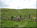
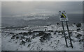
Situated on top of the Cavehill - the most prominent mountain in Belfast - at an elevation of about 350 meters, this cairn is now much destroyed due to the construction of a large radio mast.
Nearby is an old ring fort called McArt's Fort with spectacular views over Belfast, and on the path which connects the fort to the cairn there is another ruined cairn containing a small cist which probably dates to the Bronze Age. It is thought that Collinward Cairn may have contained a passage tomb originally. Visitors to the site have started a new cairn on the site of the old, by adding stones.
You may be viewing yesterday's version of this page. To see the most up to date information please register for a free account.
")
Do not use the above information on other web sites or publications without permission of the contributor.
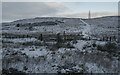
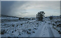
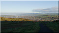
Nearby Images from Geograph Britain and Ireland:
©2014(licence)
©2022(licence)
©2022(licence)
©2024(licence)
©2022(licence)
The above images may not be of the site on this page, they are loaded from Geograph.
Please Submit an Image of this site or go out and take one for us!
Click here to see more info for this site
Nearby sites
Click here to view sites on an interactive map of the areaKey: Red: member's photo, Blue: 3rd party photo, Yellow: other image, Green: no photo - please go there and take one, Grey: site destroyed
Download sites to:
KML (Google Earth)
GPX (GPS waypoints)
CSV (Garmin/Navman)
CSV (Excel)
To unlock full downloads you need to sign up as a Contributory Member. Otherwise downloads are limited to 50 sites.
Turn off the page maps and other distractions
Nearby sites listing. In the following links * = Image available
753m SE 144° Ballyaghagan Cairn* Cairn
864m ESE 121° The Devil's Punchbowl Cave or Rock Shelter
958m SE 141° McArts Fort* Stone Fort or Dun
1.1km SSW 214° Ballyaghagan Cashel Ancient Village or Settlement (J31287936)
3.0km WSW 253° Ballyutoag Court Tomb Court Tomb
5.2km SW 220° Ballygomartin Standing Stone* Standing Stone (Menhir)
6.2km NW 310° Craigarogan* Chambered Tomb (J270842)
8.0km S 170° Belfast (Ulster Museum)* Court Tomb (J335725)
8.6km NNE 15° West Division Stone Row / Alignment (J338887)
9.0km SW 230° Tournagrough Stone Row / Alignment (J252743)
10.5km NW 321° Moyadam* Standing Stone (Menhir) (J2510388312)
12.3km SW 215° White Mountain, Lisburn and Castlereagh Standing Stone (Menhir) (J2502870021)
12.6km S 178° Ballynahatty* Henge (J32726770)
12.9km NW 325° Doagh* Holed Stone (J2416590683)
13.6km NW 305° Donegore Moat* Artificial Mound
13.7km NW 312° Donegore Hill Causewayed Enclosure
14.3km ESE 120° Greengraves* Portal Tomb (J4454073630)
15.0km NW 314° Tobergill Stone Circle (J20839051)
16.0km NNE 13° Tureagh Stone Circle (J350960)
16.4km NW 319° Browndod Court Tomb* Court Tomb
17.0km N 5° Carndoo* Court Tomb (J32849731)
17.6km E 100° Conlig Standing Stone* Standing Stone (Menhir) (J49377783)
18.3km NNE 15° Ballrickard More Stone Circle (J362981)
18.5km E 89° North Down Museum* Museum (NW634352)
20.2km SE 132° Ballygraffan Portal Tomb* Portal Tomb
View more nearby sites and additional images


 We would like to know more about this location. Please feel free to add a brief description and any relevant information in your own language.
 Wir möchten mehr über diese Stätte erfahren. Bitte zögern Sie nicht, eine kurze Beschreibung und relevante Informationen in Deutsch hinzuzufügen.
 Nous aimerions en savoir encore un peu sur les lieux. S'il vous plaît n'hesitez pas à ajouter une courte description et tous les renseignements pertinents dans votre propre langue.
 Quisieramos informarnos un poco más de las lugares. No dude en añadir una breve descripción y otros datos relevantes en su propio idioma.