


<< Our Photo Pages >> Belfast (Ulster Museum) - Court Tomb in Ireland (Northern) in Co. Armagh
Submitted by Anthony_Weir on Wednesday, 27 July 2022 Page Views:
Neolithic and Bronze AgeSite Name: Belfast (Ulster Museum) Alternative Name: BallintaggartCountry: Ireland (Northern)
NOTE: This site is 0.155 km away from the location you searched for.
County: Co. Armagh Type: Court Tomb
Nearest Town: Belfast
Map Ref: J335725
Discoverer Map Number: D15
Latitude: 54.583135N Longitude: 5.935897W
Condition:
| 5 | Perfect |
| 4 | Almost Perfect |
| 3 | Reasonable but with some damage |
| 2 | Ruined but still recognisable as an ancient site |
| 1 | Pretty much destroyed, possibly visible as crop marks |
| 0 | No data. |
| -1 | Completely destroyed |
| 5 | Superb |
| 4 | Good |
| 3 | Ordinary |
| 2 | Not Good |
| 1 | Awful |
| 0 | No data. |
| 5 | Can be driven to, probably with disabled access |
| 4 | Short walk on a footpath |
| 3 | Requiring a bit more of a walk |
| 2 | A long walk |
| 1 | In the middle of nowhere, a nightmare to find |
| 0 | No data. |
| 5 | co-ordinates taken by GPS or official recorded co-ordinates |
| 4 | co-ordinates scaled from a detailed map |
| 3 | co-ordinates scaled from a bad map |
| 2 | co-ordinates of the nearest village |
| 1 | co-ordinates of the nearest town |
| 0 | no data |
Internal Links:
External Links:
 (PID:77994)")
A good overhead view of the tomb may be had from the museum’s cafeteria.
~ 6 km N is The Giant’s Ring, Ballynahatty in county Down: a large henge enclosing a small passage-tomb.
Note: Prehistoric Rock Art in Ireland Talk, Sat, 30th July, details in the comments on our page
You may be viewing yesterday's version of this page. To see the most up to date information please register for a free account.
 - Drumbest Horns Stamp (PID:160737)")
 (PID:96125)")
Do not use the above information on other web sites or publications without permission of the contributor.
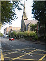
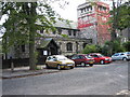
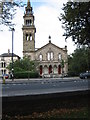
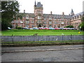
Nearby Images from Geograph Britain and Ireland:
©2005(licence)
©2005(licence)
©2005(licence)
©2005(licence)
©2005(licence)
The above images may not be of the site on this page, they are loaded from Geograph.
Please Submit an Image of this site or go out and take one for us!
Click here to see more info for this site
Nearby sites
Click here to view sites on an interactive map of the areaKey: Red: member's photo, Blue: 3rd party photo, Yellow: other image, Green: no photo - please go there and take one, Grey: site destroyed
Download sites to:
KML (Google Earth)
GPX (GPS waypoints)
CSV (Garmin/Navman)
CSV (Excel)
To unlock full downloads you need to sign up as a Contributory Member. Otherwise downloads are limited to 50 sites.
Turn off the page maps and other distractions
Nearby sites listing. In the following links * = Image available
4.9km S 191° Ballynahatty* Henge (J32726770)
6.1km NW 309° Ballygomartin Standing Stone* Standing Stone (Menhir)
7.2km N 354° McArts Fort* Stone Fort or Dun
7.2km NNW 344° Ballyaghagan Cashel Ancient Village or Settlement (J31287936)
7.3km N 353° Ballyaghagan Cairn* Cairn
7.4km N 355° The Devil's Punchbowl Cave or Rock Shelter
8.0km N 350° Collinward Cairn* Cairn
8.2km NNW 329° Ballyutoag Court Tomb Court Tomb
8.5km WNW 284° Tournagrough Stone Row / Alignment (J252743)
8.8km WSW 255° White Mountain, Lisburn and Castlereagh Standing Stone (Menhir) (J2502870021)
11.1km E 86° Greengraves* Portal Tomb (J4454073630)
13.4km NNW 333° Craigarogan* Chambered Tomb (J270842)
14.7km ESE 113° Ballygraffan Portal Tomb* Portal Tomb
16.2km N 3° West Division Stone Row / Alignment (J338887)
16.7km ENE 73° Conlig Standing Stone* Standing Stone (Menhir) (J49377783)
17.9km NNW 334° Moyadam* Standing Stone (Menhir) (J2510388312)
19.0km ENE 65° North Down Museum* Museum (NW634352)
19.7km ESE 121° Ballymartin Rock Art Rock Art (J50766285)
20.1km NW 322° Donegore Moat* Artificial Mound
20.4km NNW 335° Doagh* Holed Stone (J2416590683)
20.5km NW 326° Donegore Hill Causewayed Enclosure
22.0km NNW 327° Tobergill Stone Circle (J20839051)
22.9km E 100° Mount Stewart Cist* Cist (J5624069380)
23.5km N 5° Tureagh Stone Circle (J350960)
23.6km NNW 329° Browndod Court Tomb* Court Tomb
View more nearby sites and additional images


 We would like to know more about this location. Please feel free to add a brief description and any relevant information in your own language.
 Wir möchten mehr über diese Stätte erfahren. Bitte zögern Sie nicht, eine kurze Beschreibung und relevante Informationen in Deutsch hinzuzufügen.
 Nous aimerions en savoir encore un peu sur les lieux. S'il vous plaît n'hesitez pas à ajouter une courte description et tous les renseignements pertinents dans votre propre langue.
 Quisieramos informarnos un poco más de las lugares. No dude en añadir una breve descripción y otros datos relevantes en su propio idioma.