

<< Text Pages >> Longstone Field Circle 1 - Timber Circle in Wales in Pembrokeshire
Submitted by vicky on Sunday, 22 December 2002 Page Views: 5218
Neolithic and Bronze AgeSite Name: Longstone Field Circle 1Country: Wales
NOTE: This site is 1.831 km away from the location you searched for.
County: Pembrokeshire Type: Timber Circle
Map Ref: SM849084 Landranger Map Number: 157
Latitude: 51.732932N Longitude: 5.116425W
Condition:
| 5 | Perfect |
| 4 | Almost Perfect |
| 3 | Reasonable but with some damage |
| 2 | Ruined but still recognisable as an ancient site |
| 1 | Pretty much destroyed, possibly visible as crop marks |
| 0 | No data. |
| -1 | Completely destroyed |
| 5 | Superb |
| 4 | Good |
| 3 | Ordinary |
| 2 | Not Good |
| 1 | Awful |
| 0 | No data. |
| 5 | Can be driven to, probably with disabled access |
| 4 | Short walk on a footpath |
| 3 | Requiring a bit more of a walk |
| 2 | A long walk |
| 1 | In the middle of nowhere, a nightmare to find |
| 0 | No data. |
| 5 | co-ordinates taken by GPS or official recorded co-ordinates |
| 4 | co-ordinates scaled from a detailed map |
| 3 | co-ordinates scaled from a bad map |
| 2 | co-ordinates of the nearest village |
| 1 | co-ordinates of the nearest town |
| 0 | no data |
Internal Links:
External Links:
Timber Circle in Pembrokeshire
Have you visited this site? Please add a comment below.
You may be viewing yesterday's version of this page. To see the most up to date information please register for a free account.
Do not use the above information on other web sites or publications without permission of the contributor.
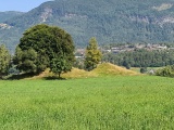
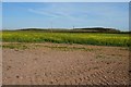
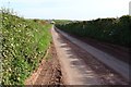
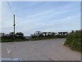
Nearby Images from Geograph Britain and Ireland:
©2019(licence)
©2019(licence)
©2021(licence)
©2021(licence)
©2006(licence)
The above images may not be of the site on this page, they are loaded from Geograph.
Please Submit an Image of this site or go out and take one for us!
Click here to see more info for this site
Nearby sites
Key: Red: member's photo, Blue: 3rd party photo, Yellow: other image, Green: no photo - please go there and take one, Grey: site destroyed
Download sites to:
KML (Google Earth)
GPX (GPS waypoints)
CSV (Garmin/Navman)
CSV (Excel)
To unlock full downloads you need to sign up as a Contributory Member. Otherwise downloads are limited to 50 sites.
Turn off the page maps and other distractions
Nearby sites listing. In the following links * = Image available
1m E 90° Longstone Field Circle 2 Timber Circle (SM849084)
36m WNW 301° Longstone Field Standing Stone (Menhir) (SM84870842)
100m W 268° Sandy Haven's Farm* Standing Stone (Menhir) (SM848084)
2.2km WSW 247° Mabesgate Longstone* Standing Stone (Menhir) (SM828076)
4.2km SW 218° Dale Fort* Hillfort (SM822052)
4.5km ESE 104° Long Stone (Hubberston)* Standing Stone (Menhir) (SM89200717)
5.2km ENE 62° Romans Castle* Ancient Village or Settlement (SM896106)
5.7km WSW 239° Great Castle Head Hillfort (SM799057)
5.9km N 9° Upper Lodge* Stone Row / Alignment (SM861142)
6.3km WNW 290° Tower Point* Promontory Fort / Cliff Castle (SM790108)
6.4km WNW 292° Nab Head (Pembrokeshire)* Ancient Village or Settlement (SM79051111)
6.4km N 9° Harold Stone (Broad Haven) Standing Stone (Menhir) (SM8615514717)
6.6km S 180° Whitedole Bay Hillfort (SM846018)
6.9km E 93° St Peter's Church (Steynton) Sculptured Stone (SM918078)
6.9km SW 226° Little Castle Point Hillfort (SM797038)
7.4km SSE 167° Pickard Head Hillfort (SM863011)
7.5km SE 126° Oil Refinery Hillfort (SM908038)
7.7km E 84° Steynton standing stone* Standing Stone (Menhir) (SM92570886)
7.8km NE 34° Hangstone Davy Standing Stone (Menhir) (SM89581465)
8.0km W 264° Victoria Bay* Hillfort (SM769079)
8.2km WSW 258° Gateholm Island* Ancient Village or Settlement (SM768071)
8.4km SSE 151° The Devil's Quoit* Burial Chamber or Dolmen (SM88650084)
8.6km N 7° Druidston Stones* Standing Stones (SM86361690)
8.7km SSE 150° Kilpaison Burrows Round Barrow(s) (SM890007)
8.8km W 271° Ring-Stone, Martin's Haven* Early Christian Sculptured Stone (SM761090)
View more nearby sites and additional images


 We would like to know more about this location. Please feel free to add a brief description and any relevant information in your own language.
 Wir möchten mehr über diese Stätte erfahren. Bitte zögern Sie nicht, eine kurze Beschreibung und relevante Informationen in Deutsch hinzuzufügen.
 Nous aimerions en savoir encore un peu sur les lieux. S'il vous plaît n'hesitez pas à ajouter une courte description et tous les renseignements pertinents dans votre propre langue.
 Quisieramos informarnos un poco más de las lugares. No dude en añadir una breve descripción y otros datos relevantes en su propio idioma.