 with our Megalithic Portal iPhone app")


<< Our Photo Pages >> St Petroc's Holy Well - Holy Well or Sacred Spring in England in Cornwall
Submitted by Rory on Monday, 01 May 2006 Page Views: 6349
Springs and Holy WellsSite Name: St Petroc's Holy WellCountry: England
NOTE: This site is 0.448 km away from the location you searched for.
County: Cornwall Type: Holy Well or Sacred Spring
Nearest Town: Bodmin
Map Ref: SX07566671
Latitude: 50.468555N Longitude: 4.713108W
Condition:
| 5 | Perfect |
| 4 | Almost Perfect |
| 3 | Reasonable but with some damage |
| 2 | Ruined but still recognisable as an ancient site |
| 1 | Pretty much destroyed, possibly visible as crop marks |
| 0 | No data. |
| -1 | Completely destroyed |
| 5 | Superb |
| 4 | Good |
| 3 | Ordinary |
| 2 | Not Good |
| 1 | Awful |
| 0 | No data. |
| 5 | Can be driven to, probably with disabled access |
| 4 | Short walk on a footpath |
| 3 | Requiring a bit more of a walk |
| 2 | A long walk |
| 1 | In the middle of nowhere, a nightmare to find |
| 0 | No data. |
| 5 | co-ordinates taken by GPS or official recorded co-ordinates |
| 4 | co-ordinates scaled from a detailed map |
| 3 | co-ordinates scaled from a bad map |
| 2 | co-ordinates of the nearest village |
| 1 | co-ordinates of the nearest town |
| 0 | no data |
Internal Links:
External Links:
I have visited· I would like to visit
lucasn visited on 19th Oct 2020 - their rating: Cond: 4 Amb: 3 Access: 4
cazzyjane have visited here
")
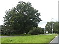
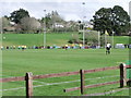
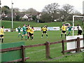
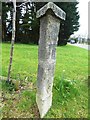
St Petroc’s Holy Well is to be found in the public park that extends east from the town centre. It sits below Priory Road beyond the football pitch, where only dog walkers and teenagers wander. There is very good evidence that the two pre-eminent wells of Bodmin have swapped names, this originally being called St. Guron’s rather than St. Petroc’s well.
You may be viewing yesterday's version of this page. To see the most up to date information please register for a free account.
")
")
")
Do not use the above information on other web sites or publications without permission of the contributor.
Nearby Images from Geograph Britain and Ireland:
©2020(licence)
©2011(licence)
©2011(licence)
©2019(licence)
©2019(licence)
The above images may not be of the site on this page, they are loaded from Geograph.
Please Submit an Image of this site or go out and take one for us!
Click here to see more info for this site
Nearby sites
Key: Red: member's photo, Blue: 3rd party photo, Yellow: other image, Green: no photo - please go there and take one, Grey: site destroyed
Download sites to:
KML (Google Earth)
GPX (GPS waypoints)
CSV (Garmin/Navman)
CSV (Excel)
To unlock full downloads you need to sign up as a Contributory Member. Otherwise downloads are limited to 50 sites.
Turn off the page maps and other distractions
Nearby sites listing. In the following links * = Image available
296m NNW 346° St Guron's Well House* Holy Well or Sacred Spring (SX075670)
681m WNW 303° Eye Well* Holy Well or Sacred Spring (SX070671)
819m NNW 334° Berry Tower Cross* Sculptured Stone (SX07236746)
882m NNE 17° Castle Hill Cross* Early Christian Sculptured Stone (SX0785567542)
1.0km WNW 302° Cocks Well* Holy Well or Sacred Spring (SX067673)
1.2km NW 305° Berrycombe Cross* Ancient Cross (SX0661067414)
1.3km SE 132° Castle Canyke* Ancient Village or Settlement (SX085658)
1.6km NE 37° Callywith Cross Early Christian Sculptured Stone (SX08566794)
1.6km SE 127° Carminow Cross Ancient Cross (SX08846569)
2.0km WNW 291° Scarlett's Well* Holy Well or Sacred Spring (SX0566767503)
2.3km NNE 15° Lancarffe Inscribed Stone Early Christian Sculptured Stone (SX08266894)
3.2km SSE 163° Holy Well (Lanhydrock)* Holy Well or Sacred Spring (SX084636)
3.2km SSE 161° Lanhydrock* Ancient Cross (SX085636)
3.7km SSW 203° St Ingunger Farm Cross* Ancient Cross (SX05976334)
4.0km S 185° Lesquite Quoit* Burial Chamber or Dolmen (SX07076276)
4.1km SSW 199° Fenton Pits Cross* Ancient Cross (SX061629)
4.1km S 190° Lesquite Cross* Ancient Cross (SX06666269)
4.4km SW 233° The Annicu Stone* Sculptured Stone (SX039642)
4.5km SW 219° Reperry Cross* Ancient Cross (SX0463963316)
4.9km NW 307° Prior's Cross* Ancient Cross (SX038698)
4.9km NW 311° Pencarrow Rounds* Hillfort (SX03987001)
5.1km ENE 65° Cardinham Churchyard* Ancient Cross (SX123687)
5.2km SSW 193° Helman Tor* Causewayed Enclosure (SX06166166)
5.4km SE 124° Bofarnel down* Barrow Cemetery (SX119635)
5.5km NW 318° Pencarrow Cross* Ancient Cross (SX040709)
View more nearby sites and additional images


 We would like to know more about this location. Please feel free to add a brief description and any relevant information in your own language.
 Wir möchten mehr über diese Stätte erfahren. Bitte zögern Sie nicht, eine kurze Beschreibung und relevante Informationen in Deutsch hinzuzufügen.
 Nous aimerions en savoir encore un peu sur les lieux. S'il vous plaît n'hesitez pas à ajouter une courte description et tous les renseignements pertinents dans votre propre langue.
 Quisieramos informarnos un poco más de las lugares. No dude en añadir una breve descripción y otros datos relevantes en su propio idioma.