

<< Text Pages >> Piedra Hincada - Standing Stone (Menhir) in Spain in Castilla y León
Submitted by MMG on Tuesday, 24 January 2006 Page Views: 3006
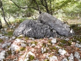
Neolithic and Bronze AgeSite Name: Piedra HincadaCountry: Spain
NOTE: This site is 26.847 km away from the location you searched for.
Region: Castilla y León Type: Standing Stone (Menhir)
Latitude: 42.891703N Longitude: 4.408564W
Condition:
| 5 | Perfect |
| 4 | Almost Perfect |
| 3 | Reasonable but with some damage |
| 2 | Ruined but still recognisable as an ancient site |
| 1 | Pretty much destroyed, possibly visible as crop marks |
| 0 | No data. |
| -1 | Completely destroyed |
| 5 | Superb |
| 4 | Good |
| 3 | Ordinary |
| 2 | Not Good |
| 1 | Awful |
| 0 | No data. |
| 5 | Can be driven to, probably with disabled access |
| 4 | Short walk on a footpath |
| 3 | Requiring a bit more of a walk |
| 2 | A long walk |
| 1 | In the middle of nowhere, a nightmare to find |
| 0 | No data. |
| 5 | co-ordinates taken by GPS or official recorded co-ordinates |
| 4 | co-ordinates scaled from a detailed map |
| 3 | co-ordinates scaled from a bad map |
| 2 | co-ordinates of the nearest village |
| 1 | co-ordinates of the nearest town |
| 0 | no data |
Be the first person to rate this site - see the 'Contribute!' box in the right hand menu.
Internal Links:
External Links:
Standing Stone (Menhir) in Palencia (Castilla y León)
For more details visit Megalitos.es.
You may be viewing yesterday's version of this page. To see the most up to date information please register for a free account.
Do not use the above information on other web sites or publications without permission of the contributor.
Nearby Images from Flickr
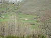
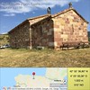
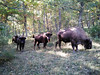

The above images may not be of the site on this page, but were taken nearby. They are loaded from Flickr so please click on them for image credits.
Click here to see more info for this site
Nearby sites
Click here to view sites on an interactive map of the areaKey: Red: member's photo, Blue: 3rd party photo, Yellow: other image, Green: no photo - please go there and take one, Grey: site destroyed
Download sites to:
KML (Google Earth)
GPX (GPS waypoints)
CSV (Garmin/Navman)
CSV (Excel)
To unlock full downloads you need to sign up as a Contributory Member. Otherwise downloads are limited to 50 sites.
Turn off the page maps and other distractions
Nearby sites listing. In the following links * = Image available
10.6km ENE 60° Fuentegrullos Standing Stone (Menhir)
16.5km ENE 77° Peñahincada Menhir* Standing Stone (Menhir)
17.1km E 80° Reinosilla* Ancient Trackway
17.5km E 88° La Llaneda Menhir* Standing Stone (Menhir)
17.6km E 88° La Puentecilla Menhir* Standing Stone (Menhir)
17.7km E 92° El Cabezudo Menhir* Standing Stone (Menhir)
17.7km E 85° La Motorra Menhir 2* Standing Stone (Menhir)
17.7km E 85° La Motorra Menhir 1* Standing Stone (Menhir)
18.0km NE 50° La Corona Stone Circle
18.3km E 98° El Peñuco Menhir* Standing Stone (Menhir)
18.8km E 96° Piedrahíta El Cañon Menhir* Standing Stone (Menhir)
20.3km ESE 102° Sansón Menhir* Standing Stone (Menhir)
20.4km E 91° Camesa Rebolledo Yacimiento Arquológico Ancient Village or Settlement
21.6km NNE 12° Sejos Standing Stones* Standing Stones
24.6km ESE 119° El Castillejo dolmen* Burial Chamber or Dolmen
26.2km ENE 66° Retortillo Juliobriga Ancient Village or Settlement
26.2km ESE 123° Portal Ancho dolmen* Burial Chamber or Dolmen
27.9km ESE 118° El Callejo menhir* Standing Stone (Menhir)
28.0km ESE 118° Las Hogas menhir* Standing Stone (Menhir)
28.1km ESE 120° Canto Hito Menhir* Standing Stone (Menhir)
32.0km ESE 118° Cuesta del Molino menhir* Standing Stone (Menhir)
33.2km SE 144° Castro de Peña Amaya Castro or Chafurdão
37.5km NNW 347° Cires 14 Round Barrow(s)
37.5km N 359° Chufin* Cave or Rock Shelter
37.5km NNW 347° Cires 13 Round Barrow(s)
View more nearby sites and additional images


 We would like to know more about this location. Please feel free to add a brief description and any relevant information in your own language.
 Wir möchten mehr über diese Stätte erfahren. Bitte zögern Sie nicht, eine kurze Beschreibung und relevante Informationen in Deutsch hinzuzufügen.
 Nous aimerions en savoir encore un peu sur les lieux. S'il vous plaît n'hesitez pas à ajouter une courte description et tous les renseignements pertinents dans votre propre langue.
 Quisieramos informarnos un poco más de las lugares. No dude en añadir una breve descripción y otros datos relevantes en su propio idioma.