 with our Megalithic Portal iPhone app")


<< Our Photo Pages >> St Canna's Stone (Llangan) - Natural Stone / Erratic / Other Natural Feature in Wales in Carmarthenshire
Submitted by Anne T on Monday, 08 January 2018 Page Views: 1744
Natural PlacesSite Name: St Canna's Stone (Llangan) Alternative Name: Chair of St Canna; St Canna's ChairCountry: Wales
NOTE: This site is 2.373 km away from the location you searched for.
County: Carmarthenshire Type: Natural Stone / Erratic / Other Natural Feature
Nearest Town: Whitland
Map Ref: SN17701874
Latitude: 51.837433N Longitude: 4.647453W
Condition:
| 5 | Perfect |
| 4 | Almost Perfect |
| 3 | Reasonable but with some damage |
| 2 | Ruined but still recognisable as an ancient site |
| 1 | Pretty much destroyed, possibly visible as crop marks |
| 0 | No data. |
| -1 | Completely destroyed |
| 5 | Superb |
| 4 | Good |
| 3 | Ordinary |
| 2 | Not Good |
| 1 | Awful |
| 0 | No data. |
| 5 | Can be driven to, probably with disabled access |
| 4 | Short walk on a footpath |
| 3 | Requiring a bit more of a walk |
| 2 | A long walk |
| 1 | In the middle of nowhere, a nightmare to find |
| 0 | No data. |
| 5 | co-ordinates taken by GPS or official recorded co-ordinates |
| 4 | co-ordinates scaled from a detailed map |
| 3 | co-ordinates scaled from a bad map |
| 2 | co-ordinates of the nearest village |
| 1 | co-ordinates of the nearest town |
| 0 | no data |
Be the first person to rate this site - see the 'Contribute!' box in the right hand menu.
Internal Links:
External Links:
I have visited· I would like to visit
geoffstickland has visited here
 (PID:197561)")
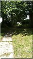
The Northern Antiquarian (TNA) features a page for this legendary healing stone - see their entry for St. Canna’s Stone, Llangan, Carmarthenshire, which has a drawing of the chair, descriptions of the stone from 19th, 20th and 21st century reference material and local folklore.
The stone is also recorded as Coflein NPRN 304241, which adds this is a: "rough stone block bearing the inscription "CANV", which may be the name of a saint or have suggested one; thought to be an early Christian monument involved in the cult of St Canna. Associated with: Canna's Well (Nprn32465); St Canna's Church (Nprn114992). The stone was moved to its present location, from SN17751875, in about 1925."
Note: Have you visited this site? Do you have any information or photographs to add?
You may be viewing yesterday's version of this page. To see the most up to date information please register for a free account.
 (PID:197562)")
Do not use the above information on other web sites or publications without permission of the contributor.
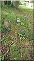
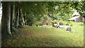
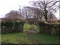
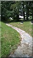
Nearby Images from Geograph Britain and Ireland:
©2021(licence)
©2021(licence)
©2013(licence)
©2021(licence)
©2021(licence)
The above images may not be of the site on this page, they are loaded from Geograph.
Please Submit an Image of this site or go out and take one for us!
Click here to see more info for this site
Nearby sites
Key: Red: member's photo, Blue: 3rd party photo, Yellow: other image, Green: no photo - please go there and take one, Grey: site destroyed
Download sites to:
KML (Google Earth)
GPX (GPS waypoints)
CSV (Garmin/Navman)
CSV (Excel)
To unlock full downloads you need to sign up as a Contributory Member. Otherwise downloads are limited to 50 sites.
Turn off the page maps and other distractions
Nearby sites listing. In the following links * = Image available
1.1km N 1° Henllan Amgoed Inscribed Stone* Standing Stone (Menhir) (SN1776719862)
2.9km W 263° Triangle of stones near Llanddewi Velfrey* Modern Stone Circle etc (SN1477418468)
4.3km SW 228° Llanddewigaer* Hillfort (SN144160)
4.5km SW 232° Caerau Gaer* Hillfort (SN14001609)
4.6km NNE 22° Cefn Brafle* Chambered Tomb (SN196229)
4.6km NNE 22° Crosshands* Standing Stones (SN196229)
5.2km SW 232° Ffynnon Dewi (Llanddewi Velfrey) Holy Well or Sacred Spring (SN13461565)
5.6km SSW 210° Llan Chambered Tomb* Chambered Tomb (SN147140)
5.7km WNW 294° Llandissilio Cursus Cursus (SN12552120)
6.4km S 178° Crug Swllt* Round Barrow(s) (SN17711231)
6.4km WNW 293° Llandissilio Cursus Cursus (SN11852146)
6.9km N 353° Gwal y Filiast* Chambered Tomb (SN17052564)
7.0km NNW 339° Coynant Maenhir Standing Stone (Menhir) (SN15412540)
7.1km NNW 340° Maen Hir Farm 1* Standing Stone (Menhir) (SN155255)
7.1km NNW 340° Efailwen-Isaf Barrow* Round Barrow(s) (SN15482550)
7.1km NNW 348° Bach-sylw* Standing Stones (SN16422575)
7.1km NNW 339° Rhos Coynant Round Barrow(s) (SN154255)
7.3km E 87° Withybush Timber Circle (SN250188)
7.3km NNW 335° Maen Hir Farm 2 and 3* Standing Stones (SN149255)
7.5km NNW 340° Maen Hir Farm 4* Standing Stone (Menhir) (SN15452589)
7.6km SSW 193° Newhouse Barrows* Barrow Cemetery (SN15711141)
7.7km SSW 197° Belle Vue* Standing Stone (Menhir) (SN15211146)
7.7km NNW 328° Capel Nebo Stone* Standing Stone (Menhir) (SN13852541)
7.9km N 356° St Clydwen's Church Cross Stone* Early Christian Sculptured Stone (SN17452660)
7.9km NW 323° Maen Pica Stone* Standing Stone (Menhir) (SN13172524)
View more nearby sites and additional images

")
 We would like to know more about this location. Please feel free to add a brief description and any relevant information in your own language.
 Wir möchten mehr über diese Stätte erfahren. Bitte zögern Sie nicht, eine kurze Beschreibung und relevante Informationen in Deutsch hinzuzufügen.
 Nous aimerions en savoir encore un peu sur les lieux. S'il vous plaît n'hesitez pas à ajouter une courte description et tous les renseignements pertinents dans votre propre langue.
 Quisieramos informarnos un poco más de las lugares. No dude en añadir una breve descripción y otros datos relevantes en su propio idioma.