


<< Our Photo Pages >> Pipe Well - Holy Well or Sacred Spring in England in Cornwall
Submitted by enkidu41 on Thursday, 25 November 2004 Page Views: 11253
Springs and Holy WellsSite Name: Pipe Well Alternative Name: The Well of Lyskiret, The Well of St MartinsCountry: England
NOTE: This site is 0.787 km away from the location you searched for.
County: Cornwall Type: Holy Well or Sacred Spring
Nearest Town: Liskeard
Map Ref: SX252644
Latitude: 50.453328N Longitude: 4.463713W
Condition:
| 5 | Perfect |
| 4 | Almost Perfect |
| 3 | Reasonable but with some damage |
| 2 | Ruined but still recognisable as an ancient site |
| 1 | Pretty much destroyed, possibly visible as crop marks |
| 0 | No data. |
| -1 | Completely destroyed |
| 5 | Superb |
| 4 | Good |
| 3 | Ordinary |
| 2 | Not Good |
| 1 | Awful |
| 0 | No data. |
| 5 | Can be driven to, probably with disabled access |
| 4 | Short walk on a footpath |
| 3 | Requiring a bit more of a walk |
| 2 | A long walk |
| 1 | In the middle of nowhere, a nightmare to find |
| 0 | No data. |
| 5 | co-ordinates taken by GPS or official recorded co-ordinates |
| 4 | co-ordinates scaled from a detailed map |
| 3 | co-ordinates scaled from a bad map |
| 2 | co-ordinates of the nearest village |
| 1 | co-ordinates of the nearest town |
| 0 | no data |
Internal Links:
External Links:
I have visited· I would like to visit
cazzyjane has visited here
")
The water of the well is fed by four springs and has never been known to run dry. Like most Cornish wells, it is meant to bring luck in matrimony and it was also believed to possess miraculous healing powers and would cure "weak eyes".
You may be viewing yesterday's version of this page. To see the most up to date information please register for a free account.
")
")
Do not use the above information on other web sites or publications without permission of the contributor.
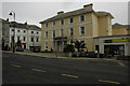
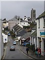
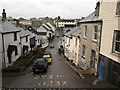
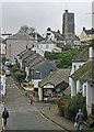
Nearby Images from Geograph Britain and Ireland:
©2009(licence)
©2009(licence)

©2019(licence)
©2009(licence)
©2012(licence)
The above images may not be of the site on this page, they are loaded from Geograph.
Please Submit an Image of this site or go out and take one for us!
Click here to see more info for this site
Nearby sites
Key: Red: member's photo, Blue: 3rd party photo, Yellow: other image, Green: no photo - please go there and take one, Grey: site destroyed
Download sites to:
KML (Google Earth)
GPX (GPS waypoints)
CSV (Garmin/Navman)
CSV (Excel)
To unlock full downloads you need to sign up as a Contributory Member. Otherwise downloads are limited to 50 sites.
Turn off the page maps and other distractions
Nearby sites listing. In the following links * = Image available
3.7km N 350° Church of St Clarus* Early Christian Sculptured Stone (SX247681)
3.9km N 354° St Cleer's Well* Holy Well or Sacred Spring (SX249683)
3.9km N 354° St Cleer Well Cross* Ancient Cross (SX249683)
4.1km S 184° St Keyne's Well* Holy Well or Sacred Spring (SX248603)
4.5km N 8° Trethevy Quoit* Burial Chamber or Dolmen (SX2593668813)
4.7km NNW 339° King Doniert's Stone* Ancient Cross (SX23626885)
6.0km NNE 13° Caradon Hill stone row Stone Row / Alignment (SX26797016)
6.1km E 85° Quethiock Cross* Ancient Cross (SX31296471)
6.2km N 1° The Long Stone (Minions)* Standing Stone (Menhir) (SX25547055)
6.3km SSW 193° Duloe* Stone Circle (SX23585831)
6.3km N 359° Minions Cairns Cairn (SX25357073)
6.5km S 188° St Cuby's Well (Duloe)* Holy Well or Sacred Spring (SX24085796)
6.5km SSW 193° St Cuby's Church Iron Age Fort* Hillfort (SX23485809)
6.6km NNE 16° Caradon Hill cairns* Barrow Cemetery (SX272707)
6.6km N 358° Minions Kerbed Cairn Cairn (SX25247103)
6.6km N 358° Minions Bronze Age round cairn. Cairn (SX25157103)
6.7km N 357° Trewalla Farm Settlement* Ancient Village or Settlement (SX25117106)
6.7km N 3° Minions Platform Round Barrow* Cairn (SX25787109)
6.8km N 5° Minions Mound* Round Barrow(s) (SX26017112)
6.8km N 349° Tregarrick Tor cairn* Chambered Cairn (SX24157115)
6.9km N 358° Minions Round Cairns* Round Cairn (SX25157126)
6.9km N 350° Tregarrick Tor hillfort* Hillfort (SX242712)
6.9km NNW 347° Tregarrick menhir* Standing Stone (Menhir) (SX23917116)
7.0km N 3° The Hurlers (S)* Stone Circle (SX25817133)
7.0km N 2° The Hurlers Pipers* Standing Stones (SX25717135)
View more nearby sites and additional images


 We would like to know more about this location. Please feel free to add a brief description and any relevant information in your own language.
 Wir möchten mehr über diese Stätte erfahren. Bitte zögern Sie nicht, eine kurze Beschreibung und relevante Informationen in Deutsch hinzuzufügen.
 Nous aimerions en savoir encore un peu sur les lieux. S'il vous plaît n'hesitez pas à ajouter une courte description et tous les renseignements pertinents dans votre propre langue.
 Quisieramos informarnos un poco más de las lugares. No dude en añadir una breve descripción y otros datos relevantes en su propio idioma.