
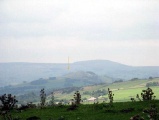

<< Our Photo Pages >> White Lady Stone - Standing Stone (Menhir) in Channel Islands and Isle of Man in Isle of Man
Submitted by coldrum on Wednesday, 03 April 2013 Page Views: 9494
Neolithic and Bronze AgeSite Name: White Lady StoneCountry: Channel Islands and Isle of Man Island: Isle of Man Type: Standing Stone (Menhir)
Map Ref: SC38597783
Latitude: 54.170806N Longitude: 4.47421W
Condition:
| 5 | Perfect |
| 4 | Almost Perfect |
| 3 | Reasonable but with some damage |
| 2 | Ruined but still recognisable as an ancient site |
| 1 | Pretty much destroyed, possibly visible as crop marks |
| 0 | No data. |
| -1 | Completely destroyed |
| 5 | Superb |
| 4 | Good |
| 3 | Ordinary |
| 2 | Not Good |
| 1 | Awful |
| 0 | No data. |
| 5 | Can be driven to, probably with disabled access |
| 4 | Short walk on a footpath |
| 3 | Requiring a bit more of a walk |
| 2 | A long walk |
| 1 | In the middle of nowhere, a nightmare to find |
| 0 | No data. |
| 5 | co-ordinates taken by GPS or official recorded co-ordinates |
| 4 | co-ordinates scaled from a detailed map |
| 3 | co-ordinates scaled from a bad map |
| 2 | co-ordinates of the nearest village |
| 1 | co-ordinates of the nearest town |
| 0 | no data |
Internal Links:
External Links:
I have visited· I would like to visit
ShamrockStone has visited here
")
Source: Pastscape:
You may be viewing yesterday's version of this page. To see the most up to date information please register for a free account.
")
")
")
Do not use the above information on other web sites or publications without permission of the contributor.
Nearby Images from Flickr


The above images may not be of the site on this page, but were taken nearby. They are loaded from Flickr so please click on them for image credits.
Click here to see more info for this site
Nearby sites
Click here to view sites on an interactive map of the areaKey: Red: member's photo, Blue: 3rd party photo, Yellow: other image, Green: no photo - please go there and take one, Grey: site destroyed
Download sites to:
KML (Google Earth)
GPX (GPS waypoints)
CSV (Garmin/Navman)
CSV (Excel)
To unlock full downloads you need to sign up as a Contributory Member. Otherwise downloads are limited to 50 sites.
Turn off the page maps and other distractions
Nearby sites listing. In the following links * = Image available
1.5km ENE 76° St Peter's Church (Onchan) Ancient Cross (SC40057814)
1.9km SSW 196° Manx Museum* Museum
4.2km W 278° White Lady of Ballafreer* Standing Stone (Menhir)
4.3km ENE 67° Glebe Well (Lonan Church) Holy Well or Sacred Spring (SC42577937)
4.4km ENE 68° Lonan Church Crosses Ancient Cross (SC42737937)
5.6km NE 48° Cloven Stones* Chambered Tomb (SC42928141)
5.9km WNW 292° Keill Vreeshey (Crosby) Sculptured Stone (SC332802)
6.0km SW 236° Speke Keeill Ancient Burial Site Early Christian Sculptured Stone (SC335746)
6.2km WSW 257° Braaid Circle* Ancient Village or Settlement (SC325766)
6.2km WSW 256° The Braaid* Ancient Village or Settlement (SC32517655)
6.5km W 275° Marown Old Church Holy Well or Sacred Spring (SC3215378674)
6.9km W 269° St. Patrick's Chair* Early Christian Sculptured Stone (SC3165577946)
6.9km W 267° St Ronan's Well Holy Well or Sacred Spring (SC3162077766)
7.2km WNW 287° St Trinian's Chapel (Marown) Ancient Cross (SC31778023)
8.4km NE 37° King Orry's Grave* Chambered Tomb (SC43898439)
8.7km SW 226° Ballakelly* Chambered Tomb (SC32147199)
9.4km WNW 286° Chibbyr Roney* Holy Well or Sacred Spring (SC296808)
10.1km SW 221° Cronk ny Merriu* Promontory Fort / Cliff Castle (SC317704)
10.2km NE 38° Spiral stone (Ballaragh)* Rock Art (SC4520085670)
10.4km NNW 341° Druidale* Ancient Village or Settlement (SC356878)
11.0km SW 225° Arragon Mooar* Round Barrow(s)
11.4km WNW 288° Ballaharra stones Burial Chamber or Dolmen
11.6km WNW 289° Giant's grave (St John's)* Cist (SC27758193)
12.3km SW 223° Cass ny Hawin Hillfort Hillfort (SC298692)
12.4km WNW 295° Giant's Grave (Isle of Man)* Chambered Tomb (SC27438340)
View more nearby sites and additional images


 We would like to know more about this location. Please feel free to add a brief description and any relevant information in your own language.
 Wir möchten mehr über diese Stätte erfahren. Bitte zögern Sie nicht, eine kurze Beschreibung und relevante Informationen in Deutsch hinzuzufügen.
 Nous aimerions en savoir encore un peu sur les lieux. S'il vous plaît n'hesitez pas à ajouter une courte description et tous les renseignements pertinents dans votre propre langue.
 Quisieramos informarnos un poco más de las lugares. No dude en añadir una breve descripción y otros datos relevantes en su propio idioma.