


<< Text Pages >> Craigenkirn (New Kilpatrick) - Cairn in Scotland in East Dunbartonshire
Submitted by Anne T on Thursday, 13 July 2017 Page Views: 1337
Neolithic and Bronze AgeSite Name: Craigenkirn (New Kilpatrick)Country: Scotland
NOTE: This site is 2.176 km away from the location you searched for.
County: East Dunbartonshire Type: Cairn
Nearest Town: Glasgow Nearest Village: Carbeth
Map Ref: NS5183978157
Latitude: 55.973471N Longitude: 4.375736W
Condition:
| 5 | Perfect |
| 4 | Almost Perfect |
| 3 | Reasonable but with some damage |
| 2 | Ruined but still recognisable as an ancient site |
| 1 | Pretty much destroyed, possibly visible as crop marks |
| 0 | No data. |
| -1 | Completely destroyed |
| 5 | Superb |
| 4 | Good |
| 3 | Ordinary |
| 2 | Not Good |
| 1 | Awful |
| 0 | No data. |
| 5 | Can be driven to, probably with disabled access |
| 4 | Short walk on a footpath |
| 3 | Requiring a bit more of a walk |
| 2 | A long walk |
| 1 | In the middle of nowhere, a nightmare to find |
| 0 | No data. |
| 5 | co-ordinates taken by GPS or official recorded co-ordinates |
| 4 | co-ordinates scaled from a detailed map |
| 3 | co-ordinates scaled from a bad map |
| 2 | co-ordinates of the nearest village |
| 1 | co-ordinates of the nearest town |
| 0 | no data |
Be the first person to rate this site - see the 'Contribute!' box in the right hand menu.
Internal Links:
External Links:
Cairn in East Dunbartonshire
Recorded as a new find on The Northern Antiquarian (TNA) in November 2013, this site is described on their page for Craigenkirn, New Kilpatrick, Dumbartonshire where they have directions on how to find this long cairn, together with an aerial view, photographs and a brief archaeology and history.
There is no entry on Canmore for this site, but they do record a plantation bank at NS 520 782 which is circular feature around 150 metres east - see their entry for Canmore ID 126184 which contains very few details.
Note: Have you visited this site? Do you have any photographs or comments to add?
You may be viewing yesterday's version of this page. To see the most up to date information please register for a free account.
Do not use the above information on other web sites or publications without permission of the contributor.
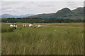
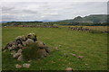
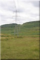
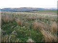
Nearby Images from Geograph Britain and Ireland:
©2015(licence)
©2015(licence)
©2015(licence)
©2009(licence)
©2015(licence)
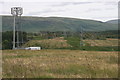
The above images may not be of the site on this page, they are loaded from Geograph.
Please Submit an Image of this site or go out and take one for us!
Click here to see more info for this site
Nearby sites
Key: Red: member's photo, Blue: 3rd party photo, Yellow: other image, Green: no photo - please go there and take one, Grey: site destroyed
Download sites to:
KML (Google Earth)
GPX (GPS waypoints)
CSV (Garmin/Navman)
CSV (Excel)
To unlock full downloads you need to sign up as a Contributory Member. Otherwise downloads are limited to 50 sites.
Turn off the page maps and other distractions
Nearby sites listing. In the following links * = Image available
2.0km NNE 29° Craigmore Cottage Standing Stones (NS529799)
2.9km NNE 27° Blanefield* Stone Row / Alignment (NS53288072)
3.2km N 352° Quinloch Muir Hillfort* Hillfort (NS51508134)
3.3km ESE 107° Echo Stone (Mugdock) Natural Stone / Erratic / Other Natural Feature (NS54937710)
3.6km NW 312° The Whangie* Natural Stone / Erratic / Other Natural Feature (NS49238066)
3.6km NNW 349° Quinloch Muir Stones* Standing Stones (NS5125181730)
4.1km S 184° Whitehill 5* Rock Art (NS51387403)
4.2km S 185° Whitehill 4* Rock Art (NS51307398)
4.3km S 187° Whitehill 3* Rock Art (NS51157386)
4.4km SSW 196° Cochno Crags* Natural Stone / Erratic / Other Natural Feature (NS50487401)
4.5km SSW 196° The Cochno Stone* Rock Art (NS50457388)
4.5km SSW 197° Auchnacraig Stone Circle* Stone Circle (NS50347391)
4.5km ESE 108° Middleton Row Stone Row / Alignment (NS561766)
4.7km ENE 73° Strathblane Churchyard* Standing Stone (Menhir) (NS5638779375)
4.8km SSW 197° Auchnacraig 1* Rock Art (NS50287365)
4.8km SSW 197° Auchnacraig 4* Rock Art (NS50297362)
4.9km SSW 199° Auchnacraig 5* Rock Art (NS501736)
4.9km E 96° Loch Ardinning (Mugdock) Rock Art (NS567775)
5.0km NW 307° Aucheneck* Chambered Cairn (NS4793681308)
5.0km ENE 74° Broadgate (Strathblane) Chambered Cairn (NS56747934)
5.1km ENE 75° Broadgate 2 Cairn (NS568793)
5.2km ENE 74° Broadgate Farm (Strathblane)* Standing Stone (Menhir) (NS5692979402)
5.6km S 171° Castlehill Fort (Bearsden)* Hillfort (NS5248272614)
5.9km SSW 202° Antonine Wall remains below Golden Hill* Stone Fort or Dun (NS49467274)
6.0km SSW 201° Golden Hill Roman Fort* Stone Fort or Dun (NS49517265)
View more nearby sites and additional images


 We would like to know more about this location. Please feel free to add a brief description and any relevant information in your own language.
 Wir möchten mehr über diese Stätte erfahren. Bitte zögern Sie nicht, eine kurze Beschreibung und relevante Informationen in Deutsch hinzuzufügen.
 Nous aimerions en savoir encore un peu sur les lieux. S'il vous plaît n'hesitez pas à ajouter une courte description et tous les renseignements pertinents dans votre propre langue.
 Quisieramos informarnos un poco más de las lugares. No dude en añadir una breve descripción y otros datos relevantes en su propio idioma.