


<< Our Photo Pages >> St Martin's Well (Fortrose) - Holy Well or Sacred Spring in Scotland in Highlands
Submitted by KiwiBetsy on Tuesday, 03 October 2006 Page Views: 4846
Springs and Holy WellsSite Name: St Martin's Well (Fortrose)Country: Scotland
NOTE: This site is 3.418 km away from the location you searched for.
County: Highlands Type: Holy Well or Sacred Spring
Nearest Town: Fortrose Nearest Village: Culbokie
Map Ref: NH645625
Latitude: 57.632014N Longitude: 4.270983W
Condition:
| 5 | Perfect |
| 4 | Almost Perfect |
| 3 | Reasonable but with some damage |
| 2 | Ruined but still recognisable as an ancient site |
| 1 | Pretty much destroyed, possibly visible as crop marks |
| 0 | No data. |
| -1 | Completely destroyed |
| 5 | Superb |
| 4 | Good |
| 3 | Ordinary |
| 2 | Not Good |
| 1 | Awful |
| 0 | No data. |
| 5 | Can be driven to, probably with disabled access |
| 4 | Short walk on a footpath |
| 3 | Requiring a bit more of a walk |
| 2 | A long walk |
| 1 | In the middle of nowhere, a nightmare to find |
| 0 | No data. |
| 5 | co-ordinates taken by GPS or official recorded co-ordinates |
| 4 | co-ordinates scaled from a detailed map |
| 3 | co-ordinates scaled from a bad map |
| 2 | co-ordinates of the nearest village |
| 1 | co-ordinates of the nearest town |
| 0 | no data |
Internal Links:
External Links:
 (PID:24650)")
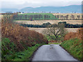
The remains of St Martin’s Well lie in a field on the Black Isle.
The farmer who owns the land and lives nearby at East Culbo Farm was very happy for us to visit the well .… though rather bemused why anyone would want to in the face of a howling gale. We found a spring still producing clear water which ran from under a heap of stones and formed a small pool before draining away into a nearby ditch.
You may be viewing yesterday's version of this page. To see the most up to date information please register for a free account.
 (PID:24649)")
Do not use the above information on other web sites or publications without permission of the contributor.
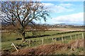
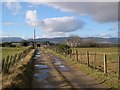
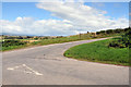
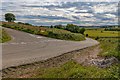
Nearby Images from Geograph Britain and Ireland:
©2024(licence)
©2007(licence)
©2010(licence)
©2020(licence)
©2014(licence)
The above images may not be of the site on this page, they are loaded from Geograph.
Please Submit an Image of this site or go out and take one for us!
Click here to see more info for this site
Nearby sites
Key: Red: member's photo, Blue: 3rd party photo, Yellow: other image, Green: no photo - please go there and take one, Grey: site destroyed
Download sites to:
KML (Google Earth)
GPX (GPS waypoints)
CSV (Garmin/Navman)
CSV (Excel)
To unlock full downloads you need to sign up as a Contributory Member. Otherwise downloads are limited to 50 sites.
Turn off the page maps and other distractions
Nearby sites listing. In the following links * = Image available
1.6km SSE 160° Woodhead Round Chambered Cairn* Chambered Cairn (NH650610)
1.6km SE 132° Wester Brae* Chambered Cairn (NH65646139)
1.6km ENE 77° Mid Brae Chambered Cairn (NH661628)
2.0km SSE 154° Woodhead Long* Chambered Cairn (NH653607)
6.5km S 178° Belmaduthy* Chambered Cairn (NH6447255983)
6.9km WNW 304° Carn Liath (Upper Park) Chambered Cairn (NH589665)
7.3km NNE 15° Carn Liath, Alness* Cairn (NH66626952)
7.4km NNE 27° Rosskeen* Class I Pictish Symbol Stone (NH6809969024)
7.5km WNW 297° Swordale Chambered Cairn Chambered Cairn (NH57886614)
7.7km WNW 296° Swordale Hill* Rock Art (NH5772066156)
7.9km S 190° Balnaguie* Chambered Cairn (NH62835473)
8.3km W 263° Clachan Biorach Chambered Cairn (NH562617)
8.6km N 7° Mill craig Chambered Tomb (NH658710)
8.8km S 181° Cloutie Well* Holy Well or Sacred Spring (NH641537)
8.9km E 88° Glenurquhart Grey Cairn* Cairn (NH73386247)
8.9km W 260° Cnoc Ravoch Chambered Cairn (NH557612)
8.9km SW 228° Mulchaich* Cairn (NH57665679)
8.9km N 9° Nonakiln Class I Pictish Symbol Stone (NH66217124)
9.7km SE 126° St Boniface's Well (Fortrose)* Holy Well or Sacred Spring (NH722565)
9.7km N 5° Cnoc Navie Chambered Cairn (NH656722)
9.9km SSE 158° Craiguck Well* Holy Well or Sacred Spring (NH679532)
10.2km WSW 248° Dingwall* Class I Pictish Symbol Stone (NH54935893)
10.2km SSW 193° The Temple (Tore)* Chambered Tomb (NH6179952610)
10.3km ESE 116° Groam House Museum* Museum (NH737577)
11.4km W 279° Balnacrae* Chambered Cairn (NH533646)
View more nearby sites and additional images


 We would like to know more about this location. Please feel free to add a brief description and any relevant information in your own language.
 Wir möchten mehr über diese Stätte erfahren. Bitte zögern Sie nicht, eine kurze Beschreibung und relevante Informationen in Deutsch hinzuzufügen.
 Nous aimerions en savoir encore un peu sur les lieux. S'il vous plaît n'hesitez pas à ajouter une courte description et tous les renseignements pertinents dans votre propre langue.
 Quisieramos informarnos un poco más de las lugares. No dude en añadir una breve descripción y otros datos relevantes en su propio idioma.