


<< Text Pages >> St Helen's Well (Coed Helen) - Holy Well or Sacred Spring in Wales in Gwynedd
Submitted by Anne T on Monday, 11 February 2019 Page Views: 1538
Springs and Holy WellsSite Name: St Helen's Well (Coed Helen) Alternative Name: Ffynnon St Helen (Caernarfon)Country: Wales
NOTE: This site is 0.285 km away from the location you searched for.
County: Gwynedd Type: Holy Well or Sacred Spring
Nearest Town: Caernarfon Nearest Village: Coed Helen / Hen Waliau
Map Ref: SH4823862224
Latitude: 53.135501N Longitude: 4.270041W
Condition:
| 5 | Perfect |
| 4 | Almost Perfect |
| 3 | Reasonable but with some damage |
| 2 | Ruined but still recognisable as an ancient site |
| 1 | Pretty much destroyed, possibly visible as crop marks |
| 0 | No data. |
| -1 | Completely destroyed |
| 5 | Superb |
| 4 | Good |
| 3 | Ordinary |
| 2 | Not Good |
| 1 | Awful |
| 0 | No data. |
| 5 | Can be driven to, probably with disabled access |
| 4 | Short walk on a footpath |
| 3 | Requiring a bit more of a walk |
| 2 | A long walk |
| 1 | In the middle of nowhere, a nightmare to find |
| 0 | No data. |
| 5 | co-ordinates taken by GPS or official recorded co-ordinates |
| 4 | co-ordinates scaled from a detailed map |
| 3 | co-ordinates scaled from a bad map |
| 2 | co-ordinates of the nearest village |
| 1 | co-ordinates of the nearest town |
| 0 | no data |
Be the first person to rate this site - see the 'Contribute!' box in the right hand menu.
Internal Links:
External Links:
Holy Well or Sacred Spring in Gwynedd
The Journal of Antiquities tells us about this overlooked and forgotten well, hidden beneath a canopy of trees almost next to the main railway line, in a secluded cutting - see their entry for St Helen’s Holy Well, Caernarfon, Gwynedd, Wales. The well originally stood next to the small medieval chapel of Capel Helen, but all signs of the chapel are virtually gone.
The Journal gives us background information on the well, the chapel and St Elen of Caernarfon, local legends and tradition, and a list of reference sources for more information. The JoA adds "Ffynnon St Helen was still in use up until the 1920s when local people visited it in order to be healed and they would take away bottles of its curative water, which was described as being plentiful ... The well stood on a raised area of land and its water was contained in a slate cistern with a flight of modern steps leading to it". Today water can still be heard alongside the well.
This well is located on private land, accessed through an iron gate which leads to the railway line and the well, so please ask for permission before visiting (and beware the trains; please stay safe!).
Note: Have you seen this site? Do you have any illustrations, drawings, photographs or information to add?
You may be viewing yesterday's version of this page. To see the most up to date information please register for a free account.
Do not use the above information on other web sites or publications without permission of the contributor.
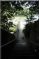
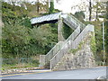
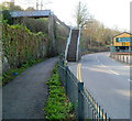
Nearby Images from Geograph Britain and Ireland:
©2019(licence)
©2011(licence)
©2011(licence)
©2014(licence)
©2015(licence)
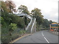
The above images may not be of the site on this page, they are loaded from Geograph.
Please Submit an Image of this site or go out and take one for us!
Click here to see more info for this site
Nearby sites
Key: Red: member's photo, Blue: 3rd party photo, Yellow: other image, Green: no photo - please go there and take one, Grey: site destroyed
Download sites to:
KML (Google Earth)
GPX (GPS waypoints)
CSV (Garmin/Navman)
CSV (Excel)
To unlock full downloads you need to sign up as a Contributory Member. Otherwise downloads are limited to 50 sites.
Turn off the page maps and other distractions
Nearby sites listing. In the following links * = Image available
338m NE 55° Segontium* Stone Fort or Dun (SH4852262408)
1.4km N 2° Modern Standing Stones (Caernarfon)* Modern Stone Circle etc (SH4833363592)
1.4km N 3° Modern Stone Circle (Caernarfon)* Modern Stone Circle etc (SH4835463629)
2.6km WSW 236° Ffynnon Faglan* Holy Well or Sacred Spring (SH46016085)
3.1km WSW 239° St Baglan's Church (Llanfaglan)* Early Christian Sculptured Stone (SH4550660714)
3.6km E 89° Cilgwythwch Maenhir* Standing Stone (Menhir) (SH51866217)
4.1km E 86° Pant Afon Bach Maenhir* Standing Stone (Menhir) (SH52366236)
4.3km E 97° Pant Ifan Maenhir* Standing Stone (Menhir) (SH52506160)
4.3km SSE 153° Gaerwen Ancient Village or Settlement (SH501583)
4.5km N 355° Perthiduon* Chambered Tomb (SH4798066758)
4.8km N 5° Brynsiencyn* Round Barrow(s) (SH488670)
4.8km NNE 13° Maen Morddwyd Early Christian Sculptured Stone (SH495669)
4.8km SSW 201° Dinas y Prif Camp* Ancient Village or Settlement (SH4633957760)
5.1km NNW 335° Bryn Gwyn Stones* Stone Circle (SH4623566927)
5.1km NNW 339° Castell Bryn-Gwyn* Henge (SH4652867061)
5.3km NNW 342° Tre'r Dryw Bach W Stone Circle (SH468673)
5.3km NNW 348° Caer Leb* Ancient Village or Settlement (SH47286747)
5.6km N 352° Ty Mawr 1 (Trefwri)* Standing Stone (Menhir) (SH4761567794)
5.7km N 350° Ty Mawr 2* Standing Stone (Menhir) (SH4743667830)
5.8km NNW 347° Pont Sarn Las Ancient Village or Settlement (SH471679)
5.8km NNW 329° Maesoglan 3* Standing Stone (Menhir) (SH454673)
5.8km E 93° Hafodlas Cairn Circle* Cairn (SH54056170)
5.9km NNW 328° Maesoglan 2* Standing Stone (Menhir) (SH453673)
6.0km NNW 328° Maesoglan 1* Standing Stone (Menhir) (SH452674)
6.2km NNW 340° Bodowyr* Passage Grave (SH46276816)
View more nearby sites and additional images


 We would like to know more about this location. Please feel free to add a brief description and any relevant information in your own language.
 Wir möchten mehr über diese Stätte erfahren. Bitte zögern Sie nicht, eine kurze Beschreibung und relevante Informationen in Deutsch hinzuzufügen.
 Nous aimerions en savoir encore un peu sur les lieux. S'il vous plaît n'hesitez pas à ajouter une courte description et tous les renseignements pertinents dans votre propre langue.
 Quisieramos informarnos un poco más de las lugares. No dude en añadir una breve descripción y otros datos relevantes en su propio idioma.