


<< Text Pages >> Beinn Ghlas - Rock Art in Scotland in Perth and Kinross
Submitted by rockartuk on Friday, 28 August 2009 Page Views: 7334
Rock ArtSite Name: Beinn Ghlas Alternative Name: Ben LawersCountry: Scotland
NOTE: This site is 1.939 km away from the location you searched for.
County: Perth and Kinross Type: Rock Art
Map Ref: NN6382839501
Latitude: 56.527750N Longitude: 4.215384W
Condition:
| 5 | Perfect |
| 4 | Almost Perfect |
| 3 | Reasonable but with some damage |
| 2 | Ruined but still recognisable as an ancient site |
| 1 | Pretty much destroyed, possibly visible as crop marks |
| 0 | No data. |
| -1 | Completely destroyed |
| 5 | Superb |
| 4 | Good |
| 3 | Ordinary |
| 2 | Not Good |
| 1 | Awful |
| 0 | No data. |
| 5 | Can be driven to, probably with disabled access |
| 4 | Short walk on a footpath |
| 3 | Requiring a bit more of a walk |
| 2 | A long walk |
| 1 | In the middle of nowhere, a nightmare to find |
| 0 | No data. |
| 5 | co-ordinates taken by GPS or official recorded co-ordinates |
| 4 | co-ordinates scaled from a detailed map |
| 3 | co-ordinates scaled from a bad map |
| 2 | co-ordinates of the nearest village |
| 1 | co-ordinates of the nearest town |
| 0 | no data |
Internal Links:
External Links:
Cup and Ring marks in Perth and Kinross. Ancient rock art discovered on Perthshire mountain. George Currie discovered the carvings while surveying an area of Ben Lawers, near Loch Tay. Mr Currie, 59, from Tealing near Dundee, has had a lifelong interest in rock art but has only pursued his interest seriously over the past five years.
The art is similar to other prehistoric pieces found in the area and is formed by depressions in the stone, known as cup marks or cup and ring marks.
The newly-discovered rock is unusual because it features more than 90 cup marks, a higher number than is usually found.
Some still show the individual blows of the craftsman’s stone pick. The purpose of the art is still unknown.
The area, cared for by the National Trust for Scotland (NTS), was surveyed five years ago by the Royal Commission on the Ancient and Historic Monuments of Scotland, but the artwork is an entirely new find.
Mr Currie, of Inveraldie Farm, said: “I go looking for rock art and just pick certain areas to go and search them out. The survey by the Royal Commission found about 100, but you’re always going to find more. The idea was to try and find others that they’d missed.”
Mr Currie said he caught sight of the stone by chance and, on investigating further, uncovered the full artwork.
NTS archaeologist Derek Alexander said the find is an exciting one as it shows there is still undiscovered art to be found.
He added: “Through both targeted research by professional archaeologists and the work of dedicated amateurs like George Currie, we now know that Ben Lawers forms one of the major concentrations of cup and ring marks in the Highlands, which suggests it was a very significant landscape in prehistory.”
Source: Press and Journal
Note: Thanks to Jan 'rockartuk' for help locating this site. George Currie discovered the site in May 2008, but the publication "Discovery and Excavation in Scotland" is always published one year after the initial report, hence the delay. There are photos of Beinn Glhlas in on BRAC.
You may be viewing yesterday's version of this page. To see the most up to date information please register for a free account.
Do not use the above information on other web sites or publications without permission of the contributor.
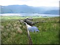
Nearby Images from Geograph Britain and Ireland:
©2011(licence)
©2011(licence)
©2011(licence)
©2023(licence)
©2011(licence)
The above images may not be of the site on this page, they are loaded from Geograph.
Please Submit an Image of this site or go out and take one for us!
Click here to see more info for this site
Nearby sites
Key: Red: member's photo, Blue: 3rd party photo, Yellow: other image, Green: no photo - please go there and take one, Grey: site destroyed
Download sites to:
KML (Google Earth)
GPX (GPS waypoints)
CSV (Garmin/Navman)
CSV (Excel)
To unlock full downloads you need to sign up as a Contributory Member. Otherwise downloads are limited to 50 sites.
Turn off the page maps and other distractions
Nearby sites listing. In the following links * = Image available
1.3km E 91° Alt a' Choire Chireinich 1 Rock Art (NN6509639442)
1.3km SE 130° Tombreck (08) Rock Art (NN6479538648)
1.4km E 87° Allt a' Choire Chireinich 2 Rock Art (NN6521839525)
1.4km E 85° Allt a' Choire Chireinich 3 Rock Art (NN6524939579)
1.5km E 86° Allt a' Choire Chireinich 4 Rock Art (NN6530639560)
1.6km SE 140° Tombreck (01) Rock Art (NN6479838284)
1.7km SE 134° Tombreck (07) Rock Art (NN6502238285)
1.8km SE 146° Carie (Kenmore) Sculptured Stone (NN6477238018)
2.3km SE 146° Tombreck (10) Ring Cairn (NN6504237559)
3.2km E 90° Easter Croftintygan Farm Standing Stone (Menhir) (NN6706839421)
3.6km ESE 101° Balnasuim* Rock Art (NN6733438677)
4.4km E 80° Machuinn* Stone Circle (NN6820140156)
4.9km SE 137° Dull Farm Stone Marker Stone (NN6704235826)
5.7km SSW 192° Creag Ard* Rock Art (NN6250433969)
6.1km ENE 56° Allt Coire Phadairlidh 1* Rock Art (NN690427)
6.7km SW 224° Tir Artair 1 (Killin) Rock Art (NN5906334807)
6.8km SSW 210° Firbush Point (Killin) Hillfort (NN602337)
6.9km SW 224° Tir Artair Standing Stone (Killin) Standing Stone (Menhir) (NN5887034720)
7.5km NNW 336° Glen Lyon - Praying Hands of Mary* Natural Stone / Erratic / Other Natural Feature (NN610465)
7.8km WSW 251° Creag na Cailleach (Killin) Ancient Mine, Quarry or other Industry (NN56403715)
8.0km WSW 245° Allt na Ceardaich Knoll Rock Art (NN564364)
8.3km N 350° St Palladius' Footprint (Camusvrachan)* Natural Stone / Erratic / Other Natural Feature (NN6262647685)
8.3km N 349° St Adamnan's Cross* Ancient Cross (NN62534768)
8.5km NNE 16° Dericambus Standing Stone (Menhir) (NN66484757)
9.1km SW 221° Kinnell* Stone Circle (NN5770032803)
View more nearby sites and additional images


 We would like to know more about this location. Please feel free to add a brief description and any relevant information in your own language.
 Wir möchten mehr über diese Stätte erfahren. Bitte zögern Sie nicht, eine kurze Beschreibung und relevante Informationen in Deutsch hinzuzufügen.
 Nous aimerions en savoir encore un peu sur les lieux. S'il vous plaît n'hesitez pas à ajouter une courte description et tous les renseignements pertinents dans votre propre langue.
 Quisieramos informarnos un poco más de las lugares. No dude en añadir una breve descripción y otros datos relevantes en su propio idioma.