


<< Text Pages >> Menhir de Kerhuon - Standing Stone (Menhir) in France in Bretagne:Finistère (29)
Submitted by holger_rix on Saturday, 23 July 2016 Page Views: 817
Neolithic and Bronze AgeSite Name: Menhir de KerhuonCountry: France
NOTE: This site is 1.386 km away from the location you searched for.
Département: Bretagne:Finistère (29) Type: Standing Stone (Menhir)
Nearest Town: Châteaulin Nearest Village: Quéménéven
Latitude: 48.117668N Longitude: 4.098062W
Condition:
| 5 | Perfect |
| 4 | Almost Perfect |
| 3 | Reasonable but with some damage |
| 2 | Ruined but still recognisable as an ancient site |
| 1 | Pretty much destroyed, possibly visible as crop marks |
| 0 | No data. |
| -1 | Completely destroyed |
| 5 | Superb |
| 4 | Good |
| 3 | Ordinary |
| 2 | Not Good |
| 1 | Awful |
| 0 | No data. |
| 5 | Can be driven to, probably with disabled access |
| 4 | Short walk on a footpath |
| 3 | Requiring a bit more of a walk |
| 2 | A long walk |
| 1 | In the middle of nowhere, a nightmare to find |
| 0 | No data. |
| 5 | co-ordinates taken by GPS or official recorded co-ordinates |
| 4 | co-ordinates scaled from a detailed map |
| 3 | co-ordinates scaled from a bad map |
| 2 | co-ordinates of the nearest village |
| 1 | co-ordinates of the nearest town |
| 0 | no data |
Be the first person to rate this site - see the 'Contribute!' box in the right hand menu.
Internal Links:
External Links:
Standing Stone (Menhir) in Bretagne:Finistère (29)
Kerhuon, Quéménéven, Châteaulin, Finistère, Brittany
Source: T4T35
Information and Pictures:
t4t35.fr
You may be viewing yesterday's version of this page. To see the most up to date information please register for a free account.
Do not use the above information on other web sites or publications without permission of the contributor.
Nearby Images from Flickr
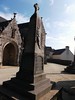
The above images may not be of the site on this page, but were taken nearby. They are loaded from Flickr so please click on them for image credits.
Click here to see more info for this site
Nearby sites
Click here to view sites on an interactive map of the areaKey: Red: member's photo, Blue: 3rd party photo, Yellow: other image, Green: no photo - please go there and take one, Grey: site destroyed
Download sites to:
KML (Google Earth)
GPX (GPS waypoints)
CSV (Garmin/Navman)
CSV (Excel)
To unlock full downloads you need to sign up as a Contributory Member. Otherwise downloads are limited to 50 sites.
Turn off the page maps and other distractions
Nearby sites listing. In the following links * = Image available
4.6km N 357° Chapelle Sainte-Génite menhir Standing Stone (Menhir)
7.2km NW 306° Le Fuseau de Sainte Barbe* Standing Stone (Menhir)
8.5km WSW 255° Menhir dit la Jument Blanche* Standing Stone (Menhir)
8.5km E 84° Dolmen de la Chapelle de Landiviguen Burial Chamber or Dolmen
8.5km WSW 240° Pierre à Cupules de Parc ar Menhir Rock Art
8.6km WSW 250° Pierre de Kazeg Ven* Burial Chamber or Dolmen
8.7km WSW 244° Dalle à Cupules de Guernevez Kertanguy Rock Art
8.8km SE 140° Menhir de Kermenhir (Briec) Standing Stone (Menhir)
12.4km W 280° St Anne's Fountain (Sainte Anne La Palud) Holy Well or Sacred Spring
12.9km NE 46° Allée Couverte dite Loch-ar-Ronfl* Passage Grave
13.3km WSW 257° Menhir in Kerlaz* Standing Stone (Menhir)
13.4km WNW 284° Coffres de Ty an Quer Cist
13.5km S 181° Stèle de Quimper Standing Stone (Menhir)
13.6km S 181° Musée Départemental Breton Museum
13.9km NW 304° Dolmen de Gouarem al Lié* Burial Chamber or Dolmen
14.3km NW 315° Dolmen de Stang an Huel Burial Chamber or Dolmen
14.4km SSE 158° Park Ar Men Sao menhir Standing Stone (Menhir)
14.5km SSW 198° Cairn de Kervastal Huella Chambered Cairn
14.8km NW 322° Cairn du Yedig Chambered Cairn
14.9km SSW 194° Fort de Kercaradec Ancient Village or Settlement
15.0km ENE 74° Tumulus de Ty-Floc'h* Chambered Cairn
15.2km ENE 59° Dolmen de Pendréau* Burial Chamber or Dolmen
15.3km NW 307° Menez Lié Dolmen* Burial Chamber or Dolmen
15.7km SSE 168° Dolmen dit de Stang Youen Burial Chamber or Dolmen
15.8km SSW 205° Dolmen de Ménez-Liaven* Burial Chamber or Dolmen
View more nearby sites and additional images


 We would like to know more about this location. Please feel free to add a brief description and any relevant information in your own language.
 Wir möchten mehr über diese Stätte erfahren. Bitte zögern Sie nicht, eine kurze Beschreibung und relevante Informationen in Deutsch hinzuzufügen.
 Nous aimerions en savoir encore un peu sur les lieux. S'il vous plaît n'hesitez pas à ajouter une courte description et tous les renseignements pertinents dans votre propre langue.
 Quisieramos informarnos un poco más de las lugares. No dude en añadir una breve descripción y otros datos relevantes en su propio idioma.