 with our Megalithic Portal iPhone app")


<< Text Pages Gwyddfryniau stone circle - Stone Circle in Wales in Gwynedd
Submitted by Geraint1 on Friday, 19 April 2024 Page Views: 0
Neolithic and Bronze AgeSite Name: Gwyddfryniau stone circleCountry: Wales
NOTE: This site is 1.831 km away from the location you searched for.
County: Gwynedd Type: Stone Circle
Nearest Town: Tywyn Nearest Village: Bryncrug
Map Ref: SH5933704229
Latitude: 52.617558N Longitude: 4.079175W
Condition:
| 5 | Perfect |
| 4 | Almost Perfect |
| 3 | Reasonable but with some damage |
| 2 | Ruined but still recognisable as an ancient site |
| 1 | Pretty much destroyed, possibly visible as crop marks |
| 0 | No data. |
| -1 | Completely destroyed |
| 5 | Superb |
| 4 | Good |
| 3 | Ordinary |
| 2 | Not Good |
| 1 | Awful |
| 0 | No data. |
| 5 | Can be driven to, probably with disabled access |
| 4 | Short walk on a footpath |
| 3 | Requiring a bit more of a walk |
| 2 | A long walk |
| 1 | In the middle of nowhere, a nightmare to find |
| 0 | No data. |
| 5 | co-ordinates taken by GPS or official recorded co-ordinates |
| 4 | co-ordinates scaled from a detailed map |
| 3 | co-ordinates scaled from a bad map |
| 2 | co-ordinates of the nearest village |
| 1 | co-ordinates of the nearest town |
| 0 | no data |
Internal Links:
External Links:
Stone Circle in Gwynedd
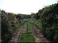
There are 5 stones that lie on the arc of a circle (see photos).
4 of the stones are spaced approximately 6m apart. There would probably have been 2 more stones between stones marked "1" and "2". There would probably have been a total of 12 or 13 stones.
The circle diameter is approximately 25m.
There is a standing stone near by (Gwyddfryniau standing stone) approximately 55 to 60m away to the southwest.
Gwyddfryniau standing stone, the centre of this circle, and the summit of Cadair Idris (by a very long way, the most prominent point on the horizon) are on a perfect straight line alignment on a bearing of 49⁰ east of North, which is 4⁰ further east than northeast.
On the summer solstice, from a viewpoint at the circle centre, the sun will appear to rise from behind the summit of Cadair Idris.
With luck, I'll be able to get photos of this on the next summer solstice.
You may be viewing yesterday's version of this page. To see the most up to date information please register for a free account.
Do not use the above information on other web sites or publications without permission of the contributor.
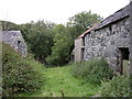
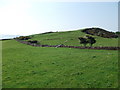
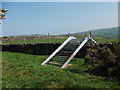
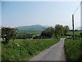
Nearby Images from Geograph Britain and Ireland:
©2006(licence)
©2012(licence)
©2012(licence)
©2012(licence)
©2012(licence)
The above images may not be of the site on this page, they are loaded from Geograph.
Please Submit an Image of this site or go out and take one for us!
Click here to see more info for this site
Nearby sites
Key: Red: member's photo, Blue: 3rd party photo, Yellow: other image, Green: no photo - please go there and take one, Grey: site destroyed
Download sites to:
KML (Google Earth)
GPX (GPS waypoints)
CSV (Garmin/Navman)
CSV (Excel)
To unlock full downloads you need to sign up as a Contributory Member. Otherwise downloads are limited to 50 sites.
Turn off the page maps and other distractions
Nearby sites listing. In the following links * = Image available
139m SW 234° Gwyddfryniau* Standing Stones (SH5922204150)
652m N 8° Waun Fach* Standing Stone (Menhir) (SH5944404873)
1.5km WSW 240° Fron Newydd Stone* Standing Stone (Menhir) (SH5797403504)
2.6km WNW 292° Llanfendigaid Stone* Standing Stone (Menhir) (SH5698705276)
2.6km NE 48° Glanmachlas Standing Stones* Standing Stones (SH6132905937)
2.7km S 171° Croes Faen* Standing Stone (Menhir) (SH59690154)
3.3km S 188° St Cadfan (Tywyn)* Early Christian Sculptured Stone (SH58770094)
3.4km NNE 22° Hut Circles And Enclosure East of Cae'r Mynach* Ancient Village or Settlement (SH607074)
3.6km NNE 22° Cairn east of Cae'r Mynach* Cairn (SH608075)
3.6km NNE 20° Circular Enclosure West of Allt Lwyd* Ancient Village or Settlement (SH607076)
3.8km NE 52° Tyrgawen* Standing Stone (Menhir) (SH6238106444)
4.0km NNE 23° Cairn West of Allt Lwyd* Cairn (SH610079)
4.1km NNE 30° Cairn and enclosure south of Allt Lwyd* Cairn (SH615077)
4.2km NNE 29° Allt Lwyd Cairn and Ritual Complex* Cairn (SH615078)
4.4km S 175° Esguan Stone* Standing Stone (Menhir) (SN5961499839)
4.5km NNE 24° Cairn South of Afon Gwril* Cairn (SH613083)
4.5km NNE 21° Afon Gwril Cairn* Cairn (SH611084)
4.7km NNE 23° Afon Gwril Hut Circle Settlement* Ancient Village or Settlement (SH613085)
4.8km N 358° Castell y Gaer* Hillfort (SH593090)
5.1km SE 125° Nant Y Bala Cairn (SH6343301213)
5.3km NNE 33° Twll Y Darren Round Barrow(s) (SH624086)
5.7km ENE 61° Craig Yr Aderyn* Hillfort (SH644068)
5.8km ENE 63° Flat topped hill enclosure near Craig-Yr-Aderyn* Ancient Village or Settlement (SH646067)
5.8km ENE 65° Bryncrug Cairn* Cairn (SH64690658)
6.1km N 5° Gwastadgoed* Standing Stones (SH601103)
View more nearby sites and additional images


 We would like to know more about this location. Please feel free to add a brief description and any relevant information in your own language.
 Wir möchten mehr über diese Stätte erfahren. Bitte zögern Sie nicht, eine kurze Beschreibung und relevante Informationen in Deutsch hinzuzufügen.
 Nous aimerions en savoir encore un peu sur les lieux. S'il vous plaît n'hesitez pas à ajouter une courte description et tous les renseignements pertinents dans votre propre langue.
 Quisieramos informarnos un poco más de las lugares. No dude en añadir una breve descripción y otros datos relevantes en su propio idioma.