


<< Text Pages >> Île aux Moutons menhir - Standing Stone (Menhir) in France in Bretagne:Finistère (29)
Submitted by TheCaptain on Tuesday, 28 December 2004 Page Views: 1744
Neolithic and Bronze AgeSite Name: Île aux Moutons menhirCountry: France
NOTE: This site is 0.997 km away from the location you searched for.
Département: Bretagne:Finistère (29) Type: Standing Stone (Menhir)
Nearest Town: Concarneau Nearest Village: Îles Glenan
Latitude: 47.775100N Longitude: 4.0288W
Condition:
| 5 | Perfect |
| 4 | Almost Perfect |
| 3 | Reasonable but with some damage |
| 2 | Ruined but still recognisable as an ancient site |
| 1 | Pretty much destroyed, possibly visible as crop marks |
| 0 | No data. |
| -1 | Completely destroyed |
| 5 | Superb |
| 4 | Good |
| 3 | Ordinary |
| 2 | Not Good |
| 1 | Awful |
| 0 | No data. |
| 5 | Can be driven to, probably with disabled access |
| 4 | Short walk on a footpath |
| 3 | Requiring a bit more of a walk |
| 2 | A long walk |
| 1 | In the middle of nowhere, a nightmare to find |
| 0 | No data. |
| 5 | co-ordinates taken by GPS or official recorded co-ordinates |
| 4 | co-ordinates scaled from a detailed map |
| 3 | co-ordinates scaled from a bad map |
| 2 | co-ordinates of the nearest village |
| 1 | co-ordinates of the nearest town |
| 0 | no data |
Be the first person to rate this site - see the 'Contribute!' box in the right hand menu.
Internal Links:
External Links:
Menhir in Finistère
IMPORTANT NOTE: Positional co-ordinates scaled from a detailed map source
You may be viewing yesterday's version of this page. To see the most up to date information please register for a free account.
Do not use the above information on other web sites or publications without permission of the contributor.
Nearby Images from Flickr
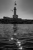
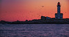
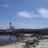
The above images may not be of the site on this page, but were taken nearby. They are loaded from Flickr so please click on them for image credits.
Click here to see more info for this site
Nearby sites
Click here to view sites on an interactive map of the areaKey: Red: member's photo, Blue: 3rd party photo, Yellow: other image, Green: no photo - please go there and take one, Grey: site destroyed
Download sites to:
KML (Google Earth)
GPX (GPS waypoints)
CSV (Garmin/Navman)
CSV (Excel)
To unlock full downloads you need to sign up as a Contributory Member. Otherwise downloads are limited to 50 sites.
Turn off the page maps and other distractions
Nearby sites listing. In the following links * = Image available
5.6km SSE 157° Île de Brunec Dolmen Burial Chamber or Dolmen
9.7km NNE 24° Menhir de Beg-Meil Standing Stone (Menhir)
11.5km WNW 292° Dolmen de Plage d'Ezer Burial Chamber or Dolmen
12.0km N 7° Lanveur menhir Standing Stone (Menhir)
12.6km WNW 300° Stèle de L'église* Standing Stone (Menhir)
12.6km ENE 65° Kerdallé menhir Standing Stone (Menhir)
13.6km NW 318° Treustel menhir* Standing Stone (Menhir)
13.6km WNW 289° Menhir de Kerdalaë-Plonivel* Standing Stone (Menhir)
13.9km ENE 66° Menhir de Beg Roz Ruat Standing Stone (Menhir)
14.1km WNW 282° Dolmen de Menez-Veil 2 Burial Chamber or Dolmen
14.1km WNW 281° Steir-Nibilic menhir Standing Stone (Menhir)
14.4km WNW 282° Dolmen de Menez-Veil* Burial Chamber or Dolmen
14.7km NNE 22° Dolmens de Kerléven* Burial Chamber or Dolmen
14.9km W 281° Menhir de Kerdalaë-Lesconil* Standing Stone (Menhir)
15.0km NE 52° Dolmen de Men Dogan* Burial Chamber or Dolmen
15.0km NW 305° Pennglaouic menhir* Standing Stone (Menhir)
15.1km NE 53° Men Dogan menhirs Standing Stones
15.5km WNW 285° Kervignon Dolmen* Burial Chamber or Dolmen
15.6km WNW 286° Kervadol Dolmens* Burial Chamber or Dolmen
15.7km WNW 284° Kerfuens Dolmens* Burial Chamber or Dolmen
15.8km NNE 18° Menhir de Coat ar Ster Standing Stone (Menhir)
15.8km NNE 26° Allée Couverte de Keristin Passage Grave
16.3km W 278° Reun menhir* Standing Stone (Menhir)
16.3km W 278° Rochers Gravés du Reun* Rock Art
16.4km NE 56° Menhir de Kergleuhant* Standing Stone (Menhir)
View more nearby sites and additional images


 We would like to know more about this location. Please feel free to add a brief description and any relevant information in your own language.
 Wir möchten mehr über diese Stätte erfahren. Bitte zögern Sie nicht, eine kurze Beschreibung und relevante Informationen in Deutsch hinzuzufügen.
 Nous aimerions en savoir encore un peu sur les lieux. S'il vous plaît n'hesitez pas à ajouter une courte description et tous les renseignements pertinents dans votre propre langue.
 Quisieramos informarnos un poco más de las lugares. No dude en añadir una breve descripción y otros datos relevantes en su propio idioma.