


<< Our Photo Pages >> Roman Amphitheatre at Tomen Y Mur - Misc. Earthwork in Wales in Gwynedd
Submitted by TAlanJones on Sunday, 27 September 2020 Page Views: 1195
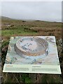
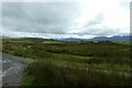
Roman, Greek and ClassicalSite Name: Roman Amphitheatre at Tomen Y MurCountry: Wales County: Gwynedd Type: Misc. Earthwork
Nearest Town: Trawsfynydd
Map Ref: SH70813891
Latitude: 52.932001N Longitude: 3.923507W
Condition:
| 5 | Perfect |
| 4 | Almost Perfect |
| 3 | Reasonable but with some damage |
| 2 | Ruined but still recognisable as an ancient site |
| 1 | Pretty much destroyed, possibly visible as crop marks |
| 0 | No data. |
| -1 | Completely destroyed |
| 5 | Superb |
| 4 | Good |
| 3 | Ordinary |
| 2 | Not Good |
| 1 | Awful |
| 0 | No data. |
| 5 | Can be driven to, probably with disabled access |
| 4 | Short walk on a footpath |
| 3 | Requiring a bit more of a walk |
| 2 | A long walk |
| 1 | In the middle of nowhere, a nightmare to find |
| 0 | No data. |
| 5 | co-ordinates taken by GPS or official recorded co-ordinates |
| 4 | co-ordinates scaled from a detailed map |
| 3 | co-ordinates scaled from a bad map |
| 2 | co-ordinates of the nearest village |
| 1 | co-ordinates of the nearest town |
| 0 | no data |
Internal Links:
External Links:
I have visited· I would like to visit
Marko visited on 19th Sep 2020 - their rating: Cond: 2 Amb: 3 Access: 5
")
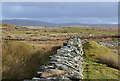
The fort was constructed under Governer Gnaeus Juius Agricola in AD 78. It was abandoned in AD 140.
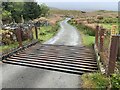
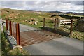
It can be reached via a narrow lane that leads from the A470.
You may be viewing yesterday's version of this page. To see the most up to date information please register for a free account.
")
")
")
Do not use the above information on other web sites or publications without permission of the contributor.
Nearby Images from Geograph Britain and Ireland:
©2014(licence)
©2022(licence)
©2022(licence)
©2008(licence)
©2020(licence)
The above images may not be of the site on this page, they are loaded from Geograph.
Please Submit an Image of this site or go out and take one for us!
Click here to see more info for this site
Nearby sites
Key: Red: member's photo, Blue: 3rd party photo, Yellow: other image, Green: no photo - please go there and take one, Grey: site destroyed
Download sites to:
KML (Google Earth)
GPX (GPS waypoints)
CSV (Garmin/Navman)
CSV (Excel)
To unlock full downloads you need to sign up as a Contributory Member. Otherwise downloads are limited to 50 sites.
Turn off the page maps and other distractions
Nearby sites listing. In the following links * = Image available
155m SW 223° Julius Perpetuus was here* Marker Stone (SH707388)
310m S 180° Sarn Helen Roman Military Road (Tomen Y Mur)* Ancient Trackway (SH708386)
353m SW 226° Tomen Y Mur (The Wall Mound)* Artificial Mound (SH70553867)
544m SSE 158° Llwyn Crwn Roman Burial Mounds* Artificial Mound (SH710384)
560m S 178° Roman Military Road south of Tomen Y Mur* Ancient Trackway (SH7081038350)
588m SSE 169° Barrows at Tomen Y Mur* Barrow Cemetery (SH7091038330)
1.8km NNE 23° The Stone of Goronwy* Holed Stone (SH7156640579)
1.9km SSE 163° Tyddyn Felin hut circle E* Ancient Village or Settlement (SH7132037130)
2.0km W 274° Nurse Cae Du Enclosed Hut Circle Settlement* Ancient Village or Settlement (SH688391)
2.2km WNW 293° Tyddyn Cwper Enclosed Settlement* Ancient Village or Settlement (SH6880039810)
2.2km ESE 118° Dolbelydr Enclosed Hut Circle Settlement* Ancient Village or Settlement (SH7272037810)
2.3km N 351° Huw Llwyd's Pulpit* Natural Stone / Erratic / Other Natural Feature (SH705412)
2.7km ESE 113° Roman Burial Mound (Dolddinas)* Artificial Mound (SH7331337786)
2.8km E 97° Craig Wen Hut Circle and oval enclosure/annex* Ancient Village or Settlement (SH7354038510)
2.8km ESE 110° Dolddinas Roman Practice Camps* Ancient Village or Settlement (SH7340037880)
2.9km NNW 346° Carreg Wen Cwm Cynfal* Standing Stone (Menhir) (SH702417)
3.1km NNW 334° Tomb of the 4th Baron of Newborough* Modern Stone Circle etc (SH69504175)
3.3km W 272° Uwchlawr Coed Hut Circle Enclosures* Ancient Village or Settlement (SH675391)
3.6km N 354° Blaen Ddol Hut Circle Settlement Ancient Village or Settlement (SH705425)
3.6km NNE 23° Sarn Helen Mound* Artificial Mound (SH723422)
3.9km NNE 21° Beddau Gwyr Ardudwy* Artificial Mound (SH723425)
3.9km SW 216° Taith Cambria (Cambrian Way)* Ancient Trackway (SH684358)
4.1km NNE 22° Cantiorix Lies Here* Early Christian Sculptured Stone (SH725427)
4.4km NE 48° Rhaeadr y Cwm Hut Circle* Ancient Village or Settlement (SH7411741772)
4.5km N 11° Cwm Teigl Stones* Stone Row / Alignment (SH718433)
View more nearby sites and additional images


 We would like to know more about this location. Please feel free to add a brief description and any relevant information in your own language.
 Wir möchten mehr über diese Stätte erfahren. Bitte zögern Sie nicht, eine kurze Beschreibung und relevante Informationen in Deutsch hinzuzufügen.
 Nous aimerions en savoir encore un peu sur les lieux. S'il vous plaît n'hesitez pas à ajouter une courte description et tous les renseignements pertinents dans votre propre langue.
 Quisieramos informarnos un poco más de las lugares. No dude en añadir una breve descripción y otros datos relevantes en su propio idioma.