 with our Megalithic Portal iPhone app")


<< Text Pages >> Daer valley - Ancient Village or Settlement in Scotland in South Lanarkshire
Submitted by coldrum on Saturday, 02 October 2010 Page Views: 7638
Multi-periodSite Name: Daer valleyCountry: Scotland County: South Lanarkshire Type: Ancient Village or Settlement
Nearest Town: Moffat
Map Ref: NS956132
Latitude: 55.401589N Longitude: 3.650142W
Condition:
| 5 | Perfect |
| 4 | Almost Perfect |
| 3 | Reasonable but with some damage |
| 2 | Ruined but still recognisable as an ancient site |
| 1 | Pretty much destroyed, possibly visible as crop marks |
| 0 | No data. |
| -1 | Completely destroyed |
| 5 | Superb |
| 4 | Good |
| 3 | Ordinary |
| 2 | Not Good |
| 1 | Awful |
| 0 | No data. |
| 5 | Can be driven to, probably with disabled access |
| 4 | Short walk on a footpath |
| 3 | Requiring a bit more of a walk |
| 2 | A long walk |
| 1 | In the middle of nowhere, a nightmare to find |
| 0 | No data. |
| 5 | co-ordinates taken by GPS or official recorded co-ordinates |
| 4 | co-ordinates scaled from a detailed map |
| 3 | co-ordinates scaled from a bad map |
| 2 | co-ordinates of the nearest village |
| 1 | co-ordinates of the nearest town |
| 0 | no data |
Be the first person to rate this site - see the 'Contribute!' box in the right hand menu.
Internal Links:
External Links:
The site at Daer Reservoir, Lanarkshire, excavated under the direction of Tam Ward, has been carbon dated to 8550 - 7950 BC. Biggar Archaeology Group write: The excavation at Daer is moving along very nicely and we have some more exciting things to report. We now have four sites where Early Neolithic material has been found in apparent association with the Mesolithic artefacts. Flint scrapers, pitchstone, and pottery have been retrieved along with a flint and a chert leaf arrow. We are wondering if (and hoping that) we have found the elusive transition between the two periods. The evidence is stacking up to say we have.
The Daer valley contains no natural chert, either in situ rock or drift geology, therefore all of the lithic found there has been brought in by the people. We have found every type and colour of local chert along with flint, pitchstone and various other types of chalcedony and mudstone/siltstones. The latter have been brought from Dumfriesshire and may indicate a travel route up the rivers Nith and Annan to connect over into the Daer valley. On two sites we have retrieved dateable charcoal from pits and surface spreads (only a tiny amount of hazel nut shell is represented) and we have managed to detect stake holes, although little of it makes much sense, however, it is early days yet.
Continually picking up lithics can be a bit boring, so we have diverted onto some of the many cairns we have found and which have been trashed by the plough. The first produced a pit full of charcoal and this is interpreted as a cremation deposit although no burnt bone was present. The second appeared to be just a pile of stones and this one may simply be the result of pre historic field clearance. We are sure that some of the other cairns will prove to be funerary in function, but most will be field clearance piles.
We have now recorded over two hundred find spots on a single hill flank, some are features such as cairns or burnt mounds while some are a single piece of chert or flint, there is no chance of investigating every location so we are targeting those considered most likely to produce the best evidence.
One thing seems to be sure and that is that upland landscapes with recorded archaeological visible sites represent only a tiny aspect of what may lie invisible until disturbed, as in the Daer valley. We still require more help to pull off this exciting work, contact us if you fancy a weekend of discovery.
Source: Biggar Archaeology Group
You may be viewing yesterday's version of this page. To see the most up to date information please register for a free account.
Do not use the above information on other web sites or publications without permission of the contributor.
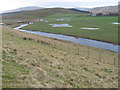
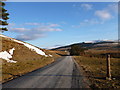
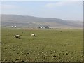
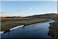
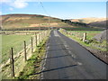
Nearby Images from Geograph Britain and Ireland:
©2008(licence)
©2013(licence)
©2014(licence)
©2013(licence)
©2018(licence)
The above images may not be of the site on this page, they are loaded from Geograph.
Please Submit an Image of this site or go out and take one for us!
Click here to see more info for this site
Nearby sites
Key: Red: member's photo, Blue: 3rd party photo, Yellow: other image, Green: no photo - please go there and take one, Grey: site destroyed
Download sites to:
KML (Google Earth)
GPX (GPS waypoints)
CSV (Garmin/Navman)
CSV (Excel)
To unlock full downloads you need to sign up as a Contributory Member. Otherwise downloads are limited to 50 sites.
Turn off the page maps and other distractions
Nearby sites listing. In the following links * = Image available
3.7km N 10° Bodsberry Hill* Hillfort (NS963168)
8.5km N 352° Kirkton Fort and Settlement* Hillfort (NS946216)
8.5km N 9° Normangill Rig Cairn* Cairn (NS97092153)
8.6km N 355° Castle Crawford Farm Fort* Hillfort (NS951218)
8.8km NNW 345° Kirkton Fort* Hillfort (NS935218)
9.1km N 9° Normangill Henge* Henge (NS97252212)
10.7km N 352° Arbory Hill* Hillfort (NS944238)
11.3km NNW 331° Blackhill Hillfort (NS9032423216)
12.0km N 350° Cold Chapel prehistoric settlement* Ancient Village or Settlement (NS93782512)
13.7km SSW 208° Mary's Well (East Morton) Holy Well or Sacred Spring (NS88870123)
14.9km ESE 112° Moffat Well* Holy Well or Sacred Spring (NT0924007200)
15.1km N 358° Devonshaw Hill* Hillfort (NS954283)
15.3km SSE 152° Lonnachie Rig Cairn (NY024995)
15.7km NE 51° Nether Dod* Stone Circle (NT08032279)
15.7km NNW 331° Wildshaw Burn* Stone Circle (NS882271)
15.8km SE 125° Dyke Row* Stone Row / Alignment (NT0837503820)
16.7km SSE 148° Stiddrig* Cairn (NY04139877)
17.5km NE 51° Menzion* Standing Stones (NT0949023980)
17.6km NE 51° Giant's Stone (Scottish Borders)* Standing Stone (Menhir) (NT09532399)
18.0km W 263° Crawick Multiverse* Modern Stone Circle etc (NS7763311439)
19.0km SSW 208° Penpont Cursus Cursus (NX86409658)
19.5km ENE 66° Talla Linnfoots* Cairn (NT13622069)
19.7km SSW 205° Nith Bridge Cross* Ancient Cross (NX8689095471)
19.8km SE 130° Poldean menhir* Standing Stone (Menhir) (NT1037900011)
19.9km S 177° Gulfhill Rig Cairn (NX963933)
View more nearby sites and additional images


 We would like to know more about this location. Please feel free to add a brief description and any relevant information in your own language.
 Wir möchten mehr über diese Stätte erfahren. Bitte zögern Sie nicht, eine kurze Beschreibung und relevante Informationen in Deutsch hinzuzufügen.
 Nous aimerions en savoir encore un peu sur les lieux. S'il vous plaît n'hesitez pas à ajouter une courte description et tous les renseignements pertinents dans votre propre langue.
 Quisieramos informarnos un poco más de las lugares. No dude en añadir una breve descripción y otros datos relevantes en su propio idioma.