


<< Our Photo Pages >> Menhir dit Croaz-ar-Peulven - Standing Stone (Menhir) in France in Bretagne:Finistère (29)
Submitted by TheCaptain on Tuesday, 28 December 2004 Page Views: 3255
Neolithic and Bronze AgeSite Name: Menhir dit Croaz-ar-Peulven Alternative Name: Plouigneau menhir, Stèle de Croas ar PeulvenCountry: France
NOTE: This site is 1.438 km away from the location you searched for.
Département: Bretagne:Finistère (29) Type: Standing Stone (Menhir)
Nearest Town: Morlaix Nearest Village: Plouigneau
Latitude: 48.571182N Longitude: 3.680935W
Condition:
| 5 | Perfect |
| 4 | Almost Perfect |
| 3 | Reasonable but with some damage |
| 2 | Ruined but still recognisable as an ancient site |
| 1 | Pretty much destroyed, possibly visible as crop marks |
| 0 | No data. |
| -1 | Completely destroyed |
| 5 | Superb |
| 4 | Good |
| 3 | Ordinary |
| 2 | Not Good |
| 1 | Awful |
| 0 | No data. |
| 5 | Can be driven to, probably with disabled access |
| 4 | Short walk on a footpath |
| 3 | Requiring a bit more of a walk |
| 2 | A long walk |
| 1 | In the middle of nowhere, a nightmare to find |
| 0 | No data. |
| 5 | co-ordinates taken by GPS or official recorded co-ordinates |
| 4 | co-ordinates scaled from a detailed map |
| 3 | co-ordinates scaled from a bad map |
| 2 | co-ordinates of the nearest village |
| 1 | co-ordinates of the nearest town |
| 0 | no data |
Be the first person to rate this site - see the 'Contribute!' box in the right hand menu.
Internal Links:
External Links:
")
Location Source: T4T35
Information:
fr.wikipedia.org
You may be viewing yesterday's version of this page. To see the most up to date information please register for a free account.
")
")
Do not use the above information on other web sites or publications without permission of the contributor.
Nearby Images from Flickr

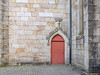
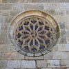
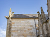
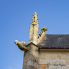
The above images may not be of the site on this page, but were taken nearby. They are loaded from Flickr so please click on them for image credits.
Click here to see more info for this site
Nearby sites
Click here to view sites on an interactive map of the areaKey: Red: member's photo, Blue: 3rd party photo, Yellow: other image, Green: no photo - please go there and take one, Grey: site destroyed
Download sites to:
KML (Google Earth)
GPX (GPS waypoints)
CSV (Garmin/Navman)
CSV (Excel)
To unlock full downloads you need to sign up as a Contributory Member. Otherwise downloads are limited to 50 sites.
Turn off the page maps and other distractions
Nearby sites listing. In the following links * = Image available
3.1km SW 223° Menhir de Creach-Edern* Standing Stone (Menhir)
6.5km ESE 114° Menhir de Kerellou* Standing Stone (Menhir)
6.6km W 278° Dolmen de Toulgoat Burial Chamber or Dolmen
6.6km NNW 345° Cromlech de Croas an Torret Stone Circle
7.4km NE 47° La Salle menhir Standing Stone (Menhir)
7.4km NNW 342° Menhir de Castell ar Jolu Standing Stone (Menhir)
10.5km NNW 332° Menhir de Kermechou Standing Stone (Menhir)
10.6km W 274° Musée des Jacobins* Museum
10.7km NW 325° Menhir de Kéréonec Standing Stone (Menhir)
10.7km SSW 205° Dolmen dit Goarem-Min-Sao Burial Chamber or Dolmen
10.8km NW 325° Menhirs de Men Bras 1 Stone Row / Alignment
10.8km NW 325° Menhirs de Men Bras 2 Stone Row / Alignment
11.0km SSW 198° Menhirs dit les Deux Menhirs* Standing Stones
12.0km NNW 331° Kerprigent Alignement de Menhirs* Stone Row / Alignment
12.2km NNE 15° Les Thermes du Hogolo* Ancient Village or Settlement
12.6km NNW 348° Bez An Inkinerez* Passage Grave
13.2km SW 224° Menhir du Foennec Standing Stone (Menhir)
13.5km E 96° Menhir de Keramanac'h Standing Stone (Menhir)
13.7km SW 223° Saint-Thégonnec menhir* Standing Stone (Menhir)
14.5km WNW 290° Alignement de Kergadoret Stone Row / Alignment
15.2km SE 128° Allée Couverte de Brohet* Passage Grave
15.2km ENE 61° Kerzistalen tumulus Chambered Tomb
15.3km NNW 334° Fontaine St Jean-du-Doigt Holy Well or Sacred Spring
16.7km SE 140° Allée Couverte de Kernescop* Passage Grave
16.9km NW 309° Barnenez Cairn* Chambered Cairn
View more nearby sites and additional images


 We would like to know more about this location. Please feel free to add a brief description and any relevant information in your own language.
 Wir möchten mehr über diese Stätte erfahren. Bitte zögern Sie nicht, eine kurze Beschreibung und relevante Informationen in Deutsch hinzuzufügen.
 Nous aimerions en savoir encore un peu sur les lieux. S'il vous plaît n'hesitez pas à ajouter une courte description et tous les renseignements pertinents dans votre propre langue.
 Quisieramos informarnos un poco más de las lugares. No dude en añadir una breve descripción y otros datos relevantes en su propio idioma.