


<< Text Pages >> Y Foel Cherwn - Cairn in Wales in West Glamorgan
Submitted by coldrum on Wednesday, 10 December 2008 Page Views: 3491
Neolithic and Bronze AgeSite Name: Y Foel CherwnCountry: Wales
NOTE: This site is 2.955 km away from the location you searched for.
County: West Glamorgan Type: Cairn
Nearest Village: Rhigos
Map Ref: SN89840388
Latitude: 51.722786N Longitude: 3.596218W
Condition:
| 5 | Perfect |
| 4 | Almost Perfect |
| 3 | Reasonable but with some damage |
| 2 | Ruined but still recognisable as an ancient site |
| 1 | Pretty much destroyed, possibly visible as crop marks |
| 0 | No data. |
| -1 | Completely destroyed |
| 5 | Superb |
| 4 | Good |
| 3 | Ordinary |
| 2 | Not Good |
| 1 | Awful |
| 0 | No data. |
| 5 | Can be driven to, probably with disabled access |
| 4 | Short walk on a footpath |
| 3 | Requiring a bit more of a walk |
| 2 | A long walk |
| 1 | In the middle of nowhere, a nightmare to find |
| 0 | No data. |
| 5 | co-ordinates taken by GPS or official recorded co-ordinates |
| 4 | co-ordinates scaled from a detailed map |
| 3 | co-ordinates scaled from a bad map |
| 2 | co-ordinates of the nearest village |
| 1 | co-ordinates of the nearest town |
| 0 | no data |
Be the first person to rate this site - see the 'Contribute!' box in the right hand menu.
Internal Links:
External Links:
Cairn in West Glamorgan
Damaged cairn about 8m in diameter.
Further information at the Royal Commission on the Ancient and Historical Monuments of Wales site:
https://www.coflein.gov.uk/en/site/304771
You may be viewing yesterday's version of this page. To see the most up to date information please register for a free account.
Do not use the above information on other web sites or publications without permission of the contributor.
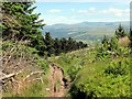
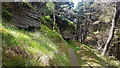
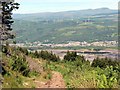
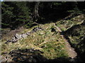
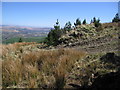
Nearby Images from Geograph Britain and Ireland:
©2014(licence)
©2020(licence)
©2014(licence)
©2009(licence)
©2009(licence)
The above images may not be of the site on this page, they are loaded from Geograph.
Please Submit an Image of this site or go out and take one for us!
Click here to see more info for this site
Nearby sites
Key: Red: member's photo, Blue: 3rd party photo, Yellow: other image, Green: no photo - please go there and take one, Grey: site destroyed
Download sites to:
KML (Google Earth)
GPX (GPS waypoints)
CSV (Garmin/Navman)
CSV (Excel)
To unlock full downloads you need to sign up as a Contributory Member. Otherwise downloads are limited to 50 sites.
Turn off the page maps and other distractions
Nearby sites listing. In the following links * = Image available
349m SW 232° Craig-Y-Pant Cairn (SN89560367)
1.1km ESE 123° Garn Fach Cairn (SN90740327)
1.4km SE 136° Carn Foesan Cairn (SN90780288)
2.0km E 101° Llyn Fawr* Holy Well or Sacred Spring (SN91770347)
3.0km SE 129° Blaenrhondda Ancient Village* Ancient Village or Settlement (SN92160193)
4.9km S 175° Carn y Wiwer* Cairn (SS9019499035)
5.6km N 356° Sgwd Gwladus Stone* Natural Stone / Erratic / Other Natural Feature (SN896095)
5.8km S 169° Bachgen Carreg* Cairn (SS9081298111)
6.6km S 172° Mynydd Blaengwynfi Cairn* Cairn (SS9060297368)
6.8km SSE 168° Pebyll Cairn* Ring Cairn (SS9108097239)
7.9km NW 304° Cwm Irfon Standing Stones (Seven Sisters) Standing Stones (SN834085)
8.0km N 352° Nant Hir stone* Marker Stone (SN889118)
8.2km WSW 246° Carn Caca Cairn* Ring Cairn (SN82230077)
8.7km SSE 164° Crugyrafan* Round Barrow(s) (SS920954)
8.9km NE 55° Mynydd y Glog* Cairn (SN97270886)
8.9km N 8° Dyffryn Nedd Hillfort (SN913127)
9.5km NNE 24° Carn yr Arian* Round Cairn (SN93901253)
9.8km SE 141° Treorchy Gorsedd Circle* Modern Stone Circle etc (SS9585596145)
9.8km S 170° The Werfa Round Barrow(s) (SS913942)
10.3km SSE 155° Bwlch y Clawdd* Modern Stone Circle etc (SS94039450)
10.3km N 9° Gelli-Nedd* Hillfort (SN91741400)
10.3km SSE 150° Bwlch y Clawdd Cairn Cairn (SS948948)
10.4km NE 50° Cefn Sychpant* Round Cairn (SN97951036)
10.5km SE 128° Tarren Maerdy Cairn 1 Cairn (SS97959720)
10.7km NNW 340° Pump Maen (Five Stones)* Stone Row / Alignment (SN86361400)
View more nearby sites and additional images


 We would like to know more about this location. Please feel free to add a brief description and any relevant information in your own language.
 Wir möchten mehr über diese Stätte erfahren. Bitte zögern Sie nicht, eine kurze Beschreibung und relevante Informationen in Deutsch hinzuzufügen.
 Nous aimerions en savoir encore un peu sur les lieux. S'il vous plaît n'hesitez pas à ajouter une courte description et tous les renseignements pertinents dans votre propre langue.
 Quisieramos informarnos un poco más de las lugares. No dude en añadir una breve descripción y otros datos relevantes en su propio idioma.