

<< Text Pages >> Lynedoch Cottage (1) - Standing Stone (Menhir) in Scotland in Perth and Kinross
Submitted by BigSweetie on Thursday, 25 March 2004 Page Views: 5160
Neolithic and Bronze AgeSite Name: Lynedoch Cottage (1)Country: Scotland
NOTE: This site is 2.57 km away from the location you searched for.
County: Perth and Kinross Type: Standing Stone (Menhir)
Nearest Town: Perth Nearest Village: Methven
Map Ref: NO02962898 Landranger Map Number: 52
Latitude: 56.442977N Longitude: 3.575612W
Condition:
| 5 | Perfect |
| 4 | Almost Perfect |
| 3 | Reasonable but with some damage |
| 2 | Ruined but still recognisable as an ancient site |
| 1 | Pretty much destroyed, possibly visible as crop marks |
| 0 | No data. |
| -1 | Completely destroyed |
| 5 | Superb |
| 4 | Good |
| 3 | Ordinary |
| 2 | Not Good |
| 1 | Awful |
| 0 | No data. |
| 5 | Can be driven to, probably with disabled access |
| 4 | Short walk on a footpath |
| 3 | Requiring a bit more of a walk |
| 2 | A long walk |
| 1 | In the middle of nowhere, a nightmare to find |
| 0 | No data. |
| 5 | co-ordinates taken by GPS or official recorded co-ordinates |
| 4 | co-ordinates scaled from a detailed map |
| 3 | co-ordinates scaled from a bad map |
| 2 | co-ordinates of the nearest village |
| 1 | co-ordinates of the nearest town |
| 0 | no data |
Be the first person to rate this site - see the 'Contribute!' box in the right hand menu.
Internal Links:
External Links:
Standing Stone in Perthshire
Have you visited this site? Please add a comment below.
You may be viewing yesterday's version of this page. To see the most up to date information please register for a free account.
Do not use the above information on other web sites or publications without permission of the contributor.
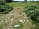
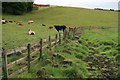
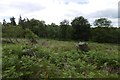
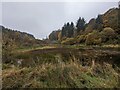
Nearby Images from Geograph Britain and Ireland:
©2007(licence)
©2017(licence)
©2023(licence)
©2023(licence)
©2023(licence)
The above images may not be of the site on this page, they are loaded from Geograph.
Please Submit an Image of this site or go out and take one for us!
Click here to see more info for this site
Nearby sites
Key: Red: member's photo, Blue: 3rd party photo, Yellow: other image, Green: no photo - please go there and take one, Grey: site destroyed
Download sites to:
KML (Google Earth)
GPX (GPS waypoints)
CSV (Garmin/Navman)
CSV (Excel)
To unlock full downloads you need to sign up as a Contributory Member. Otherwise downloads are limited to 50 sites.
Turn off the page maps and other distractions
Nearby sites listing. In the following links * = Image available
619m E 85° Lynedoch Cottage (2) Standing Stone (Menhir) (NO03582902)
873m ESE 107° Lynedoch Cottage (3) Standing Stone (Menhir) (NO03792870)
2.9km E 92° Moneydie* Stone Circle (NO059288)
4.1km NE 40° Cowford Standing Stone (Menhir) (NO05633205)
5.5km SSW 205° Bachilton Stone Circle (NO005241)
5.7km SE 135° Huntingtower Cairn (NO069249)
5.7km W 279° Kor Stone* Standing Stone (Menhir) (NN97333004)
5.7km ENE 65° Gellybank* Standing Stones (NO082313)
6.0km ENE 76° Cramflat* Standing Stone (Menhir) (NO0885530322)
6.1km NNE 24° Pitsundry* Stone Circle (NO0558834454)
6.1km NE 47° Loak Stone Standing Stone (Menhir) (NO07573305)
6.2km E 99° Broxy Kennels* Hillfort (NO09112788)
6.2km NE 48° Loak Court Hill Round Barrow(s) (NO07733301)
6.3km SE 127° Mains Of Huntingtower Stone Circle (NO079251)
6.4km E 93° Denmarkfield Farm Standing Stone (Menhir) (NO09402844)
6.5km E 101° Whinny Hill Round Cairn (NO093276)
6.5km ENE 57° Newmill souterrain* Souterrain (Fogou, Earth House) (NO08513239)
6.7km ESE 121° Hunting Tower Cursus (NO087254)
6.8km E 95° King's Stone* Standing Stone (Menhir) (NO09712828)
7.3km ENE 62° Overbenchil* Standing Stone (Menhir) (NO095322)
7.4km NNW 346° Tullybeagles* Stone Circle (NO013362)
7.9km NNW 331° Sack Stone* Standing Stone (Menhir) (NN9925535973)
8.3km ENE 74° Colen* Stone Circle (NO110311)
8.6km N 7° Witch's Stone* Standing Stone (Menhir) (NO042375)
8.6km E 95° Scone Cursus Cursus (NO11532797)
View more nearby sites and additional images


 We would like to know more about this location. Please feel free to add a brief description and any relevant information in your own language.
 Wir möchten mehr über diese Stätte erfahren. Bitte zögern Sie nicht, eine kurze Beschreibung und relevante Informationen in Deutsch hinzuzufügen.
 Nous aimerions en savoir encore un peu sur les lieux. S'il vous plaît n'hesitez pas à ajouter une courte description et tous les renseignements pertinents dans votre propre langue.
 Quisieramos informarnos un poco más de las lugares. No dude en añadir una breve descripción y otros datos relevantes en su propio idioma.