


<< Text Pages >> Bachilton - Stone Circle in Scotland in Perth and Kinross
Submitted by Anonymous on Monday, 11 November 2002 Page Views: 7365
Neolithic and Bronze AgeSite Name: BachiltonCountry: Scotland
NOTE: This site is 2.929 km away from the location you searched for.
County: Perth and Kinross Type: Stone Circle
Map Ref: NO005241 Landranger Map Number: 52
Latitude: 56.398640N Longitude: 3.613639W
Condition:
| 5 | Perfect |
| 4 | Almost Perfect |
| 3 | Reasonable but with some damage |
| 2 | Ruined but still recognisable as an ancient site |
| 1 | Pretty much destroyed, possibly visible as crop marks |
| 0 | No data. |
| -1 | Completely destroyed |
| 5 | Superb |
| 4 | Good |
| 3 | Ordinary |
| 2 | Not Good |
| 1 | Awful |
| 0 | No data. |
| 5 | Can be driven to, probably with disabled access |
| 4 | Short walk on a footpath |
| 3 | Requiring a bit more of a walk |
| 2 | A long walk |
| 1 | In the middle of nowhere, a nightmare to find |
| 0 | No data. |
| 5 | co-ordinates taken by GPS or official recorded co-ordinates |
| 4 | co-ordinates scaled from a detailed map |
| 3 | co-ordinates scaled from a bad map |
| 2 | co-ordinates of the nearest village |
| 1 | co-ordinates of the nearest town |
| 0 | no data |
Internal Links:
External Links:
Stone Circle in Perthshire
Have you visited this site? Please contribute a description or any thoughts by adding a comment.
You may be viewing yesterday's version of this page. To see the most up to date information please register for a free account.
Do not use the above information on other web sites or publications without permission of the contributor.
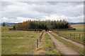
Nearby Images from Geograph Britain and Ireland:
©2006(licence)
©2008(licence)
©2019(licence)
©2019(licence)
©2008(licence)
The above images may not be of the site on this page, they are loaded from Geograph.
Please Submit an Image of this site or go out and take one for us!
Click here to see more info for this site
Nearby sites
Key: Red: member's photo, Blue: 3rd party photo, Yellow: other image, Green: no photo - please go there and take one, Grey: site destroyed
Download sites to:
KML (Google Earth)
GPX (GPS waypoints)
CSV (Garmin/Navman)
CSV (Excel)
To unlock full downloads you need to sign up as a Contributory Member. Otherwise downloads are limited to 50 sites.
Turn off the page maps and other distractions
Nearby sites listing. In the following links * = Image available
5.5km NNE 25° Lynedoch Cottage (1) Standing Stone (Menhir) (NO02962898)
5.6km NE 34° Lynedoch Cottage (3) Standing Stone (Menhir) (NO03792870)
5.8km NNE 31° Lynedoch Cottage (2) Standing Stone (Menhir) (NO03582902)
6.4km E 82° Huntingtower Cairn (NO069249)
6.7km NNW 331° Kor Stone* Standing Stone (Menhir) (NN97333004)
7.1km NE 48° Moneydie* Stone Circle (NO059288)
7.3km SSW 214° Trinity Well (Trinity Gask) Holy Well or Sacred Spring (NN96311812)
7.4km E 81° Mains Of Huntingtower Stone Circle (NO079251)
7.7km W 269° Fowlis Wester 2* Class III Pictish Cross Slab (NN92812408)
7.7km W 268° Fowlis Wester 1* Class II Pictish Symbol Stone (NN92772404)
7.8km W 263° New Fowlis* Stone Circle (NN92712329)
8.0km SSE 168° Leadketty Stone Circle (NO020162)
8.1km SE 143° Forteviot Cross* Sculptured Stone (NO0518017527)
8.1km SE 143° St Andrew's Church (Forteviot) Class III Pictish Cross Slab (NO052175)
8.1km W 274° Fowlis Wester East* Stone Circle (NN9242624917)
8.1km W 274° Fowlis Wester West* Stone Circle (NN9240124916)
8.2km SSW 199° Haugh Of Aberuthven* Standing Stone (Menhir) (NN97711643)
8.3km SE 142° Forteviot Dagger Burial* Cist (NO055175)
8.3km E 80° Hunting Tower Cursus (NO087254)
8.4km S 169° Leadketty Stone Circle (NO01921581)
8.4km W 268° Thorn Recumbent Stones* Standing Stones (NN92042397)
8.4km W 268° Thorn Stone Pair* Standing Stones (NN92032404)
8.6km SE 145° Forteviot Timber Circle (NO053169)
8.8km SSW 199° Loanhead (Aberuthven) Stone Circle (NN974158)
9.4km ENE 65° Broxy Kennels* Hillfort (NO09112788)
View more nearby sites and additional images


 We would like to know more about this location. Please feel free to add a brief description and any relevant information in your own language.
 Wir möchten mehr über diese Stätte erfahren. Bitte zögern Sie nicht, eine kurze Beschreibung und relevante Informationen in Deutsch hinzuzufügen.
 Nous aimerions en savoir encore un peu sur les lieux. S'il vous plaît n'hesitez pas à ajouter une courte description et tous les renseignements pertinents dans votre propre langue.
 Quisieramos informarnos un poco más de las lugares. No dude en añadir una breve descripción y otros datos relevantes en su propio idioma.