


<< Text Pages >> Kirknewton stone - Sculptured Stone in Scotland in West Lothian
Submitted by alligator on Monday, 24 March 2003 Page Views: 7136
Multi-periodSite Name: Kirknewton stoneCountry: Scotland
NOTE: This site is 6.424 km away from the location you searched for.
County: West Lothian Type: Sculptured Stone
Map Ref: NT11426693 Landranger Map Number: 65
Latitude: 55.887333N Longitude: 3.417752W
Condition:
| 5 | Perfect |
| 4 | Almost Perfect |
| 3 | Reasonable but with some damage |
| 2 | Ruined but still recognisable as an ancient site |
| 1 | Pretty much destroyed, possibly visible as crop marks |
| 0 | No data. |
| -1 | Completely destroyed |
| 5 | Superb |
| 4 | Good |
| 3 | Ordinary |
| 2 | Not Good |
| 1 | Awful |
| 0 | No data. |
| 5 | Can be driven to, probably with disabled access |
| 4 | Short walk on a footpath |
| 3 | Requiring a bit more of a walk |
| 2 | A long walk |
| 1 | In the middle of nowhere, a nightmare to find |
| 0 | No data. |
| 5 | co-ordinates taken by GPS or official recorded co-ordinates |
| 4 | co-ordinates scaled from a detailed map |
| 3 | co-ordinates scaled from a bad map |
| 2 | co-ordinates of the nearest village |
| 1 | co-ordinates of the nearest town |
| 0 | no data |
Be the first person to rate this site - see the 'Contribute!' box in the right hand menu.
Internal Links:
External Links:
Sculptured Stone in West Lothian
Canmore site no. 50341.
You may be viewing yesterday's version of this page. To see the most up to date information please register for a free account.
Do not use the above information on other web sites or publications without permission of the contributor.
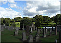
Nearby Images from Geograph Britain and Ireland:
©2018(licence)
©2017(licence)
©2017(licence)
©2020(licence)
©2010(licence)
The above images may not be of the site on this page, they are loaded from Geograph.
Please Submit an Image of this site or go out and take one for us!
Click here to see more info for this site
Nearby sites
Key: Red: member's photo, Blue: 3rd party photo, Yellow: other image, Green: no photo - please go there and take one, Grey: site destroyed
Download sites to:
KML (Google Earth)
GPX (GPS waypoints)
CSV (Garmin/Navman)
CSV (Excel)
To unlock full downloads you need to sign up as a Contributory Member. Otherwise downloads are limited to 50 sites.
Turn off the page maps and other distractions
Nearby sites listing. In the following links * = Image available
1.6km ESE 104° Kaimes Standing Stones (NT130665)
2.1km E 90° Dalmahoy Hill Hillfort (NT135669)
3.1km NNE 24° Witches' Stone (Ratho)* Rock Art (NT12736973)
3.1km NNE 27° Tormain Hill* Rock Art (NT12906967)
4.1km ENE 68° Newhouse Standing Stone Standing Stone (Menhir) (NT15296838)
4.5km NNE 22° Witchis Stane* Standing Stone (Menhir) (NT13177104)
5.7km N 8° Huly Hill Standing Stones* Standing Stones (NT1234272610)
5.7km N 8° Huly Hill Cairn* Round Cairn (NT1234272610)
5.8km N 11° Lochend menhir* Standing Stone (Menhir) (NT12667263)
6.5km NE 38° Gogar Stone* Standing Stone (Menhir) (NT15487199)
6.9km E 82° St Mungo's Well (Edinburgh)* Holy Well or Sacred Spring (NT18346773)
8.0km NNE 16° Carlowrie (Kirkliston) Rock Art (NT138746)
8.2km NNE 24° Cat Stane (Kirkliston)* Standing Stone (Menhir) (NT1489374373)
9.7km SW 229° Cromwell's Stone (West Calder) Natural Stone / Erratic / Other Natural Feature (NT03986068)
9.8km NE 37° Cammo Stone* Standing Stone (Menhir) (NT1747774681)
9.9km SE 140° Monks Rig, Font Stone* Ancient Cross (NT17585919)
9.9km NE 54° Physic Well (Corstorphine)* Holy Well or Sacred Spring (NT19597252)
9.9km NE 54° Lady Well* Holy Well or Sacred Spring (NT196726)
10.2km ESE 118° Carnethy Hill cairn* Cairn (NT20386192)
10.6km SE 132° Camp Hill Burnt Mound South* Artificial Mound (NT19145970)
10.6km SE 132° Camp Hill Burnt Mound North* Artificial Mound (NT19185973)
10.7km SE 132° Braidwood Fort* Hillfort (NT1928059630)
11.2km NNW 341° Justice Stone Standing Stone (Menhir) (NT08087759)
11.5km NNE 16° Crossall Hill (South Queensferry)* Ancient Cross (NT14907791)
11.5km N 6° Bell Stane (Queensferry) Standing Stone (Menhir) (NT12827840)
View more nearby sites and additional images

")
 We would like to know more about this location. Please feel free to add a brief description and any relevant information in your own language.
 Wir möchten mehr über diese Stätte erfahren. Bitte zögern Sie nicht, eine kurze Beschreibung und relevante Informationen in Deutsch hinzuzufügen.
 Nous aimerions en savoir encore un peu sur les lieux. S'il vous plaît n'hesitez pas à ajouter une courte description et tous les renseignements pertinents dans votre propre langue.
 Quisieramos informarnos un poco más de las lugares. No dude en añadir una breve descripción y otros datos relevantes en su propio idioma.