


<< Our Photo Pages >> Bontnewydd Cave - Cave or Rock Shelter in Wales in Denbighshire
Submitted by TimPrevett on Monday, 14 October 2002 Page Views: 20962
Natural PlacesSite Name: Bontnewydd Cave Alternative Name: PontnewyddCountry: Wales
NOTE: This site is 0.619 km away from the location you searched for.
County: Denbighshire Type: Cave or Rock Shelter
Nearest Town: Denbigh
Map Ref: SJ009712 Landranger Map Number: 116
Latitude: 53.228563N Longitude: 3.485985W
Condition:
| 5 | Perfect |
| 4 | Almost Perfect |
| 3 | Reasonable but with some damage |
| 2 | Ruined but still recognisable as an ancient site |
| 1 | Pretty much destroyed, possibly visible as crop marks |
| 0 | No data. |
| -1 | Completely destroyed |
| 5 | Superb |
| 4 | Good |
| 3 | Ordinary |
| 2 | Not Good |
| 1 | Awful |
| 0 | No data. |
| 5 | Can be driven to, probably with disabled access |
| 4 | Short walk on a footpath |
| 3 | Requiring a bit more of a walk |
| 2 | A long walk |
| 1 | In the middle of nowhere, a nightmare to find |
| 0 | No data. |
| 5 | co-ordinates taken by GPS or official recorded co-ordinates |
| 4 | co-ordinates scaled from a detailed map |
| 3 | co-ordinates scaled from a bad map |
| 2 | co-ordinates of the nearest village |
| 1 | co-ordinates of the nearest town |
| 0 | no data |
Internal Links:
External Links:
I have visited· I would like to visit
Loughlorien would like to visit
TimPrevett has visited here
")
A very important site in the history of humans in Wales, dating back to circa 220,000 BC. The cave was bricked up, with 3 doors barring access to the interior, though the outer door has shifted on its hinges.
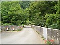
It is still nonetheless worthwhile paying a visit if in the area, and looking closely. Parking is a challenge in the village beneath. Try in a layby on the right hand side on the lane to Tyddyn Bleiddin, or in front of the gate from which there is a short walk to the facade.
You may be viewing yesterday's version of this page. To see the most up to date information please register for a free account.
")
")
")
Do not use the above information on other web sites or publications without permission of the contributor.
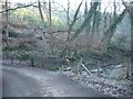
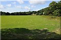
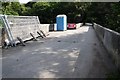
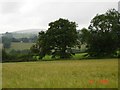
Nearby Images from Geograph Britain and Ireland:
©2006(licence)
©2014(licence)
©2014(licence)
©2005(licence)
©2005(licence)
The above images may not be of the site on this page, they are loaded from Geograph.
Please Submit an Image of this site or go out and take one for us!
Click here to see more info for this site
Nearby sites
Key: Red: member's photo, Blue: 3rd party photo, Yellow: other image, Green: no photo - please go there and take one, Grey: site destroyed
Download sites to:
KML (Google Earth)
GPX (GPS waypoints)
CSV (Garmin/Navman)
CSV (Excel)
To unlock full downloads you need to sign up as a Contributory Member. Otherwise downloads are limited to 50 sites.
Turn off the page maps and other distractions
Nearby sites listing. In the following links * = Image available
353m WNW 285° Nant-Y-Graig Cave or Rock Shelter (SJ00567130)
822m NNE 15° Tan-y-graig Stone Row / Alignment (SJ01137199)
1.3km N 351° Tyddyn Bleiddyn* Chambered Cairn (SJ00727246)
1.6km ESE 115° Cefn-Yr-Ogof Cave or Rock Shelter (SJ023705)
2.0km E 92° Ffynnon Fair (Trefnant)* Holy Well or Sacred Spring (SJ02927107)
3.1km SE 131° Plas Heaton Cave Cave or Rock Shelter (SJ03206911)
3.6km W 278° Mynydd-y-Gaer* Hillfort (SH973718)
5.5km NW 323° St George's Well (Denbighshire) Holy Well or Sacred Spring (SH97657567)
5.6km NNW 331° Terfyn Well Holy Well or Sacred Spring (SH98317613)
6.1km NW 317° Dinorben Hillfort (SH968757)
7.5km E 80° St Beuno's Well (Tremeirchion)* Holy Well or Sacred Spring (SJ083723)
7.6km E 79° Cae Gwyn* Cave or Rock Shelter (SJ0843972501)
7.7km E 79° Ffynnon Beuno (Caves)* Cave or Rock Shelter (SJ0849972500)
7.8km SW 231° Plas Newydd Barrow* Round Barrow(s) (SH94716644)
8.1km ENE 75° Penuchaf Cairn (SJ08837315)
8.4km ENE 67° Moel Maen Efa* Barrow Cemetery (SJ087743)
8.4km NNE 24° Ffynnon Fair (Rhuddlan)* Holy Well or Sacred Spring (SJ045788)
8.6km NE 51° Llyn-Y-Gorseddau 1 Round Barrow(s) (SJ07657651)
8.6km E 91° Moel-y-Gaer (Bodfari)* Hillfort (SJ09527080)
8.6km NE 50° Llyn-Y-Gorseddau 2 Round Barrow(s) (SJ07687657)
8.6km NE 50° Llyn-Y-Gorseddau 3 Round Barrow(s) (SJ07647662)
8.7km E 81° Cefn Du Ancient Village or Settlement (SJ0956272450)
8.9km NE 43° Marion Bach 1 Round Barrow(s) (SJ07057759)
9.0km NE 47° Aelwyd Uchaf (Cottage) Barrows Round Barrow(s) (SJ0758577185)
9.1km NE 35° Moel Hiraddug* Hillfort (SJ063785)
View more nearby sites and additional images


 We would like to know more about this location. Please feel free to add a brief description and any relevant information in your own language.
 Wir möchten mehr über diese Stätte erfahren. Bitte zögern Sie nicht, eine kurze Beschreibung und relevante Informationen in Deutsch hinzuzufügen.
 Nous aimerions en savoir encore un peu sur les lieux. S'il vous plaît n'hesitez pas à ajouter une courte description et tous les renseignements pertinents dans votre propre langue.
 Quisieramos informarnos un poco más de las lugares. No dude en añadir una breve descripción y otros datos relevantes en su propio idioma.