

<< Text Pages >> Helm End - Hillfort in Scotland in Scottish Borders
Submitted by SolarMegalith on Wednesday, 16 November 2011 Page Views: 2709
Iron Age and Later PrehistorySite Name: Helm EndCountry: Scotland
NOTE: This site is 2.573 km away from the location you searched for.
County: Scottish Borders Type: Hillfort
Nearest Village: Broughton
Map Ref: NT10983532
Latitude: 55.603321N Longitude: 3.414471W
Condition:
| 5 | Perfect |
| 4 | Almost Perfect |
| 3 | Reasonable but with some damage |
| 2 | Ruined but still recognisable as an ancient site |
| 1 | Pretty much destroyed, possibly visible as crop marks |
| 0 | No data. |
| -1 | Completely destroyed |
| 5 | Superb |
| 4 | Good |
| 3 | Ordinary |
| 2 | Not Good |
| 1 | Awful |
| 0 | No data. |
| 5 | Can be driven to, probably with disabled access |
| 4 | Short walk on a footpath |
| 3 | Requiring a bit more of a walk |
| 2 | A long walk |
| 1 | In the middle of nowhere, a nightmare to find |
| 0 | No data. |
| 5 | co-ordinates taken by GPS or official recorded co-ordinates |
| 4 | co-ordinates scaled from a detailed map |
| 3 | co-ordinates scaled from a bad map |
| 2 | co-ordinates of the nearest village |
| 1 | co-ordinates of the nearest town |
| 0 | no data |
Internal Links:
External Links:
Hillfort in Scottish Borders
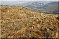
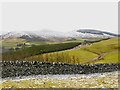
Earthwork remains of an Iron Age hillfort and settlement.
Read More at ScotlandsPlaces.
You may be viewing yesterday's version of this page. To see the most up to date information please register for a free account.
Do not use the above information on other web sites or publications without permission of the contributor.
Nearby Images from Geograph Britain and Ireland:
©2010(licence)
©2023(licence)
©2023(licence)
©2010(licence)
©2023(licence)
The above images may not be of the site on this page, they are loaded from Geograph.
Please Submit an Image of this site or go out and take one for us!
Click here to see more info for this site
Nearby sites
Key: Red: member's photo, Blue: 3rd party photo, Yellow: other image, Green: no photo - please go there and take one, Grey: site destroyed
Download sites to:
KML (Google Earth)
GPX (GPS waypoints)
CSV (Garmin/Navman)
CSV (Excel)
To unlock full downloads you need to sign up as a Contributory Member. Otherwise downloads are limited to 50 sites.
Turn off the page maps and other distractions
Nearby sites listing. In the following links * = Image available
930m SSW 203° Whitslade Hill Burnt Mound Artificial Mound (NT10603447)
1.4km SSE 156° Piper's Stone Standing Stone (Menhir) (NT11533400)
1.5km E 84° Dreva Craig* Standing Stone (Menhir) (NT12453545)
1.7km E 88° Dreva Craig* Hillfort (NT12673533)
1.7km SSE 164° Rachan Hill Henge (NT11423363)
1.9km E 83° Dreva Hill West (Broughton)* Ancient Village or Settlement (NT12923553)
2.7km W 268° Parkgatestone Hill Ancient Village or Settlement (NT08293529)
2.9km E 87° Drumelzier Haugh* Standing Stone (Menhir) (NT13933542)
3.0km SW 234° Mill Rings Misc. Earthwork (NT08493357)
3.3km ESE 104° Tinnis Castle* Hillfort (NT14153444)
3.4km W 271° Cleuch Hill* Cairn (NT07573546)
3.5km SW 232° Knowe Kniffling* Hillfort (NT08163323)
4.2km SSE 163° Woodend, Mossfennan Farm* Cist (NT12173124)
4.7km E 84° Altar Stone, Stobo* Standing Stone (Menhir) (NT15703573)
4.8km WSW 255° Mitchelhill Rings Hillfort (NT06283417)
6.0km S 173° Laigh Hill (Tweeddale)* Ancient Village or Settlement (NT11632933)
6.2km S 172° Norman's Castle* Stone Fort or Dun (NT11722915)
6.5km S 177° Patervan Cairn, Buildings & Mound* Cairn (NT11192885)
6.8km S 177° Patervan Settlement* Ancient Village or Settlement (NT11252854)
7.4km WNW 288° Moat Park Heritage Centre Museum (NT040378)
7.6km ENE 71° Stobo Kirk standing stone* Standing Stone (Menhir) (NT1826037655)
8.1km WSW 246° Nisbet* Hillfort (NT03543216)
8.5km WNW 303° Carwood Farm Ancient Village or Settlement (NT039401)
8.7km N 355° Netherurd Mains (Kirkurd) Ancient Cross (NT10414403)
8.9km WSW 252° Snaip Hill* Hillfort (NT02463269)
View more nearby sites and additional images


 We would like to know more about this location. Please feel free to add a brief description and any relevant information in your own language.
 Wir möchten mehr über diese Stätte erfahren. Bitte zögern Sie nicht, eine kurze Beschreibung und relevante Informationen in Deutsch hinzuzufügen.
 Nous aimerions en savoir encore un peu sur les lieux. S'il vous plaît n'hesitez pas à ajouter une courte description et tous les renseignements pertinents dans votre propre langue.
 Quisieramos informarnos un poco más de las lugares. No dude en añadir una breve descripción y otros datos relevantes en su propio idioma.