


<< Our Photo Pages >> Giant's Stone (Scottish Borders) - Standing Stone (Menhir) in Scotland in Scottish Borders
Submitted by vicky on Monday, 15 March 2004 Page Views: 12852
Neolithic and Bronze AgeSite Name: Giant's Stone (Scottish Borders) Alternative Name: MenzionCountry: Scotland
NOTE: This site is 2.468 km away from the location you searched for.
County: Scottish Borders Type: Standing Stone (Menhir)
Nearest Town: Tweedsmuir Nearest Village: Menzion
Map Ref: NT09532399 Landranger Map Number: 72
Latitude: 55.501282N Longitude: 3.433767W
Condition:
| 5 | Perfect |
| 4 | Almost Perfect |
| 3 | Reasonable but with some damage |
| 2 | Ruined but still recognisable as an ancient site |
| 1 | Pretty much destroyed, possibly visible as crop marks |
| 0 | No data. |
| -1 | Completely destroyed |
| 5 | Superb |
| 4 | Good |
| 3 | Ordinary |
| 2 | Not Good |
| 1 | Awful |
| 0 | No data. |
| 5 | Can be driven to, probably with disabled access |
| 4 | Short walk on a footpath |
| 3 | Requiring a bit more of a walk |
| 2 | A long walk |
| 1 | In the middle of nowhere, a nightmare to find |
| 0 | No data. |
| 5 | co-ordinates taken by GPS or official recorded co-ordinates |
| 4 | co-ordinates scaled from a detailed map |
| 3 | co-ordinates scaled from a bad map |
| 2 | co-ordinates of the nearest village |
| 1 | co-ordinates of the nearest town |
| 0 | no data |
Be the first person to rate this site - see the 'Contribute!' box in the right hand menu.
Internal Links:
External Links:
I have visited· I would like to visit
nicoladidsbury has visited here
 (PID:11886)")
The Northern Antiquarian (TNA) feature a page for this stone - see their entry for Giant’s Stone, Tweedsmuir, Peeblesshire, which gives directions for finding this stone together with a copy of the 1865 OS map showing the location of both the Giant's Stone and the Giant's Grave, together with a brief archaeology & history.
This stone is also recorded as Canmore ID 48527, which gives the locations of the three standing stones in this area: NT 0952 2397, NT 0949 2398 and NT 0953 2399. The record refers specifically to the Giant's Stone at NT 0952 2397: "The Giant's Stone, 5'2" high, is referred to in an account of 1834, but no mention is made of two other stones which stand nearby. One of these, 55' W of the Giant's Stone and the same distance S of the cairn is 3' 2" in height, while the other, 62' N of the Giant's Stone and 65' E of the cairn, is 3' 6" in height."
You may be viewing yesterday's version of this page. To see the most up to date information please register for a free account.
Do not use the above information on other web sites or publications without permission of the contributor.
austenjohnreid has found this location on Google Street View:
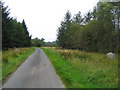
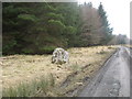
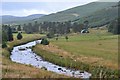
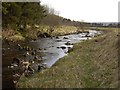
Nearby Images from Geograph Britain and Ireland:
©2007(licence)
©2010(licence)
©2013(licence)
©2008(licence)
©2008(licence)
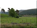
The above images may not be of the site on this page, they are loaded from Geograph.
Please Submit an Image of this site or go out and take one for us!
Click here to see more info for this site
Nearby sites
Key: Red: member's photo, Blue: 3rd party photo, Yellow: other image, Green: no photo - please go there and take one, Grey: site destroyed
Download sites to:
KML (Google Earth)
GPX (GPS waypoints)
CSV (Garmin/Navman)
CSV (Excel)
To unlock full downloads you need to sign up as a Contributory Member. Otherwise downloads are limited to 50 sites.
Turn off the page maps and other distractions
Nearby sites listing. In the following links * = Image available
41m WSW 255° Menzion* Standing Stones (NT0949023980)
1.9km SW 230° Nether Dod* Stone Circle (NT08032279)
4.9km NNE 19° Patervan Settlement* Ancient Village or Settlement (NT11252854)
5.1km NNE 18° Patervan Cairn, Buildings & Mound* Cairn (NT11192885)
5.2km SE 128° Talla Linnfoots* Cairn (NT13622069)
5.6km NNE 22° Norman's Castle* Stone Fort or Dun (NT11722915)
5.7km NNE 20° Laigh Hill (Tweeddale)* Ancient Village or Settlement (NT11632933)
6.6km ESE 123° Megget Stone* Standing Stone (Menhir) (NT1505720292)
7.7km NNE 19° Woodend, Mossfennan Farm* Cist (NT12173124)
9.3km N 350° Knowe Kniffling* Hillfort (NT08163323)
9.6km N 353° Mill Rings Misc. Earthwork (NT08493357)
9.8km N 10° Rachan Hill Henge (NT11423363)
10.1km NW 323° Nisbet* Hillfort (NT03543216)
10.2km N 10° Piper's Stone Standing Stone (Menhir) (NT11533400)
10.3km ENE 59° Nethertown Stone Circle (NT185291)
10.5km N 5° Whitslade Hill Burnt Mound Artificial Mound (NT10603447)
10.7km NNW 341° Mitchelhill Rings Hillfort (NT06283417)
11.2km NW 320° Snaip Hill* Hillfort (NT02463269)
11.2km ENE 65° Manorhead Standing Stone (Menhir) (NT19862850)
11.4km N 353° Parkgatestone Hill Ancient Village or Settlement (NT08293529)
11.4km NNE 23° Tinnis Castle* Hillfort (NT14153444)
11.4km N 6° Helm End Hillfort (NT10983532)
11.6km N 349° Cleuch Hill* Cairn (NT07573546)
11.6km NW 320° Culterpark Hill* Hillfort (NT02213305)
11.8km NNE 14° Dreva Craig* Hillfort (NT12673533)
View more nearby sites and additional images


 We would like to know more about this location. Please feel free to add a brief description and any relevant information in your own language.
 Wir möchten mehr über diese Stätte erfahren. Bitte zögern Sie nicht, eine kurze Beschreibung und relevante Informationen in Deutsch hinzuzufügen.
 Nous aimerions en savoir encore un peu sur les lieux. S'il vous plaît n'hesitez pas à ajouter une courte description et tous les renseignements pertinents dans votre propre langue.
 Quisieramos informarnos un poco más de las lugares. No dude en añadir una breve descripción y otros datos relevantes en su propio idioma.