


<< Our Photo Pages >> Altar Stone, Stobo - Standing Stone (Menhir) in Scotland in Scottish Borders
Submitted by austenjohnreid on Friday, 13 August 2004 Page Views: 12026
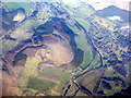
Neolithic and Bronze AgeSite Name: Altar Stone, StoboCountry: Scotland
NOTE: This site is 1.674 km away from the location you searched for.
County: Scottish Borders Type: Standing Stone (Menhir)
Nearest Town: Peebles Nearest Village: Stobo
Map Ref: NT15703573 Landranger Map Number: 72
Latitude: 55.607845N Longitude: 3.339706W
Condition:
| 5 | Perfect |
| 4 | Almost Perfect |
| 3 | Reasonable but with some damage |
| 2 | Ruined but still recognisable as an ancient site |
| 1 | Pretty much destroyed, possibly visible as crop marks |
| 0 | No data. |
| -1 | Completely destroyed |
| 5 | Superb |
| 4 | Good |
| 3 | Ordinary |
| 2 | Not Good |
| 1 | Awful |
| 0 | No data. |
| 5 | Can be driven to, probably with disabled access |
| 4 | Short walk on a footpath |
| 3 | Requiring a bit more of a walk |
| 2 | A long walk |
| 1 | In the middle of nowhere, a nightmare to find |
| 0 | No data. |
| 5 | co-ordinates taken by GPS or official recorded co-ordinates |
| 4 | co-ordinates scaled from a detailed map |
| 3 | co-ordinates scaled from a bad map |
| 2 | co-ordinates of the nearest village |
| 1 | co-ordinates of the nearest town |
| 0 | no data |
Internal Links:
External Links:
I have visited· I would like to visit
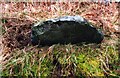
Anne T visited on 10th Aug 2016 - their rating: Cond: 2 Amb: 3 Access: 5 Altar Stone, near Stobo, Scottish Borders: This stone is clearly marked on the map and features on the Portal, but I can find out nothing about it on Canmore or other web sites.
From Tinnis Castle, driving up the B712 through Drumelzier and Drumelzier Haugh, just past Dawyck Botanic Garden, a small road turns sharp left up through a hamlet called ‘Altarstone’. Opposite the farmhouse, hidden beneath tree branches at the edge of the road is the altar stone Intriguing Need to find out more about this.
")
Other stories are about Merlin chasing a witch, she changed into a hare and gave him the slip at this spot scratching the top of the stone as she went; the marks are still there. Merlin was baptised at this stone (by Saint Mungo a.k.a St. Kentigern), the day before he died. The menhir at Drumizlier Haugh marks the spot where he died, its about half a mile away.
You may be viewing yesterday's version of this page. To see the most up to date information please register for a free account.
")
")
")
Do not use the above information on other web sites or publications without permission of the contributor.
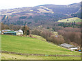
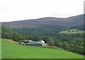
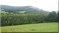
Nearby Images from Geograph Britain and Ireland:
©2014(licence)
©2005(licence)
©2020(licence)
©2020(licence)
©2016(licence)
The above images may not be of the site on this page, they are loaded from Geograph.
Please Submit an Image of this site or go out and take one for us!
Click here to see more info for this site
Nearby sites
Key: Red: member's photo, Blue: 3rd party photo, Yellow: other image, Green: no photo - please go there and take one, Grey: site destroyed
Download sites to:
KML (Google Earth)
GPX (GPS waypoints)
CSV (Garmin/Navman)
CSV (Excel)
To unlock full downloads you need to sign up as a Contributory Member. Otherwise downloads are limited to 50 sites.
Turn off the page maps and other distractions
Nearby sites listing. In the following links * = Image available
1.8km W 259° Drumelzier Haugh* Standing Stone (Menhir) (NT13933542)
2.0km SW 229° Tinnis Castle* Hillfort (NT14153444)
2.8km W 265° Dreva Hill West (Broughton)* Ancient Village or Settlement (NT12923553)
3.0km W 261° Dreva Craig* Hillfort (NT12673533)
3.2km NE 52° Stobo Kirk standing stone* Standing Stone (Menhir) (NT1826037655)
3.3km W 264° Dreva Craig* Standing Stone (Menhir) (NT12453545)
4.5km WSW 246° Piper's Stone Standing Stone (Menhir) (NT11533400)
4.7km W 264° Helm End Hillfort (NT10983532)
4.8km WSW 243° Rachan Hill Henge (NT11423363)
5.2km WSW 255° Whitslade Hill Burnt Mound Artificial Mound (NT10603447)
5.7km SW 217° Woodend, Mossfennan Farm* Cist (NT12173124)
6.1km NE 44° Sheriff Muir Standing Stones* Standing Stones (NT20094005)
6.7km NE 45° Meldon Bridge Timber Circle (NT205404)
6.9km ENE 78° Cademuir Hill* Hillfort (NT22473708)
7.2km SSE 156° Nethertown Stone Circle (NT185291)
7.4km W 265° Parkgatestone Hill Ancient Village or Settlement (NT08293529)
7.5km WSW 252° Mill Rings Misc. Earthwork (NT08493357)
7.5km ENE 66° Kirkton Manor* Standing Stone (Menhir) (NT22693863)
7.6km SSW 211° Laigh Hill (Tweeddale)* Ancient Village or Settlement (NT11632933)
7.7km SSW 210° Norman's Castle* Stone Fort or Dun (NT11722915)
7.9km WSW 251° Knowe Kniffling* Hillfort (NT08163323)
8.1km W 267° Cleuch Hill* Cairn (NT07573546)
8.2km SSW 212° Patervan Cairn, Buildings & Mound* Cairn (NT11192885)
8.3km SSE 149° Manorhead Standing Stone (Menhir) (NT19862850)
8.4km SSW 211° Patervan Settlement* Ancient Village or Settlement (NT11252854)
View more nearby sites and additional images


 We would like to know more about this location. Please feel free to add a brief description and any relevant information in your own language.
 Wir möchten mehr über diese Stätte erfahren. Bitte zögern Sie nicht, eine kurze Beschreibung und relevante Informationen in Deutsch hinzuzufügen.
 Nous aimerions en savoir encore un peu sur les lieux. S'il vous plaît n'hesitez pas à ajouter une courte description et tous les renseignements pertinents dans votre propre langue.
 Quisieramos informarnos un poco más de las lugares. No dude en añadir una breve descripción y otros datos relevantes en su propio idioma.