

<< Text Pages >> Pen-Y-Gaer (Efenechtyd) - Hillfort in Wales in Denbighshire
Submitted by coldrum on Tuesday, 12 October 2010 Page Views: 4563
Iron Age and Later PrehistorySite Name: Pen-Y-Gaer (Efenechtyd)Country: Wales
NOTE: This site is 2.893 km away from the location you searched for.
County: Denbighshire Type: Hillfort
Map Ref: SJ10585484
Latitude: 53.083265N Longitude: 3.336448W
Condition:
| 5 | Perfect |
| 4 | Almost Perfect |
| 3 | Reasonable but with some damage |
| 2 | Ruined but still recognisable as an ancient site |
| 1 | Pretty much destroyed, possibly visible as crop marks |
| 0 | No data. |
| -1 | Completely destroyed |
| 5 | Superb |
| 4 | Good |
| 3 | Ordinary |
| 2 | Not Good |
| 1 | Awful |
| 0 | No data. |
| 5 | Can be driven to, probably with disabled access |
| 4 | Short walk on a footpath |
| 3 | Requiring a bit more of a walk |
| 2 | A long walk |
| 1 | In the middle of nowhere, a nightmare to find |
| 0 | No data. |
| 5 | co-ordinates taken by GPS or official recorded co-ordinates |
| 4 | co-ordinates scaled from a detailed map |
| 3 | co-ordinates scaled from a bad map |
| 2 | co-ordinates of the nearest village |
| 1 | co-ordinates of the nearest town |
| 0 | no data |
Be the first person to rate this site - see the 'Contribute!' box in the right hand menu.
Internal Links:
External Links:
Hillfort in Denbighshire (Sir Ddinbych)
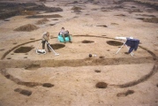
"An Iron Age hillfort, roughly oval in plan, measuring about 200m NE-SW by 150m; presently fossilised in the field boundaries encircling the summit."
Source: Coflein
You may be viewing yesterday's version of this page. To see the most up to date information please register for a free account.
Do not use the above information on other web sites or publications without permission of the contributor.
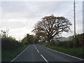
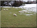
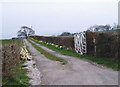
Nearby Images from Geograph Britain and Ireland:
©2015(licence)
©2006(licence)
©2006(licence)
©2017(licence)
©2019(licence)
The above images may not be of the site on this page, they are loaded from Geograph.
Please Submit an Image of this site or go out and take one for us!
Click here to see more info for this site
Nearby sites
Key: Red: member's photo, Blue: 3rd party photo, Yellow: other image, Green: no photo - please go there and take one, Grey: site destroyed
Download sites to:
KML (Google Earth)
GPX (GPS waypoints)
CSV (Garmin/Navman)
CSV (Excel)
To unlock full downloads you need to sign up as a Contributory Member. Otherwise downloads are limited to 50 sites.
Turn off the page maps and other distractions
Nearby sites listing. In the following links * = Image available
1.0km NW 318° Carreg Clocaenog* Standing Stone (Menhir) (SJ0991755605)
3.4km NNE 29° Gorsedd Stones Ruthin, Modern Eisteddfod Stone Circle* Modern Stone Circle etc (SJ123578)
3.9km NNE 26° Maen Huail* Standing Stone (Menhir) (SJ1237558279)
4.0km ENE 60° Cefn Coch Tumulus Round Barrow(s) (SJ141568)
4.5km NE 49° St Meugan's Cross Early Christian Sculptured Stone (SJ14005774)
5.3km SW 230° Ffynnon Sarah* Holy Well or Sacred Spring (SJ064515)
5.5km WSW 252° Bedd Emlyn* Cairn (SJ0525053240)
5.7km WSW 252° Bryn Beddau North* Ring Cairn (SJ0508053130)
5.8km WSW 250° Bryn Beddau South* Cairn (SJ0505052970)
5.8km S 171° Tom Dongen Round Barrow* Round Barrow(s) (SJ1137049060)
6.3km WSW 248° Bryn Beddau Stone Circle* Stone Circle (SJ0472952587)
6.3km WSW 246° Maen Llwyd (Denbighshire)* Standing Stone (Menhir) (SJ04795238)
6.3km E 80° Llanarmon Yn Lal Burial Mounds* Round Barrow(s) (SJ168558)
6.5km ESE 103° Moel Y Waun Round Cairn North* Round Cairn (SJ169533)
6.5km ESE 104° Moel Y Waun Round Cairn South* Round Cairn (SJ169532)
6.5km E 83° Moel Y Plas Tumulus* Round Cairn (SJ171555)
6.6km WSW 246° Caerau Two (Denbighshire)* Ancient Village or Settlement (SJ0446552227)
6.8km WSW 246° Caerau One (Denbighshire) Ancient Village or Settlement (SJ0432252169)
7.0km W 266° Capel Hiraethog ring cairn* Ring Cairn (SJ036545)
7.2km ENE 66° Moel Gwy Tumulus* Round Cairn (SJ172576)
7.4km W 266° Capel Hiraethog III* Stone Circle (SJ032545)
7.7km SE 133° Rhos Lydan Round Barrows* Barrow Cemetery (SJ161495)
7.8km NE 46° Foel Fenlli* Hillfort (SJ1632060080)
8.0km SW 224° Dinas Melin-y-Wig* Hillfort (SJ049492)
8.0km S 180° Bwrdd y Tri Arglwydd* Chambered Tomb (SJ10454682)
View more nearby sites and additional images


 We would like to know more about this location. Please feel free to add a brief description and any relevant information in your own language.
 Wir möchten mehr über diese Stätte erfahren. Bitte zögern Sie nicht, eine kurze Beschreibung und relevante Informationen in Deutsch hinzuzufügen.
 Nous aimerions en savoir encore un peu sur les lieux. S'il vous plaît n'hesitez pas à ajouter une courte description et tous les renseignements pertinents dans votre propre langue.
 Quisieramos informarnos un poco más de las lugares. No dude en añadir una breve descripción y otros datos relevantes en su propio idioma.