


<< Text Pages >> Haley Hole Well (Brownstown) - Holy Well or Sacred Spring in Scotland in Orkney
Submitted by Anne T on Wednesday, 20 February 2019 Page Views: 936
Springs and Holy WellsSite Name: Haley Hole Well (Brownstown) Alternative Name: Mineral Well (Brinkies Brae Hill); Haley Hole (Brownstown)Country: Scotland
NOTE: This site is 0.6 km away from the location you searched for.
County: Orkney Type: Holy Well or Sacred Spring
Nearest Town: Stromness
Map Ref: HY2477609314
Latitude: 58.964371N Longitude: 3.309727W
Condition:
| 5 | Perfect |
| 4 | Almost Perfect |
| 3 | Reasonable but with some damage |
| 2 | Ruined but still recognisable as an ancient site |
| 1 | Pretty much destroyed, possibly visible as crop marks |
| 0 | No data. |
| -1 | Completely destroyed |
| 5 | Superb |
| 4 | Good |
| 3 | Ordinary |
| 2 | Not Good |
| 1 | Awful |
| 0 | No data. |
| 5 | Can be driven to, probably with disabled access |
| 4 | Short walk on a footpath |
| 3 | Requiring a bit more of a walk |
| 2 | A long walk |
| 1 | In the middle of nowhere, a nightmare to find |
| 0 | No data. |
| 5 | co-ordinates taken by GPS or official recorded co-ordinates |
| 4 | co-ordinates scaled from a detailed map |
| 3 | co-ordinates scaled from a bad map |
| 2 | co-ordinates of the nearest village |
| 1 | co-ordinates of the nearest town |
| 0 | no data |
Be the first person to rate this site - see the 'Contribute!' box in the right hand menu.
Internal Links:
External Links:
I have visited· I would like to visit
kmstringer78 visited on 13th Apr 2023 - their rating: Amb: 3 Access: 5 The well sits perhaps 2 meters off the road, which is not heavily traveled. A wall has been built up around it to a height of about 1.5 meters, with a flat stone slab over the top. Just a short walk uphill from Stromness, so worth a visit if you're in the area.
The Journal of Antiquities tells us about this chalybeate well which is located quarter of a mile to the north west of Stromness, in the valley a short distance to the south west of Brinkies Brae Hill - se their entry for The Mineral Well, Near Brinkies Brae, Stromness, Orkney. The Journal tells us the well was long favoured by the locals of Stromness as a cure for their ailments, and gives directions for finding this site, together with a description and a list of reference sources for more information.
The well is also recorded as Canmore ID 295343, which tells us the well was originally thought to be sacred. It appears on the 1st edition of the OS 6inch map for Orkney, 1882. The well "is situated on the E side of a minor road leading from Brownstown House on the outskirts of Stromness to The Loons". The Canmore record also includes a photograph of the well.
Note: Have you visited this site? Do you have any photographs or information to add?
You may be viewing yesterday's version of this page. To see the most up to date information please register for a free account.
Do not use the above information on other web sites or publications without permission of the contributor.
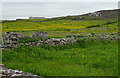
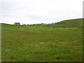
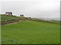
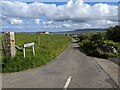
Nearby Images from Geograph Britain and Ireland:
©2018(licence)
©2015(licence)
©2006(licence)
©2023(licence)
©2023(licence)
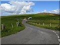
The above images may not be of the site on this page, they are loaded from Geograph.
Please Submit an Image of this site or go out and take one for us!
Click here to see more info for this site
Nearby sites
Key: Red: member's photo, Blue: 3rd party photo, Yellow: other image, Green: no photo - please go there and take one, Grey: site destroyed
Download sites to:
KML (Google Earth)
GPX (GPS waypoints)
CSV (Garmin/Navman)
CSV (Excel)
To unlock full downloads you need to sign up as a Contributory Member. Otherwise downloads are limited to 50 sites.
Turn off the page maps and other distractions
Nearby sites listing. In the following links * = Image available
1.3km SW 229° Warebeth* Chambered Tomb (HY238085)
1.7km W 279° Brockan* Ancient Village or Settlement (HY231096)
1.7km W 267° Leafea* Standing Stones (HY23060927)
1.8km ESE 102° Quoyelsh* Ancient Village or Settlement (HY265089)
2.3km W 269° Broch of Breckness* Broch or Nuraghe (HY225093)
3.1km NE 37° Deepdale Cottages* Standing Stones (HY267118)
3.2km N 0° Una* Artificial Mound (HY24841254)
3.2km ENE 60° Howe Chambered Tomb* Chambered Tomb (HY276109)
3.5km NE 43° Deepdale Stones* Standing Stone (Menhir) (HY272118)
3.6km ENE 71° Cummi Howe* Broch or Nuraghe (HY282104)
3.8km ENE 76° Corn Hillock* Cairn (HY28481015)
4.2km NE 53° Diamond Cottage* Promontory Fort / Cliff Castle (HY28211176)
4.2km NE 54° Unstan* Chambered Cairn (HY28291172)
4.3km E 81° The Cairns* Cairn (HY29050987)
5.4km SW 219° Braebister* Promontory Fort / Cliff Castle (HY21300522)
5.6km ESE 123° Sower Castle* Ancient Village or Settlement (HY29400620)
5.7km N 5° Voy.* Ancient Village or Settlement (HY25351497)
5.7km NNE 12° Voy Crannogs* Crannog (HY261149)
5.8km NE 50° Possible large stone circle in Loch of Stenness Stone Circle (HY2933112934)
5.9km NE 51° Fairy Well (Stenness)* Holy Well or Sacred Spring (HY2943212982)
5.9km ENE 66° Standing Stones Hotel* Chambered Cairn (HY30251165)
6.0km NE 42° Wasbister Disc Barrow* Round Barrow(s) (HY289137)
6.0km NE 42° Dyke o'Sean* Ancient Village or Settlement (HY289137)
6.0km NE 47° Salt Knowe* Round Barrow(s) (HY293133)
6.1km NE 48° South Knowe* Artificial Mound (HY29411328)
View more nearby sites and additional images


 We would like to know more about this location. Please feel free to add a brief description and any relevant information in your own language.
 Wir möchten mehr über diese Stätte erfahren. Bitte zögern Sie nicht, eine kurze Beschreibung und relevante Informationen in Deutsch hinzuzufügen.
 Nous aimerions en savoir encore un peu sur les lieux. S'il vous plaît n'hesitez pas à ajouter une courte description et tous les renseignements pertinents dans votre propre langue.
 Quisieramos informarnos un poco más de las lugares. No dude en añadir una breve descripción y otros datos relevantes en su propio idioma.