<< Our Photo Pages >> St Cuthbert's Stone and Well (Waverbridge) - Holy Well or Sacred Spring in England in Cumbria
Submitted by Anne T on Monday, 08 January 2018 Page Views: 1583
Springs and Holy WellsSite Name: St Cuthbert's Stone and Well (Waverbridge)Country: England
NOTE: This site is 3.394 km away from the location you searched for.
County: Cumbria Type: Holy Well or Sacred Spring
Nearest Town: Wigton Nearest Village: Waverbridge
Map Ref: NY2148648605
Latitude: 54.826106N Longitude: 3.223625W
Condition:
| 5 | Perfect |
| 4 | Almost Perfect |
| 3 | Reasonable but with some damage |
| 2 | Ruined but still recognisable as an ancient site |
| 1 | Pretty much destroyed, possibly visible as crop marks |
| 0 | No data. |
| -1 | Completely destroyed |
| 5 | Superb |
| 4 | Good |
| 3 | Ordinary |
| 2 | Not Good |
| 1 | Awful |
| 0 | No data. |
| 5 | Can be driven to, probably with disabled access |
| 4 | Short walk on a footpath |
| 3 | Requiring a bit more of a walk |
| 2 | A long walk |
| 1 | In the middle of nowhere, a nightmare to find |
| 0 | No data. |
| 5 | co-ordinates taken by GPS or official recorded co-ordinates |
| 4 | co-ordinates scaled from a detailed map |
| 3 | co-ordinates scaled from a bad map |
| 2 | co-ordinates of the nearest village |
| 1 | co-ordinates of the nearest town |
| 0 | no data |
Internal Links:
External Links:
I have visited· I would like to visit
Anne T visited on 14th Jun 2020 - their rating: Cond: 2 Amb: 3 Access: 4 St Cuthbert's Stone & Well: We were making our first (and only for a long time) essential trip out, and passed within 400m of this well, so screeched to a halt at the entrance to the track (Watergate Lonning) at its junction with the B5302 at NY 21277 49139, and took our daily exercise walking down slope towards the well.
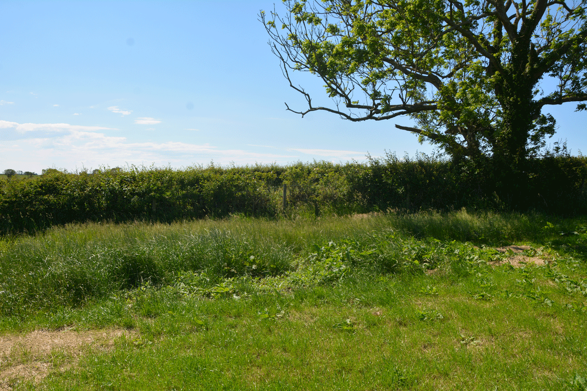
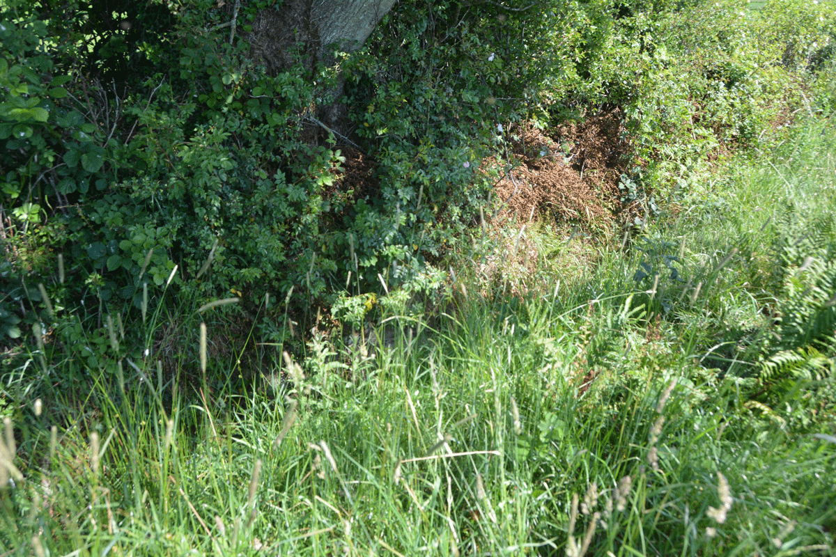
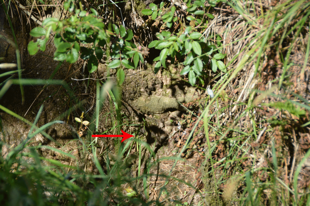
There is some sign of the well - in the field as an un-mown area of grass and in the hedge-line under the tree are remnants of a stone structure between the tree roots and along the bank of the ditch. All along the left hand side of the track (eastern side) is a drainage ditch, which we presume took the water from the fields, then when you get to the well, the water from the well joins the ditch. The well was dry at the time of our visit.
The stone was marked on the OS map, but was several fields away, with no gates in sight, so with time pressing, I photographed the well and we set off for our destination. So very odd to be out-and-about after months at home, but lots of other cars on the road, and difficult to rejoin the main road due to the high speed traffic.
The Northern Antiquarian (TNA) features a site for this holy well - see their entry for St. Cuthbert’s Stone & Well, Waverbridge, Cumbria, which gives directions for finding this site, together with a brief description and local folklore.
TNA quotes from Hutchinson's 1794 History of the County of Cumberland: "St. Cuthbert’s Well 'is a fine copious spring of remarkably pure and sweet water which…is called Helly-well, i.e. Haly or Holy Well. It formerly was the custom for the youth of all the neighbouring villages to assemble at this well early in the afternoon of the second Sunday in May, and there to join in a variety of rural sports. It was the village wake, and took place here, it is possible, when the keeping of wakes and fairs in the churchyard was discontinued. And it differed from the wakes of later times chiefly in this, that though it was a meeting entirely devoted to festivity and mirth, no strong drink of any kind was ever seen there, nor anything ever drunk but the beverage furnished by the Naiad of the place. A curate of the parish, about twenty years ago (c.1774), on the idea that it was a profanation of the Sabbath, saw fit to set his face against it; and having deservedly great influence in the parish, the meetings at Helly-well have ever since been discontinued'."
TNA adds: "Two hundred yards away across the fields to the east of this small spring of water, was once seen “a pretty large rock of granite, called St. Cuthbert’s Stane”, though it’s not featured on any modern map – and apart from the folklore-quote (below) being repeated in a couple of other sources, I can find little more about it. The old first edition OS-map shows it right up against the walling. Is it still there?"
Note: Have you visited this site? Do you know if the stone still exists? Do you have any photographs or information to add?
You may be viewing yesterday's version of this page. To see the most up to date information please register for a free account.


Do not use the above information on other web sites or publications without permission of the contributor.
Click here to see more info for this site
Nearby sites
Key: Red: member's photo, Blue: 3rd party photo, Yellow: other image, Green: no photo - please go there and take one, Grey: site destroyed
Download sites to:
KML (Google Earth)
GPX (GPS waypoints)
CSV (Garmin/Navman)
CSV (Excel)
To unlock full downloads you need to sign up as a Contributory Member. Otherwise downloads are limited to 50 sites.
Turn off the page maps and other distractions
Nearby sites listing. In the following links * = Image available
4.1km WSW 248° St Mungo's Well (Bromfield)* Holy Well or Sacred Spring (NY1760747131)
4.2km WSW 247° St Mungo's Church (Bromfield)* Ancient Cross (NY1758247034)
7.8km NE 51° Fairy Well (Aikton)* Holy Well or Sacred Spring (NY27635340)
8.0km SSW 206° Blennerhasset Cross* Ancient Cross (NY1783141517)
9.3km S 173° Ireby Old Church* Ancient Cross (NY2238839305)
9.5km SW 224° St Kentigern (Aspatria)* Ancient Cross (NY1475541910)
9.6km SW 224° St Patrick's Well (Aspatria)* Holy Well or Sacred Spring (NY147418)
10.2km NE 36° Finglandrigg Spa Well (Chalybeate)* Holy Well or Sacred Spring (NY2770956749)
10.8km SSE 155° Daleside Tumulus* Round Barrow(s) (NY259387)
11.0km S 189° The Battery Enclosure* Misc. Earthwork (NY19653775)
11.2km SE 134° Faulds Brow Banked Cairn Cairn (NY2937140629)
11.2km SE 136° Faulds Brow Banjo Enclosure* Misc. Earthwork (NY2912340331)
11.3km SE 134° Faulds Brow Holed stone and Enclosure* Holed Stone (NY2950340623)
11.5km SSE 152° Aughertree Fell outlier standing stones* Stone Row / Alignment (NY2675338384)
11.6km SSE 153° Aughertree Fell stone circle* Stone Circle (NY2658138140)
11.9km S 170° High Ireby Standing Stone* Standing Stone (Menhir) (NY234369)
11.9km SSE 158° Green How Enclosure* Causewayed Enclosure (NY25753751)
11.9km SE 139° Faulds Brow Standing stones alignment* Stone Row / Alignment (NY2919339540)
11.9km SSE 155° Aughertree fell standing stones* Standing Stones (NY2627837699)
12.4km E 96° Shawk Quarries Holy Well (Dalston) Holy Well or Sacred Spring (NY3380047100)
12.5km E 95° St Michael's Well (Shawk)* Holy Well or Sacred Spring (NY3395047280)
13.9km SW 221° Gilcrux Holy Well Holy Well or Sacred Spring (NY1210038270)
14.0km SE 127° St Mungo's Well (Cumbria)* Holy Well or Sacred Spring (NY3251339910)
14.3km SW 222° St Mary's Church (Gilcrux)* Ancient Cross (NY1173438176)
14.3km SW 222° The Hatching Well (Gilcrux)* Holy Well or Sacred Spring (NY1172638137)
View more nearby sites and additional images




 We would like to know more about this location. Please feel free to add a brief description and any relevant information in your own language.
 Wir möchten mehr über diese Stätte erfahren. Bitte zögern Sie nicht, eine kurze Beschreibung und relevante Informationen in Deutsch hinzuzufügen.
 Nous aimerions en savoir encore un peu sur les lieux. S'il vous plaît n'hesitez pas à ajouter une courte description et tous les renseignements pertinents dans votre propre langue.
 Quisieramos informarnos un poco más de las lugares. No dude en añadir una breve descripción y otros datos relevantes en su propio idioma.