


<< Text Pages >> Inveresk B Cursus - Cursus in Scotland in East Lothian
Submitted by EssexMan on Wednesday, 07 April 2010 Page Views: 3063
Neolithic and Bronze AgeSite Name: Inveresk B CursusCountry: Scotland
NOTE: This site is 3.047 km away from the location you searched for.
County: East Lothian Type: Cursus
Nearest Town: Musselburgh Nearest Village: Inveresk
Map Ref: NT34957051 Landranger Map Number: 66
Latitude: 55.923250N Longitude: 3.04251W
Condition:
| 5 | Perfect |
| 4 | Almost Perfect |
| 3 | Reasonable but with some damage |
| 2 | Ruined but still recognisable as an ancient site |
| 1 | Pretty much destroyed, possibly visible as crop marks |
| 0 | No data. |
| -1 | Completely destroyed |
| 5 | Superb |
| 4 | Good |
| 3 | Ordinary |
| 2 | Not Good |
| 1 | Awful |
| 0 | No data. |
| 5 | Can be driven to, probably with disabled access |
| 4 | Short walk on a footpath |
| 3 | Requiring a bit more of a walk |
| 2 | A long walk |
| 1 | In the middle of nowhere, a nightmare to find |
| 0 | No data. |
| 5 | co-ordinates taken by GPS or official recorded co-ordinates |
| 4 | co-ordinates scaled from a detailed map |
| 3 | co-ordinates scaled from a bad map |
| 2 | co-ordinates of the nearest village |
| 1 | co-ordinates of the nearest town |
| 0 | no data |
Internal Links:
External Links:
Minor Cursus in East Lothian
Status: Possible
NMR No. NT37SE 49
Extent: 900mx180m
Note: This location marks one terminal (end) of a cursus monument. The location of the other terminal can be found in the Nearby Site list below.
You may be viewing yesterday's version of this page. To see the most up to date information please register for a free account.
Do not use the above information on other web sites or publications without permission of the contributor.
Nearby Images from Geograph Britain and Ireland:
©2019(licence)
©2018(licence)
©2010(licence)
©2009(licence)
©2010(licence)
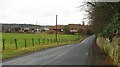
The above images may not be of the site on this page, they are loaded from Geograph.
Please Submit an Image of this site or go out and take one for us!
Click here to see more info for this site
Nearby sites
Key: Red: member's photo, Blue: 3rd party photo, Yellow: other image, Green: no photo - please go there and take one, Grey: site destroyed
Download sites to:
KML (Google Earth)
GPX (GPS waypoints)
CSV (Garmin/Navman)
CSV (Excel)
To unlock full downloads you need to sign up as a Contributory Member. Otherwise downloads are limited to 50 sites.
Turn off the page maps and other distractions
Nearby sites listing. In the following links * = Image available
290m N 357° Inveresk A Cursus Cursus (NT34947080)
672m N 4° Inveresk A Cursus Cursus (NT35017118)
800m NNE 15° Inveresk B Cursus Cursus (NT35177128)
5.1km W 277° Niddrie House* Standing Stone (Menhir) (NT29877125)
5.4km NE 40° Johnnie Moat Stone (Prestonpans) Natural Stone / Erratic / Other Natural Feature (NT38507455)
6.6km W 269° Ravenswood Avenue* Standing Stone (Menhir) (NT2828270502)
7.1km WNW 287° Delf Well* Holy Well or Sacred Spring (NT282727)
7.2km WNW 291° Holyrood Park Stone (Edinburgh) Natural Stone / Erratic / Other Natural Feature (NT28267313)
7.3km WNW 291° Dunsapie Crag* Hillfort (NT28177316)
7.5km W 270° Cat Stane (Inch)* Standing Stone (Menhir) (NT27457068)
7.6km WNW 287° Arthur's Seat* Hillfort (NT27647282)
7.7km WNW 300° St Triduana's Wellhouse* Holy Well or Sacred Spring (NT2833274468)
7.7km WNW 284° Samson's Ribs* Promontory Fort / Cliff Castle (NT27457250)
7.9km WSW 253° Balm Well* Holy Well or Sacred Spring (NT2732268363)
8.0km WNW 292° St Anthony's Well (Edinburgh)* Holy Well or Sacred Spring (NT27527364)
8.4km WNW 288° Salisbury Crags* Promontory Fort / Cliff Castle (NT27007326)
8.4km WNW 291° St Margaret's Well (Edinburgh)* Holy Well or Sacred Spring (NT2713373712)
8.5km WNW 285° Slidey Stane (Holyrood Park)* Natural Stone / Erratic / Other Natural Feature (NT2676672765)
8.7km W 277° Penny Well (Edinburgh)* Holy Well or Sacred Spring (NT26367177)
8.9km WNW 292° Girth Cross (Canongate)* Ancient Cross (NT2673973910)
9.1km WNW 290° Canongate Mercat Cross* Ancient Cross (NT2647273812)
9.2km WNW 290° St John's Cross (Canongate)* Ancient Cross (NT2628873733)
9.3km WNW 284° Edinburgh Runestone* Carving (NT2598972937)
9.5km WNW 286° National Museum of Scotland (Early Christian Stones)* Ancient Cross (NT2583273324)
9.6km WNW 286° National Museum of Scotland* Museum (NT2574873290)
View more nearby sites and additional images


 We would like to know more about this location. Please feel free to add a brief description and any relevant information in your own language.
 Wir möchten mehr über diese Stätte erfahren. Bitte zögern Sie nicht, eine kurze Beschreibung und relevante Informationen in Deutsch hinzuzufügen.
 Nous aimerions en savoir encore un peu sur les lieux. S'il vous plaît n'hesitez pas à ajouter une courte description et tous les renseignements pertinents dans votre propre langue.
 Quisieramos informarnos un poco más de las lugares. No dude en añadir una breve descripción y otros datos relevantes en su propio idioma.