


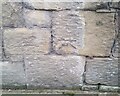
<< Other Photo Pages >> Wrexham County Borough Museum - Museum in Wales in Wrexham
Submitted by Andy B on Thursday, 09 October 2008 Page Views: 9818
MuseumsSite Name: Wrexham County Borough MuseumCountry: Wales
NOTE: This site is 0.863 km away from the location you searched for.
County: Wrexham Type: Museum
Nearest Town: Wrexham
Map Ref: SJ3318950455
Latitude: 53.047166N Longitude: 2.998061W
Condition:
| 5 | Perfect |
| 4 | Almost Perfect |
| 3 | Reasonable but with some damage |
| 2 | Ruined but still recognisable as an ancient site |
| 1 | Pretty much destroyed, possibly visible as crop marks |
| 0 | No data. |
| -1 | Completely destroyed |
| 5 | Superb |
| 4 | Good |
| 3 | Ordinary |
| 2 | Not Good |
| 1 | Awful |
| 0 | No data. |
| 5 | Can be driven to, probably with disabled access |
| 4 | Short walk on a footpath |
| 3 | Requiring a bit more of a walk |
| 2 | A long walk |
| 1 | In the middle of nowhere, a nightmare to find |
| 0 | No data. |
| 5 | co-ordinates taken by GPS or official recorded co-ordinates |
| 4 | co-ordinates scaled from a detailed map |
| 3 | co-ordinates scaled from a bad map |
| 2 | co-ordinates of the nearest village |
| 1 | co-ordinates of the nearest town |
| 0 | no data |
Internal Links:
External Links:
")
There’s plenty to see in your new museum:
A new family friendly gallery offering you the chance to see the museum collections, enjoy the stories they tell and watch the area’s heritage brought to life on film
A new gallery to showcase national collections from around Wales
A glazed extension providing space for a reception area, museum shop and the stylish new museum café
Follow your nose through the streets of Victorian Wrexham
Listen to the news of Brymbo Man’s discovery before meeting him face to face
Admire the skill of Bronze Age smiths who made the Rossett Hoard
More details on their Web Site.
Address: Regent Street, Wrexham, LL11 1RB
Phone: 01978 317970
Note: The Tomb Builders: Wales 4000–3000BC New exhibition opens, see comment.
You may be viewing yesterday's version of this page. To see the most up to date information please register for a free account.
Do not use the above information on other web sites or publications without permission of the contributor.
davidmorgan has found this location on Google Street View:
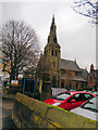
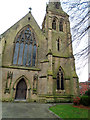
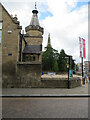
Nearby Images from Geograph Britain and Ireland:
©2019(licence)
©2019(licence)
©2021(licence)
©2021(licence)
©2021(licence)
The above images may not be of the site on this page, they are loaded from Geograph.
Please Submit an Image of this site or go out and take one for us!
Click here to see more info for this site
Nearby sites
Key: Red: member's photo, Blue: 3rd party photo, Yellow: other image, Green: no photo - please go there and take one, Grey: site destroyed
Download sites to:
KML (Google Earth)
GPX (GPS waypoints)
CSV (Garmin/Navman)
CSV (Excel)
To unlock full downloads you need to sign up as a Contributory Member. Otherwise downloads are limited to 50 sites.
Turn off the page maps and other distractions
Nearby sites listing. In the following links * = Image available
836m S 183° Fairy Oak* Round Barrow(s) (SJ33144962)
1.1km SSE 167° Hillbury* Round Barrow(s) (SJ33424939)
2.0km NE 35° Wrexham Gorsedd Circle Modern Stone Circle etc (SJ3436752064)
3.2km N 358° Bryn Alyn* Hillfort (SJ33125370)
3.3km NE 53° Borras Quarry Neolithic Village Ancient Village or Settlement (SJ35855243)
3.4km SW 226° Croes-Foel* Round Barrow(s) (SJ307481)
3.6km SW 219° Hafod-y-bwch* Round Barrow(s) (SJ309477)
3.9km NW 317° Bryn Y Gaer Hillfort and St Paul's Church Hillfort (SJ30585334)
4.7km NNE 17° The Atropos Altar Stone* Sculptured Stone (SJ34645497)
5.9km SE 141° Gerwyn Fechan Cursus (SJ36884584)
6.1km NNW 329° Plas Maen Stone* Rock Art (SJ3015555755)
6.5km NNW 337° Siambr Gladdu Abermorddu* Cairn (SJ30695648)
6.6km WNW 285° Minera Cup Stone* Rock Art (SJ26875225)
7.2km NNW 345° Caer Estyn* Hillfort (SJ314574)
7.5km SSW 208° Offa's Dyke west of Ruabon Misc. Earthwork (SJ29564386)
8.2km NNE 25° St Peter's Well (Denbighshire) Holy Well or Sacred Spring (SJ36735784)
8.2km NNW 344° Hope Church Early Medieval Stones* Ancient Cross (SJ310584)
8.9km NNW 339° Park in the Past* Museum (SJ301588)
9.1km W 261° Cefn-y-Gader cairn 1* Cairn (SJ241492)
9.4km W 265° Cefn-y-Gader cairn (2)* Cairn (SJ23774971)
9.5km NE 55° Churton* Long Barrow (SJ411558)
9.6km NE 53° Knowl Plantation Barrow Cemetery (SJ410561)
9.7km W 264° Aber Sychnant* Cairn (SJ23454963)
10.1km W 281° Maes Maelor* Barrow Cemetery (SJ23275255)
10.7km NE 41° Poulton Timber Circle* Ancient Village or Settlement (SJ4033558472)
View more nearby sites and additional images


 We would like to know more about this location. Please feel free to add a brief description and any relevant information in your own language.
 Wir möchten mehr über diese Stätte erfahren. Bitte zögern Sie nicht, eine kurze Beschreibung und relevante Informationen in Deutsch hinzuzufügen.
 Nous aimerions en savoir encore un peu sur les lieux. S'il vous plaît n'hesitez pas à ajouter une courte description et tous les renseignements pertinents dans votre propre langue.
 Quisieramos informarnos un poco más de las lugares. No dude en añadir una breve descripción y otros datos relevantes en su propio idioma.