 with our Megalithic Portal iPhone app")


<< Our Photo Pages >> Bigland Round - Chambered Cairn in Scotland
Submitted by drolaf on Sunday, 26 June 2022 Page Views: 510
Neolithic and Bronze AgeSite Name: Bigland RoundCountry: Scotland Type: Chambered Cairn
Nearest Village: Sourin
Map Ref: HY438325
Latitude: 59.175481N Longitude: 2.98495W
Condition:
| 5 | Perfect |
| 4 | Almost Perfect |
| 3 | Reasonable but with some damage |
| 2 | Ruined but still recognisable as an ancient site |
| 1 | Pretty much destroyed, possibly visible as crop marks |
| 0 | No data. |
| -1 | Completely destroyed |
| 5 | Superb |
| 4 | Good |
| 3 | Ordinary |
| 2 | Not Good |
| 1 | Awful |
| 0 | No data. |
| 5 | Can be driven to, probably with disabled access |
| 4 | Short walk on a footpath |
| 3 | Requiring a bit more of a walk |
| 2 | A long walk |
| 1 | In the middle of nowhere, a nightmare to find |
| 0 | No data. |
| 5 | co-ordinates taken by GPS or official recorded co-ordinates |
| 4 | co-ordinates scaled from a detailed map |
| 3 | co-ordinates scaled from a bad map |
| 2 | co-ordinates of the nearest village |
| 1 | co-ordinates of the nearest town |
| 0 | no data |
Internal Links:
External Links:
I have visited· I would like to visit
drolaf visited on 11th Jun 2022 - their rating: Cond: 3 Amb: 4 Access: 3 These smaller chambered cairns are often ignored but there are several in NE Rousay
")
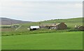
Bigland Round
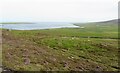
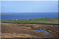
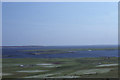
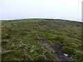
One of the many small stalled cairns in the North east of Rousay, on the glacial ridges above the farmland.
The bank and ditch are in good condition, and some of the stall slabs are in place.
Access was by special arrangement. It lies on private farmland across the valley from the cairns on Faraclett hill. 200m north west of the Rinyo Neolithic settlement (now infilled).
For more information see Canmore Site ID 2709.
A near-circular burial cairn of Orkney-Cromarty type, with a tripartite chamber
The cairn measures between 11.3 m and 12.5 m in diameter, with some distortion of the outline caused by quarrying on the NE side prior to excavation. Two concentric wall faces are visible, c.1m apart. The outer face survives to a maximum height of 0.3m; the less prominent inner face survives mainly on the S side of the cairn. Access to the chamber is from the SE through a passage measuring 1.1m long by 0.6m wide.
The passage had been blocked in antiquity by a large stone set flush to the outer facade. The inner end of the passage is marked by two portal stones, 0.6m apart. The chamber measures 4.8m long by 2.1m wide (maximum) and contains three compartments separated by upright, paired slabs. The innermost compartment is 1.7m long, the central compartment 1.8 m long and the outer compartment 1m long.
The compartment walls comprise up to five courses of masonry and stand up to 0.5m high. The pairs of orthostats between the compartments stand between 0.6m and 1.2m high.
sidewalls of the innermost chamber converge towards a massive single central orthostat, standing 1m high. Pairs of upright slabs at right angles to both sides of the innermost compartment are thought to represent supports for low benches or shelves.
A continuous bank c.0.75m high by 3.5m wide, and a shallow ditch c.0.5 m deep by up to 1m across, encircle the tomb.
You may be viewing yesterday's version of this page. To see the most up to date information please register for a free account.
")
")
")
Do not use the above information on other web sites or publications without permission of the contributor.
Nearby Images from Geograph Britain and Ireland:
©2021(licence)
©2009(licence)
©2012(licence)
©2015(licence)
©2021(licence)
The above images may not be of the site on this page, they are loaded from Geograph.
Please Submit an Image of this site or go out and take one for us!
Click here to see more info for this site
Nearby sites
Key: Red: member's photo, Blue: 3rd party photo, Yellow: other image, Green: no photo - please go there and take one, Grey: site destroyed
Download sites to:
KML (Google Earth)
GPX (GPS waypoints)
CSV (Garmin/Navman)
CSV (Excel)
To unlock full downloads you need to sign up as a Contributory Member. Otherwise downloads are limited to 50 sites.
Turn off the page maps and other distractions
Nearby sites listing. In the following links * = Image available
282m NE 44° Faraclett Head West Cairn (HY44003270)
283m NE 41° Faraclett Head East Cairn (HY43993271)
449m SW 216° Bigland Long (Rousay) Cairn (HY43533214)
919m ENE 77° Yetnasteen* Standing Stone (Menhir) (HY447327)
1.5km WSW 248° Kierfea Hill (Rousay) Cairn (HY42423196)
1.5km ESE 103° Scockness* Ancient Village or Settlement (HY45263214)
2.1km WSW 241° Knowe of Craie* Chambered Cairn (HY41963153)
3.7km SSW 200° Tammaskirk* Ancient Village or Settlement (HY42502907)
4.1km W 279° Bretta Ness* Ancient Village or Settlement (HY39723324)
4.1km W 267° Knowe of Lingro Cairn (HY3964832378)
4.4km W 281° Wasbister* Crannog (HY395334)
4.5km S 178° Cubbie Roo's Burden* Chambered Cairn (HY43932800)
5.0km SSW 193° Taversoe Tuick* Chambered Cairn (HY42572761)
5.4km SSW 205° Blackhammer* Chambered Tomb (HY41422761)
5.6km SW 215° Knowe of Yarso* Chambered Cairn (HY40482795)
5.8km SSW 203° Knowe of Hunclett* Broch or Nuraghe (HY41442722)
5.9km SW 219° Knowe of Ramsay* Chambered Cairn (HY40042800)
5.9km SE 142° Onziebist* Chambered Cairn (HY4741827807)
6.0km SW 220° Knowe of Lairo* Chambered Cairn (HY39922796)
6.0km SSW 213° Langstane (Orkney)* Standing Stone (Menhir) (HY404275)
6.3km SW 216° Knowe of Burrian (Frotoft)* Broch or Nuraghe (HY40062745)
6.3km S 173° Braes of Ha’Breck, Wyre. Ancient Village or Settlement (HY445262)
6.4km SW 225° Viera Lodge Broch or Nuraghe (HY392281)
6.4km W 266° Knowe of Dale* Misc. Earthwork (HY37423217)
6.4km SW 236° Westness Chambererd Tomb* Chambered Tomb (HY38402898)
View more nearby sites and additional images


 We would like to know more about this location. Please feel free to add a brief description and any relevant information in your own language.
 Wir möchten mehr über diese Stätte erfahren. Bitte zögern Sie nicht, eine kurze Beschreibung und relevante Informationen in Deutsch hinzuzufügen.
 Nous aimerions en savoir encore un peu sur les lieux. S'il vous plaît n'hesitez pas à ajouter une courte description et tous les renseignements pertinents dans votre propre langue.
 Quisieramos informarnos un poco más de las lugares. No dude en añadir una breve descripción y otros datos relevantes en su propio idioma.