 with our Megalithic Portal iPhone app")


<< Text Pages >> East Surrigarth (Westray) - Chambered Cairn in Scotland in Orkney
Submitted by AKFisher on Sunday, 14 April 2024 Page Views: 6
Neolithic and Bronze AgeSite Name: East Surrigarth (Westray)Country: Scotland
NOTE: This site is 1.658 km away from the location you searched for.
County: Orkney Type: Chambered Cairn
Map Ref: HY49214520
Latitude: 59.290197N Longitude: 2.893295W
Condition:
| 5 | Perfect |
| 4 | Almost Perfect |
| 3 | Reasonable but with some damage |
| 2 | Ruined but still recognisable as an ancient site |
| 1 | Pretty much destroyed, possibly visible as crop marks |
| 0 | No data. |
| -1 | Completely destroyed |
| 5 | Superb |
| 4 | Good |
| 3 | Ordinary |
| 2 | Not Good |
| 1 | Awful |
| 0 | No data. |
| 5 | Can be driven to, probably with disabled access |
| 4 | Short walk on a footpath |
| 3 | Requiring a bit more of a walk |
| 2 | A long walk |
| 1 | In the middle of nowhere, a nightmare to find |
| 0 | No data. |
| 5 | co-ordinates taken by GPS or official recorded co-ordinates |
| 4 | co-ordinates scaled from a detailed map |
| 3 | co-ordinates scaled from a bad map |
| 2 | co-ordinates of the nearest village |
| 1 | co-ordinates of the nearest town |
| 0 | no data |
Internal Links:
External Links:
Chambered Cairn in Orkney
From the Orkney Coastal Zone Assessment 1998 (see link): "A mound, highly likely to be a chambered cairn, measuring 20m long and standing up to 1m high, has been truncated by the sea. The surviving portion measures about 8m wide. The coastal exposure contains structural remains, including several columns of masonry, which have collapsed in-situ, along with edge-set blocks and upright slabs. Towards the centre of this 25m long exposure, there are remnants of coursed walling which stands up to 0.7m high. A large horizontal slab which is located to the south end of the section may be part of a larger feature. The site is highly vulnerable to further damage and requires urgent assessment."
Additional information links:
1. canmore.org.uk/site/296355/westray-east-surrigarth
2. archaeologyorkney.com/tombs-of-the-isles/westray/east-surrigarth-westray/
3. canmore.org.uk/event/545640 (Coastal Zone Assessment)
You may be viewing yesterday's version of this page. To see the most up to date information please register for a free account.
Do not use the above information on other web sites or publications without permission of the contributor.
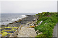
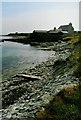
Nearby Images from Geograph Britain and Ireland:
©2019(licence)
©2007(licence)
©2019(licence)
©2011(licence)
©2008(licence)
The above images may not be of the site on this page, they are loaded from Geograph.
Please Submit an Image of this site or go out and take one for us!
Click here to see more info for this site
Nearby sites
Key: Red: member's photo, Blue: 3rd party photo, Yellow: other image, Green: no photo - please go there and take one, Grey: site destroyed
Download sites to:
KML (Google Earth)
GPX (GPS waypoints)
CSV (Garmin/Navman)
CSV (Excel)
To unlock full downloads you need to sign up as a Contributory Member. Otherwise downloads are limited to 50 sites.
Turn off the page maps and other distractions
Nearby sites listing. In the following links * = Image available
3.5km NW 309° Tofts Ness (Sanday) Cairn (HY4654547449)
5.7km N 4° St Tredwell's Chapel Stone Row / Alignment (HY497509)
5.9km W 263° Fitty Hill (Westray) Chambered Cairn (HY43324451)
6.0km WSW 254° Powdykes (Westray) Chambered Cairn (HY4343543627)
6.1km SW 236° Berst Ness Ancient Village or Settlement (HY441418)
6.2km NNW 327° Vere Point (Westray) Chambered Cairn (HY45845046)
6.3km WNW 298° Westray Heritage Centre* Museum (HY43724825)
6.4km WNW 288° Curquoy, Westray Cairn (HY431473)
6.5km NW 305° Pierowall Quarry* Chambered Cairn (HY43894905)
6.6km WNW 285° Knucker Hill (Westray) Chambered Cairn (HY4287547013)
6.7km N 351° Knap of Howar* Ancient Village or Settlement (HY483518)
6.8km NNE 12° Holm of Papa Westray Central Chambered Cairn (HY50705185)
6.8km NNE 14° Holm of Papa Westray South* Chambered Cairn (HY50915183)
7.2km N 9° Holm of Papa Westray North* Chambered Cairn (HY50445228)
7.5km N 356° St Boniface's Church Hog Back Stone* Early Christian Sculptured Stone (HY48825270)
7.5km N 356° Munkerhoose* Ancient Village or Settlement (HY48785274)
7.6km WNW 302° Links of Noltland* Ancient Village or Settlement (HY42804930)
8.0km WNW 298° The Lum Head (Westray) Chambered Cairn (HY4221649107)
8.0km SSE 153° Faray Chambered Cairn (HY52743797)
8.5km SE 133° Linkertaing* Chambered Cairn (HY55393937)
9.6km SE 131° Carrick House* Chambered Cairn (HY56363880)
9.8km SE 136° Vinquoy* Chambered Cairn (HY56013809)
10.2km SE 136° Huntersquoy* Chambered Cairn (HY56263773)
10.4km SE 136° Braeside* Chambered Cairn (HY56333757)
10.5km SE 136° Fold of Setter* Misc. Earthwork (HY56423750)
View more nearby sites and additional images


 We would like to know more about this location. Please feel free to add a brief description and any relevant information in your own language.
 Wir möchten mehr über diese Stätte erfahren. Bitte zögern Sie nicht, eine kurze Beschreibung und relevante Informationen in Deutsch hinzuzufügen.
 Nous aimerions en savoir encore un peu sur les lieux. S'il vous plaît n'hesitez pas à ajouter une courte description et tous les renseignements pertinents dans votre propre langue.
 Quisieramos informarnos un poco más de las lugares. No dude en añadir una breve descripción y otros datos relevantes en su propio idioma.