

<< Text Pages >> Westonzoyland Cursus - Cursus in England in Somerset
Submitted by EssexMan on Wednesday, 07 April 2010 Page Views: 5116
Neolithic and Bronze AgeSite Name: Westonzoyland CursusCountry: England
NOTE: This site is 0.243 km away from the location you searched for.
County: Somerset Type: Cursus
Nearest Town: Bridgewater Nearest Village: Westonzoyland
Map Ref: ST36263450 Landranger Map Number: 182
Latitude: 51.106238N Longitude: 2.911811W
Condition:
| 5 | Perfect |
| 4 | Almost Perfect |
| 3 | Reasonable but with some damage |
| 2 | Ruined but still recognisable as an ancient site |
| 1 | Pretty much destroyed, possibly visible as crop marks |
| 0 | No data. |
| -1 | Completely destroyed |
| 5 | Superb |
| 4 | Good |
| 3 | Ordinary |
| 2 | Not Good |
| 1 | Awful |
| 0 | No data. |
| 5 | Can be driven to, probably with disabled access |
| 4 | Short walk on a footpath |
| 3 | Requiring a bit more of a walk |
| 2 | A long walk |
| 1 | In the middle of nowhere, a nightmare to find |
| 0 | No data. |
| 5 | co-ordinates taken by GPS or official recorded co-ordinates |
| 4 | co-ordinates scaled from a detailed map |
| 3 | co-ordinates scaled from a bad map |
| 2 | co-ordinates of the nearest village |
| 1 | co-ordinates of the nearest town |
| 0 | no data |
Internal Links:
External Links:
Long Enclosure in Somerset
Status: Doubtful
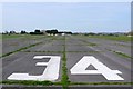
Associated with airfield
You may be viewing yesterday's version of this page. To see the most up to date information please register for a free account.
Do not use the above information on other web sites or publications without permission of the contributor.
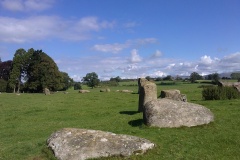
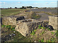
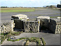
Nearby Images from Geograph Britain and Ireland:
©2010(licence)
©2010(licence)
©2010(licence)
©2015(licence)
©2015(licence)
The above images may not be of the site on this page, they are loaded from Geograph.
Please Submit an Image of this site or go out and take one for us!
Click here to see more info for this site
Nearby sites
Key: Red: member's photo, Blue: 3rd party photo, Yellow: other image, Green: no photo - please go there and take one, Grey: site destroyed
Download sites to:
KML (Google Earth)
GPX (GPS waypoints)
CSV (Garmin/Navman)
CSV (Excel)
To unlock full downloads you need to sign up as a Contributory Member. Otherwise downloads are limited to 50 sites.
Turn off the page maps and other distractions
Nearby sites listing. In the following links * = Image available
3.2km ESE 108° Greylake Mesolithic open-air cemetery Natural Stone / Erratic / Other Natural Feature (ST393335)
3.9km NW 314° Chedzoy Cursus Cursus (ST33503721)
5.5km SSW 199° Athelney* Hillfort (ST344293)
6.1km NNE 25° Holy Well (Edington)* Holy Well or Sacred Spring (ST3888639970)
6.4km N 7° Sulphur spring Holy Well or Sacred Spring (ST37124085)
8.7km WNW 291° St. John's Well (Somerset)* Holy Well or Sacred Spring (ST282377)
8.8km NE 43° Sweet Track* Ancient Trackway (ST424408)
9.3km NE 42° Avalon Marshes Visitor Centre* Museum (ST426413)
9.6km ESE 114° High Ham Cursus Cursus (ST45013048)
9.8km NE 34° Abbot's Way* Ancient Trackway (ST419425)
9.9km NE 41° Peat Moors Centre* Museum (ST429419)
11.0km NW 325° Pawlett Cursus Cursus (ST300435)
11.1km NW 321° Pawlett Cursus Cursus (ST294433)
11.4km NE 47° Meare Lake Village Ancient Village or Settlement (ST4472642100)
11.4km S 181° St. Catherine's Well (Swell)* Holy Well or Sacred Spring (ST360231)
12.3km E 100° Dundon Hill* Hillfort (ST484322)
12.5km ESE 101° Dundon Beacon Barrow* Round Barrow(s) (ST485319)
13.1km WNW 297° Cannington Camp* Hillfort (ST246405)
13.5km N 7° Mark Village Cross* Ancient Cross (ST3804947838)
14.2km E 95° New Ditch* Ancient Village or Settlement (ST504332)
14.3km ENE 71° Market Cross (Glastonbury) Ancient Cross (ST4987538924)
14.3km ENE 71° Glastonbury Lake Village Museum* Museum (ST499389)
14.4km ENE 72° St Joseph's Well* Holy Well or Sacred Spring (ST49993883)
14.4km ENE 64° Glastonbury Lake Village* Ancient Village or Settlement (ST493407)
14.4km ENE 72° Omphalos Stone (Glastonbury Abbey)* Natural Stone / Erratic / Other Natural Feature (ST501387)
View more nearby sites and additional images


 We would like to know more about this location. Please feel free to add a brief description and any relevant information in your own language.
 Wir möchten mehr über diese Stätte erfahren. Bitte zögern Sie nicht, eine kurze Beschreibung und relevante Informationen in Deutsch hinzuzufügen.
 Nous aimerions en savoir encore un peu sur les lieux. S'il vous plaît n'hesitez pas à ajouter une courte description et tous les renseignements pertinents dans votre propre langue.
 Quisieramos informarnos un poco más de las lugares. No dude en añadir una breve descripción y otros datos relevantes en su propio idioma.