 with our Megalithic Portal iPhone app")


<< Text Pages >> Linlathen - Class I Pictish Symbol Stone in Scotland in Angus
Submitted by alligator on Monday, 24 March 2003 Page Views: 7998
Early Medieval (Dark Age)Site Name: Linlathen Alternative Name: Castle Greg, Cairn GregCountry: Scotland
NOTE: This site is 2.581 km away from the location you searched for.
County: Angus Type: Class I Pictish Symbol Stone
Map Ref: NO46623376 Landranger Map Number: 54
Latitude: 56.492886N Longitude: 2.868546W
Condition:
| 5 | Perfect |
| 4 | Almost Perfect |
| 3 | Reasonable but with some damage |
| 2 | Ruined but still recognisable as an ancient site |
| 1 | Pretty much destroyed, possibly visible as crop marks |
| 0 | No data. |
| -1 | Completely destroyed |
| 5 | Superb |
| 4 | Good |
| 3 | Ordinary |
| 2 | Not Good |
| 1 | Awful |
| 0 | No data. |
| 5 | Can be driven to, probably with disabled access |
| 4 | Short walk on a footpath |
| 3 | Requiring a bit more of a walk |
| 2 | A long walk |
| 1 | In the middle of nowhere, a nightmare to find |
| 0 | No data. |
| 5 | co-ordinates taken by GPS or official recorded co-ordinates |
| 4 | co-ordinates scaled from a detailed map |
| 3 | co-ordinates scaled from a bad map |
| 2 | co-ordinates of the nearest village |
| 1 | co-ordinates of the nearest town |
| 0 | no data |
Internal Links:
External Links:
Class I Pictish Symbol Stone in Angus
For details, visit: http://www.archaeoptics.co.uk/products/ecms/145.html
You may be viewing yesterday's version of this page. To see the most up to date information please register for a free account.
")
Do not use the above information on other web sites or publications without permission of the contributor.
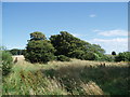
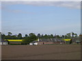
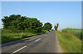
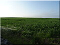
Nearby Images from Geograph Britain and Ireland:
©2012(licence)
©2005(licence)
©2021(licence)
©2021(licence)
©2012(licence)
The above images may not be of the site on this page, they are loaded from Geograph.
Please Submit an Image of this site or go out and take one for us!
Click here to see more info for this site
Nearby sites
Key: Red: member's photo, Blue: 3rd party photo, Yellow: other image, Green: no photo - please go there and take one, Grey: site destroyed
Download sites to:
KML (Google Earth)
GPX (GPS waypoints)
CSV (Garmin/Navman)
CSV (Excel)
To unlock full downloads you need to sign up as a Contributory Member. Otherwise downloads are limited to 50 sites.
Turn off the page maps and other distractions
Nearby sites listing. In the following links * = Image available
1.2km SSE 150° Balmossie Den (Broughty Ferry)* Holy Well or Sacred Spring (NO4721732714)
2.8km ENE 65° Drumsturdy Hill* Broch or Nuraghe (NO492349)
3.6km ENE 78° Ardestie* Souterrain (Fogou, Earth House) (NO5019434441)
5.0km ENE 63° Carlungie* Souterrain (Fogou, Earth House) (NO51123597)
5.0km E 79° Barry Cursus Cursus (NO51603465)
5.4km E 84° Woodhill House* Rock Art (NO520343)
6.3km NNW 349° Carrot Hill* Rock Art (NO45454000)
6.7km NE 51° Camus Cross (Angus)* Ancient Cross (NO519379)
6.9km NW 308° Tealing* Souterrain (Fogou, Earth House) (NO412381)
7.2km WSW 242° McManus Galleries* Museum (NO40253047)
7.8km NW 320° Tealing Stones* Standing Stones (NO4165139785)
8.0km NW 318° Huntingfaulds* Rock Art (NO41303974)
8.9km W 279° Strathmartine 3 Class II Pictish Symbol Stone (NO378352)
9.0km E 80° Carnoustie Neolithic Halls, Bronze Age roundhouses and Hoard* Ancient Village or Settlement (NO5553135246)
9.6km NW 307° Prieston* Rock Art (NO39023960)
9.6km WNW 298° Balkemback* Stone Circle (NO382384)
9.7km E 86° The Singing Stone (Summstein) Modern Stone Circle etc
9.8km NW 314° Gallow Hill B* Rock Art (NO39584066)
9.9km WNW 292° Balluderon* Class II Pictish Symbol Stone (NO37483758)
10.0km NW 310° Gallow Hill A* Rock Art (NO39054033)
10.7km WSW 254° Dark Stane Roundie* Round Barrow(s) (NO362310)
11.1km W 265° Camperdown Standing Stone* Standing Stone (Menhir) (NO3549632905)
11.2km WNW 293° Balkello Standing Stone* Standing Stone (Menhir) (NO36333830)
11.3km W 281° Templelands (Auchterhouse) Stone Circle (NO355360)
11.5km WSW 258° Balgarthno* Stone Circle (NO35333161)
View more nearby sites and additional images


 We would like to know more about this location. Please feel free to add a brief description and any relevant information in your own language.
 Wir möchten mehr über diese Stätte erfahren. Bitte zögern Sie nicht, eine kurze Beschreibung und relevante Informationen in Deutsch hinzuzufügen.
 Nous aimerions en savoir encore un peu sur les lieux. S'il vous plaît n'hesitez pas à ajouter une courte description et tous les renseignements pertinents dans votre propre langue.
 Quisieramos informarnos un poco más de las lugares. No dude en añadir una breve descripción y otros datos relevantes en su propio idioma.