

<< Our Photo Pages >> Robin Hood's Stone - Standing Stone (Menhir) in England in Merseyside
Submitted by Kammer on Wednesday, 09 June 2004 Page Views: 23156
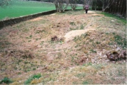
Neolithic and Bronze AgeSite Name: Robin Hood's StoneCountry: England
NOTE: This site is 1.233 km away from the location you searched for.
County: Merseyside Type: Standing Stone (Menhir)
Nearest Town: Liverpool
Map Ref: SJ3997886383 Landranger Map Number: 108
Latitude: 53.370884N Longitude: 2.903575W
Condition:
| 5 | Perfect |
| 4 | Almost Perfect |
| 3 | Reasonable but with some damage |
| 2 | Ruined but still recognisable as an ancient site |
| 1 | Pretty much destroyed, possibly visible as crop marks |
| 0 | No data. |
| -1 | Completely destroyed |
| 5 | Superb |
| 4 | Good |
| 3 | Ordinary |
| 2 | Not Good |
| 1 | Awful |
| 0 | No data. |
| 5 | Can be driven to, probably with disabled access |
| 4 | Short walk on a footpath |
| 3 | Requiring a bit more of a walk |
| 2 | A long walk |
| 1 | In the middle of nowhere, a nightmare to find |
| 0 | No data. |
| 5 | co-ordinates taken by GPS or official recorded co-ordinates |
| 4 | co-ordinates scaled from a detailed map |
| 3 | co-ordinates scaled from a bad map |
| 2 | co-ordinates of the nearest village |
| 1 | co-ordinates of the nearest town |
| 0 | no data |
Internal Links:
External Links:
I have visited· I would like to visit
Hodur visited on 10th Jun 2018 - their rating: Cond: 3 Amb: 1 Access: 5
ChrisHealey visited on 10th Jun 2018 - their rating: Cond: 3 Amb: 1 Access: 5
markj99 visited on 4th Apr 2014 - their rating: Cond: 3 Amb: 3 Access: 5 Robin Hood's Stone is the definitive example of an anachronism, a standing stone in an urban environment. The green iron railings which imprison the standing stone emphasise it's alienation.
Average ratings for this site from all visit loggers: Condition: 3 Ambience: 1.67 Access: 5
")
No longer in it's original position, the stone was moved in 1928 to accommodate a housing development.
For more information see Pastscape Monument No. 67205 which says that the cup marks are still visible at its base, not yet buried beneath the plinth. The entry adds this "Bronze Age standing stone, originally part of the complex of stone monuments known as the Calderstones which lie to the north east." Scheduled.
The Northern Antiquarian (TNA) also features a page for this standing stone - see their entry for Robin Hood’s Stone, Allerton, Liverpool, Lancashire, which says this is: "similar in size and appearance to one of the cup-marked Tuilyies standing stones in Fife, Scotland." The TNA page includes local folklore and includes an early photograph of the stone.
The Journal of Antiquities also includes an entry for Robin Hood’s Stone, Allerton, Liverpool, Merseyside, which includes a description, a photograph, directions for finding this stone and a list of reference sources for more information.The Journal adds: "In 1970 a similar stone was ploughed up in a farmer’s field at Haskayne, north of the city, and this also had grooves made by thousands of years of weathering. And so it is presumed this, and the so-called Robin Hood’s Stone, were probably part of the Calder Stones which date back 4,000 years to the Bronze-Age".
For the scheduling information see Historic England List ID 1020984, which adds: "At the base of the stone is a bronze plaque which announces the recent history of the monument: `THIS MONOLITH/ KNOWN AS ROBIN HOODS STONE STOOD/IN A FIELD NAMED THE STONE HEY/AT A SPOT 198 FEET DISTANT AND IN A /DIRECTION BEARING 7 DEGREES EAST OF TRUE/NORTH FROM ITS PRESENT POSITION TO/ WHICH IT WAS MOVED IN AUGUST 1928/ THE ARROW INDICATES THE DIRECTION OF THE ORIGINAL SITE'. Beneath this, in smaller capitals `THIS SIDE OF THE STONE FORMERLY FACED SOUTH'."
You may be viewing yesterday's version of this page. To see the most up to date information please register for a free account.
")
")
")
")
")
")
")
")
")
")
")
")
")
")
Do not use the above information on other web sites or publications without permission of the contributor.
Click here to see more info for this site
Nearby sites
Key: Red: member's photo, Blue: 3rd party photo, Yellow: other image, Green: no photo - please go there and take one, Grey: site destroyed
Download sites to:
KML (Google Earth)
GPX (GPS waypoints)
CSV (Garmin/Navman)
CSV (Excel)
To unlock full downloads you need to sign up as a Contributory Member. Otherwise downloads are limited to 50 sites.
Turn off the page maps and other distractions
Nearby sites listing. In the following links * = Image available
883m W 277° Solomon's Tomb Modern Stone Circle etc (SJ391865)
1.3km NNE 18° The Calderstones* Chambered Tomb (SJ4040287622)
2.5km ESE 103° Camp Hill (Woolton) Hillfort (SJ424858)
3.3km NNW 347° Monk's Well (Wavertree)* Holy Well or Sacred Spring (SJ39288959)
6.4km WSW 237° St Patrick's Well (Bromborough)* Holy Well or Sacred Spring (SJ34538295)
6.6km SW 230° St Barnabas (Bromborough)* Ancient Cross (SJ3491082212)
6.8km NW 310° World Museum Liverpool* Museum (SJ348908)
8.5km NNW 338° Modern stone circle on Cherry Avenue* Modern Stone Circle etc (SJ3687894265)
9.4km NNW 333° St Mary (Walton on the Hill) Ancient Cross (SJ35889482)
10.0km WNW 285° The Bonks Barrow Cemetery (SJ303891)
10.6km SW 225° Raby Mound Round Barrow(s) (SJ32377891)
11.2km ENE 62° St Anne's Well (St Helens)* Holy Well or Sacred Spring (SJ49969143)
11.7km WNW 287° Bidston Hill Rock Carvings* Carving (SJ288900)
11.8km E 83° St Luke's Church (Farnworth) Ancient Cross (SJ5171287749)
12.5km SSE 160° St Mary (Thornton Le Moors)* Ancient Cross (SJ44157455)
12.9km W 267° Arrowe Park standing stones Standing Stones (SJ27058596)
13.8km W 279° Overchurch* Stone Circle (SJ264888)
14.0km SW 230° St Mary and St Helen (Neston)* Ancient Cross (SJ29157749)
14.2km W 270° Greasby Copse Ancient Village or Settlement (SJ25788664)
14.4km SE 139° Helsby Hill* Hillfort (SJ493754)
14.7km SE 127° Synagogue Well Holy Well or Sacred Spring (SJ51687742)
15.0km SW 216° Hampston's Well* Holy Well or Sacred Spring (SJ3099074309)
15.4km SE 133° Woodhouses* Hillfort (SJ511757)
15.5km W 264° Thor's Stone* Natural Stone / Erratic / Other Natural Feature (SJ2447484933)
15.6km NNW 342° St Helen's Well (Sefton) Holy Well or Sacred Spring (SD35450129)
View more nearby sites and additional images


 We would like to know more about this location. Please feel free to add a brief description and any relevant information in your own language.
 Wir möchten mehr über diese Stätte erfahren. Bitte zögern Sie nicht, eine kurze Beschreibung und relevante Informationen in Deutsch hinzuzufügen.
 Nous aimerions en savoir encore un peu sur les lieux. S'il vous plaît n'hesitez pas à ajouter une courte description et tous les renseignements pertinents dans votre propre langue.
 Quisieramos informarnos un poco más de las lugares. No dude en añadir una breve descripción y otros datos relevantes en su propio idioma.